Tag Archives: Whitmoor

A Possible Standing Stone on High Curley Hill

https://leylinesdecoded.co.uk/2019/07/19/a-possible-standing-stone-on-high-curley-hill/

It has recently been pointed out to me by a fellow researcher, David Fernleigh, that if my NEWLANDS LINE is extended as a backsight from my base point at Whitmoor Barrow, there is a clear line of sight for some 7.2 miles across flat countryside to High Curley Hill near Lightwater village.   This line is orientated to the mid-winter sunrise in the south-east and the backsight is to the mid-summer sunset in the north-west. The two opposing bearings align because they fall within the critical band of latitude which passes through the site of Stonehenge where a similar coincidence of sighting may be found.

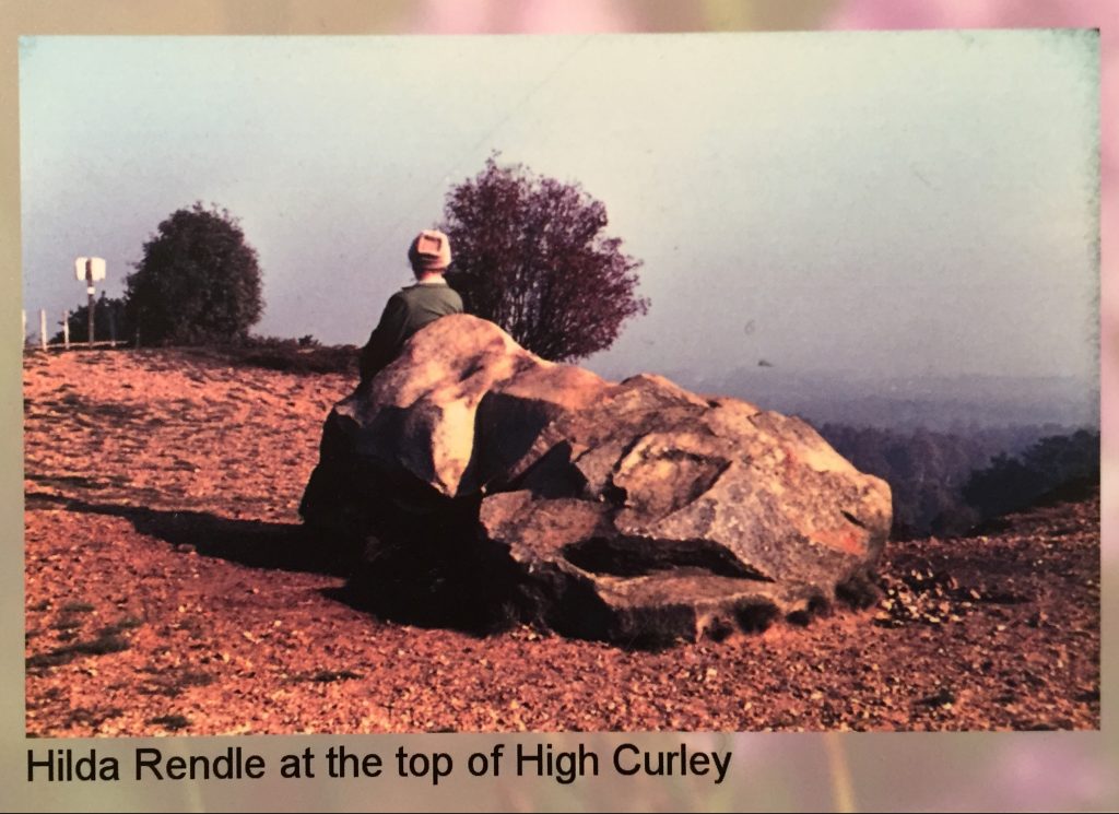
It is unfortunate that the view toward Whitmoor is now obscured by mature trees, many of which are evergreen pines.   The old photograph below is copied from a notice board at the Surrey Heath Museum and shows that there were once uninterrupted views to the far horizon.   This sarsen stone is unusual; although there are other sarsens in this area this is the most outstanding example.

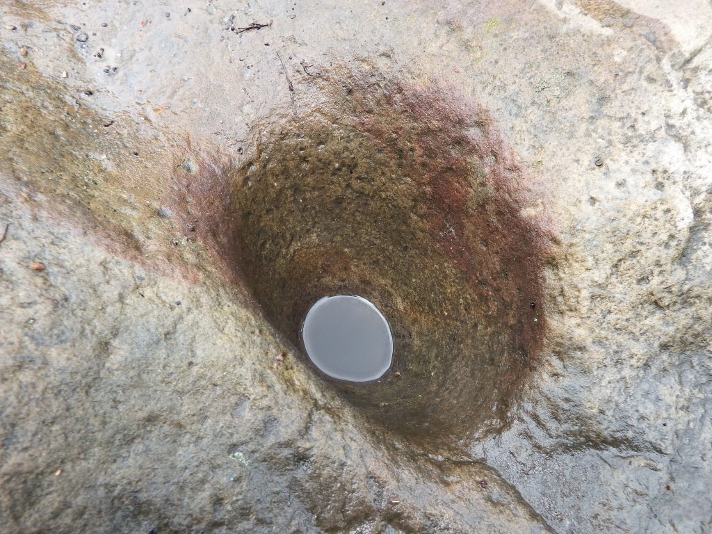
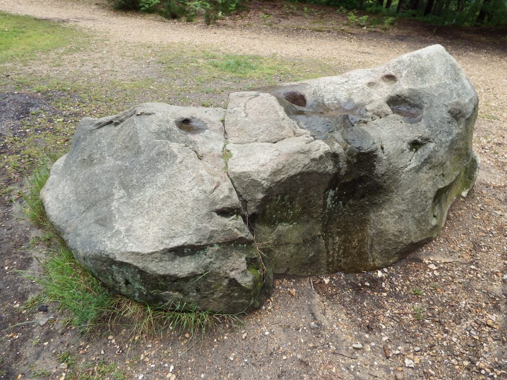
On my second visit to the hill, I noticed a strange indentation in the sarsen; in the photograph below a conical depression can be seen in the centre.   There are other depressions but I believe these were created by root growth when the sandstone was being formed and had not yet solidified into the hard rock we now see.


This depression is obviously man-made.   It is very smooth and regular, unlike any of the natural features.   The remaining rainwater conceals an evenly dished base.   At the surface it is about 15 centimetres in diameter and is some 16 cm deep.   I have no idea of the age or purpose of this feature.

But this stone, although interesting, is not on the alignment, so further site investigation was required.   The summit of the hill is a flat plateau at a height above sea level of around 420 feet. The summit is at the end of a ridge extending from the west and there are views to the horizon in all directions apart from along this ridge.   It would surely have been of significance to prehistoric peoples with its flat top measuring approximately 140 metres by 40 metres wide offering panoramic views to horizons some thirty or more miles away.

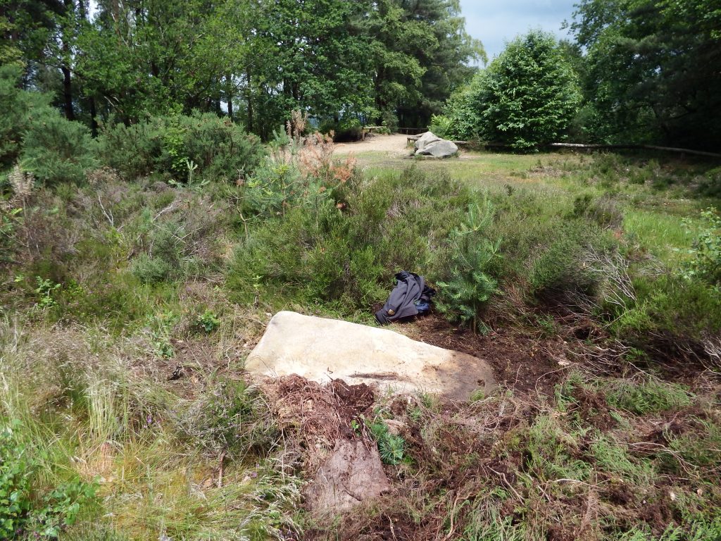
Taking a ranging rod; a trowel; and a pruning saw; my next visit was concentrated on the area where the backsight of the alignment crossed the hill about 44 metres from the sarsen.   The area around the sarsen and out to the viewing point in the north-west is well-trodden and clear of scrub, but coming back towards the south-east the ground has a dense covering of heather and gorse.   Working my way from the alignment back north-west towards the sarsen I stumbled across the corner of another sarsen just visible through the growth.   The pruning saw proved ideal for ripping through the covering of heather roots to reveal a large recumbent stone.   The next photograph shows the relationship between the two sarsens, the distance between them is about 21 metres, and the recumbent stone is about 27 metres from the alignment, a very small error over seven miles and without investigation of the rising and setting of the sun at this elevation.

This photograph below is all I have been able to expose to date.   This is a public country park and I did not want to be seen digging around the stone to ascertain its extent, besides which at my age, the effort to get this far was quite crippling.   The exposed surface measured some six feet long by 2.5 feet wide (1.8m x 1.2m).   Probing the edges did not help in determining the depth or limits of the stone.

As it is so close to the mid-summer sunset alignment, I am going to be so bold as to suggest the possibility that this sarsen was once a standing stone fallen in antiquity.

The pale corner is just visible on Google Earth at   51°20’45.41″N    0°41’30.92″W.   The altitude is given as 411 feet which gives a clear line of sight back to Whitmoor Barrow.   This is best viewed in Google Earth by selecting June 2018 in the ‘Historic Imagery’ option.

It now needs younger and fitter researchers, and with the permission of Surrey Heath Borough Council, to undertake a proper archaeological dig.   I would love to see the whole plateau subjected to examination, at the very least by ground penetration radar.

Best access to this site is from the public car park in the Lightwater Country Park off High View Road, Lightwater, postcode GU18 5YF.
 

Culverswell Barrow

The following Page is copied into Posts because it seems very few visitors look beyond the Posts and therefore miss this important finding which is crucial to the credibility of the  pattern.

The CROOKSBURY LINE at 232.32 degrees from North would appear to be aligned to the mid-winter sunset.  At just over 7 Druid Miles (DM) the line passes through St Bartholomew’s Church at Wanborough.  At just over 8 DM, and on the extremity of visibility, lies the site of the Hogs Back Barrow on a high ridge which appears to be the aiming point for the midwinter sunset.  The line then passes close by Hillbury Hillfort at 10 DM, but it is other alignments which pass through the fort itself, and then carries on to Culverswell Barrow.   Although precisely on the line it is slightly beyond the 12 DM point at the crest of the hill. Carrying on down the hill the alignment terminates between two very close tumuli known as Crooksbury Barrows. Nothing has so far been found beyond this point.

Culverswell Barrow

Culverswell Barrow ditch with mound on right side viewed from the south before the removal of trees.

232_12 Culverswell Barrow


RED LETTER DAY

On 25 July 1979 I finally proved to my own satisfaction that at least one of the alignments was laid out intentionally by prehistoric peoples. I had always realised that my case would be greatly enhanced by the discovery of a previously unrecorded barrow in a precise location predetermined by myself prior to a site visit.

It had seemed logical that one would be more likely to find a prehistoric site on the highest point of an alignment and so profiles were produced using the contours shown on the Ordnance Survey six inch to the mile maps. These proved very useful for the demonstration of sightlines and showed several high points where no ancient site was recorded. One of the most prominent of these was at Culverswell Hill on Crooksbury Common at the south western end of the CROOKSBURY LINE. The alignment was followed on a compass bearing from the well-preserved bowl barrow about 300 m to the South West. After negotiating some dense rhododendron bushes I emerged onto the pine covered plateau to the North West of the bluff to be confronted by a large mound surrounded by a shallow ditch. It was so obviously a barrow that it was quite beyond me that it was unknown to the Surrey Archaeological Society. The top was deeply cut by a badly eroded cross- trench indicating that it had been dug into at some time in the distant past but had remained unrecorded. The following weekend a tacheometric traverse was carried out from Littleworth Cross to the mound through the nearby Crooksbury barrows and back to the road thus establishing a grid reference for my survey pegs by the barrow to 1m of accuracy. When plotted onto the 1 to 1250 Ordnance Survey sheet it would seem to be in alignment as predicted.

The barrow has since been visited by the County Archaeologist who requested the county’s foremost expert on the Bronze Age. Mr Stuart Needham, to give his opinion. Mr Needham ruled out the alternatives such as a windmill stead, or landscaping and concluded his report by expressing great surprise that such a fine prehistoric monument had remained unrecorded in an area well known for its earthworks. I suspect that one reason is that most people walking in this area of Scots pine covered sandy hills would use the established paths. The path which crosses below the bluff affords a view up to the barrow but as no ditch is visible from the south side owing to the erosion of the slope, the earthwork appears to be merely the top of the small hill. The ditch and mound are only obvious when viewed from the North, the least accessible direction.

Letter to Dr D G Bird, County Archaeological Officer, from Stuart Needham.

‘Dear David

ROUND MOUND ON CULVERSWELL HILL C. SU 89234561.

Thank you for notifying of this earthwork;   I have recently had the opportunity of visiting the site.   I found a sizeable round mound approximately 24.8m diameter and perhaps approaching 2m in height.

The top of the mound has been mutilated in the past by the digging of a cross-shaped trench, now much silted.   Around roughly half of the mound’s base may be detected traces of a ditch 2.8m across and at present barely 0.2m deep.   The mound is sited on the end of an eastward facing spur with steep slopes on three sides.   The ditch peters out here, perhaps there having been no necessity for it, or otherwise it has been removed or concealed by a greater degree of erosion down the slopes.   Inspection of the side of a foxhole suggested a possible composite mound structure, but as usual such evidence is ambiguous.   The ground to the west rises gently and evenly with no indications of undulations frequent in this sort of sandy terrain resulting from natural agencies, or extractive disturbance.   There are some rhododendron clumps immediately to the west of the mound, but no sign of any associated landscaping.

In my opinion the extant features – the size, circular plan, evidence for a ditch, and its siting – are strongly in favour of it being a genuine ditched bowl barrow, which would of course normally be referable to the earlier Bronze Age.   Other possibilities such as a natural mound, a feature of relatively recent landscaping, or the base of a post windmill, can I think be reasonably dismissed for the present.

It really is astonishing that that such a fine upstanding monument should have escaped notice for so long in view of the proximity of the triple (sic) bell barrow on Crooksbury Common!

Best wishes

Stuart Needham’

In the summer of 2015 the site was visited with the purpose of carrying out a GPS survey and the resultant coordinates were added to the AutoCAD database.  This showed that the original survey was accurate and that the barrow was indeed perfectly on the alignment.

Weston Wood Mound and Settlement

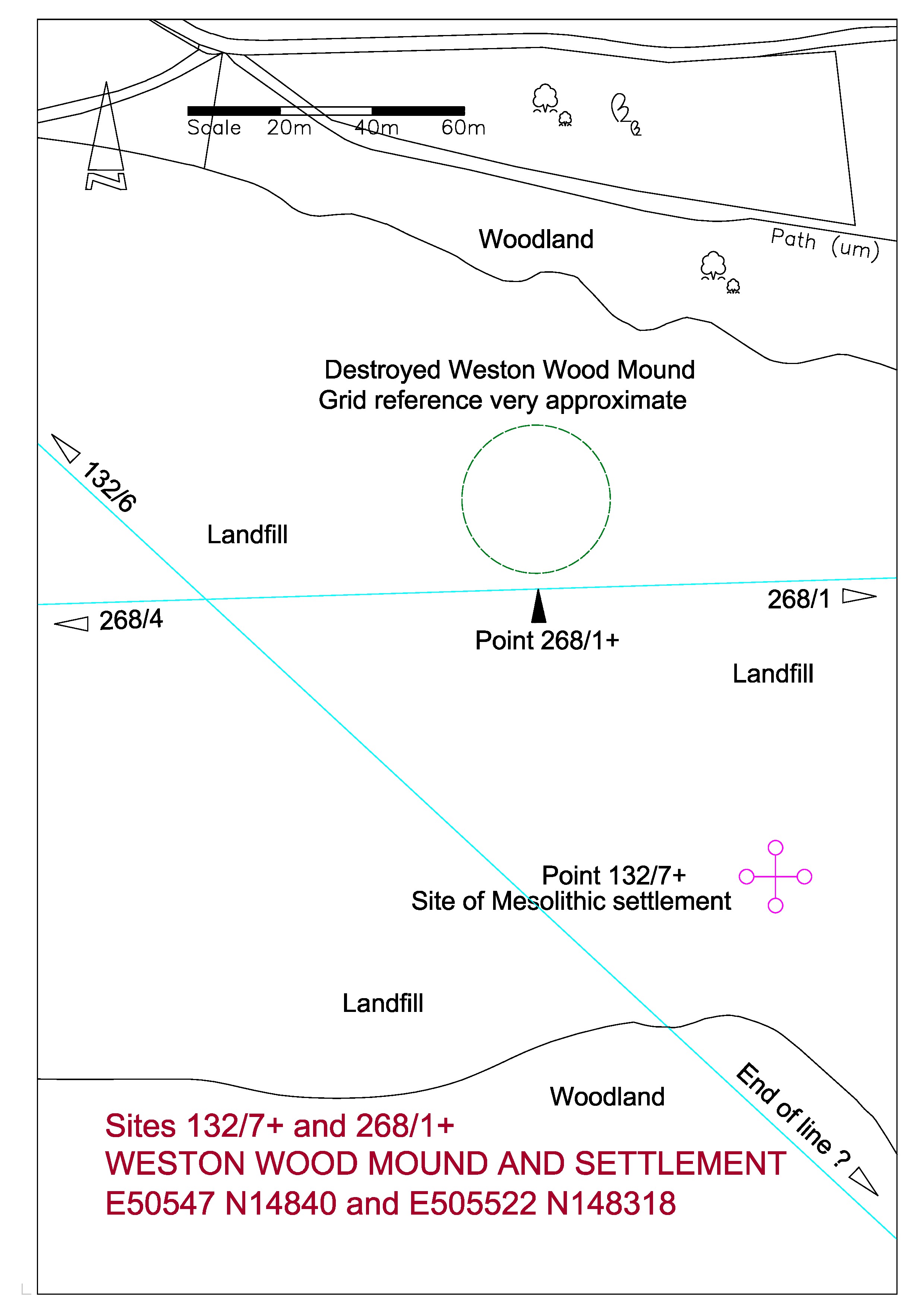
The NEWLANDS LINE, at 132° is 100 °  from the Crooksbury Line, and again starts from Whitmoor Barrow.  At 4 Druid Miles (DM) it passes through St John’s Church at Merrow and carries on to Newlands Corner Barrow at 6 DM.  These distances are very precise and have been used as the decided criterion of the Druid Mile.  In Weston Wood the line brushes the side of the reported position of a disputed barrow, now completely destroyed by sand extraction, and then passes through the site of a Mesolithic settlement.  At 9 DM passes close by Shere Heath Barrow but not close enough to be taken as an alignment.

268_1+ Weston Wood Mound

268_1+ Weston Wood Mound-page-0

The path at the top of the above plan is the main prehistoric trackway through Surrey, popularly known as the Pilgrims Way, which followed the North Downs from Kent through to Salisbury Plain.

THE MESOLITHIC SETTLEMENT

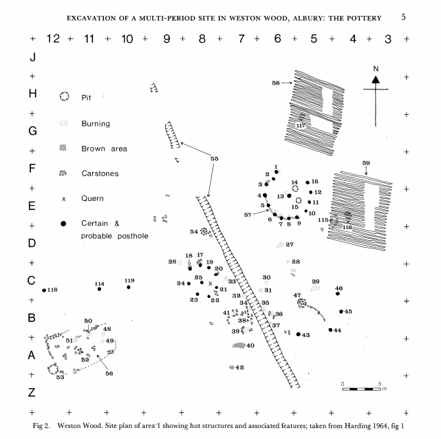
I have recently unearthed a sketch plan from the Surrey Archaeological Society archives of the excavation in Weston Wood of the Mesolithic settlement carried out c1961-3. The plan covers an area fifty metres square. It shows a trackway running from the south-east towards the north-west; with various post holes and points of interest; and with two areas of ploughed field to the east side. The excavation was carried out by an amateur team and appears rather inadequate by today’s standards and indeed I believe that the notes for this excavation have still not been published after half a century. Unfortunately this site has long been eaten away by sand extraction and is now a landfill site.

Weston Wood Excavation 1964

The Newlands Line is on a bearing of 132 degrees from Grid North. The trackway on the plan is at the bearing of about 152 degrees using the given North point. The excavation plan is a fairly poor sketch, not drawn very carefully by today’s standards, and is located with very approximate Ordnance Survey co-ordinates, and I suspect that the site of excavation was located very approximately in this area of scrubby land near the edge of the encroaching sand extraction with no local detail to tie in to the Ordnance Survey. The excavators set out a five metre grid as shown by the reference marks on the edges of the plan and it is possible that they located north using a compass. The plan is dated 1964 and at this time Magnetic North was some 13 degrees west of Grid North. We have about a 20 degree difference between the path on the plan and the Newlands Line, but if the North point was established using a magnetic compass then we only have a difference between the Newlands Line and the path of some 7 degrees. The Line is some 40 metres to the west of the given OS co-ordinates for the site but these are only to ten metres accuracy indicating a lack of precision.

This is certainly all very speculative and I would like to emphasize that I include this site, not because I have much faith in the validity of my findings, but because I have tried to include as much information as I can to help any possible future research.   There are obvious problems, such as the time period involved.   The Mesolithic period ended some five thousand years ago, so any relationship to the alignments would appear to be coincidental.   The most likely factor for the positioning of a settlement here would be the proximity of the natural spring at the Silent Pool.

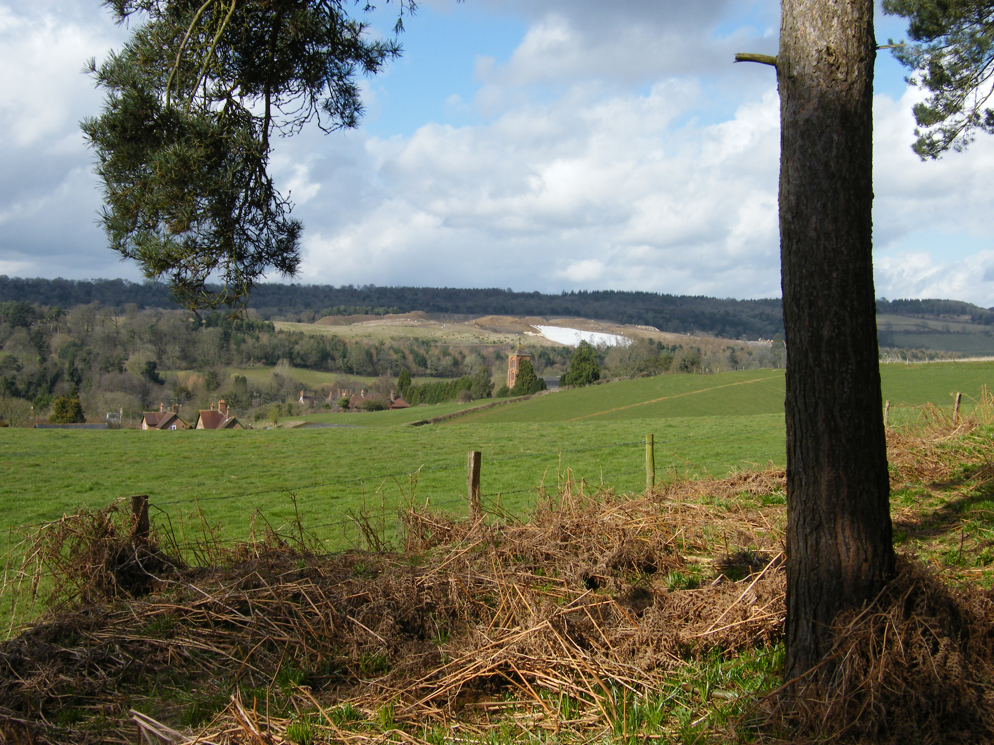
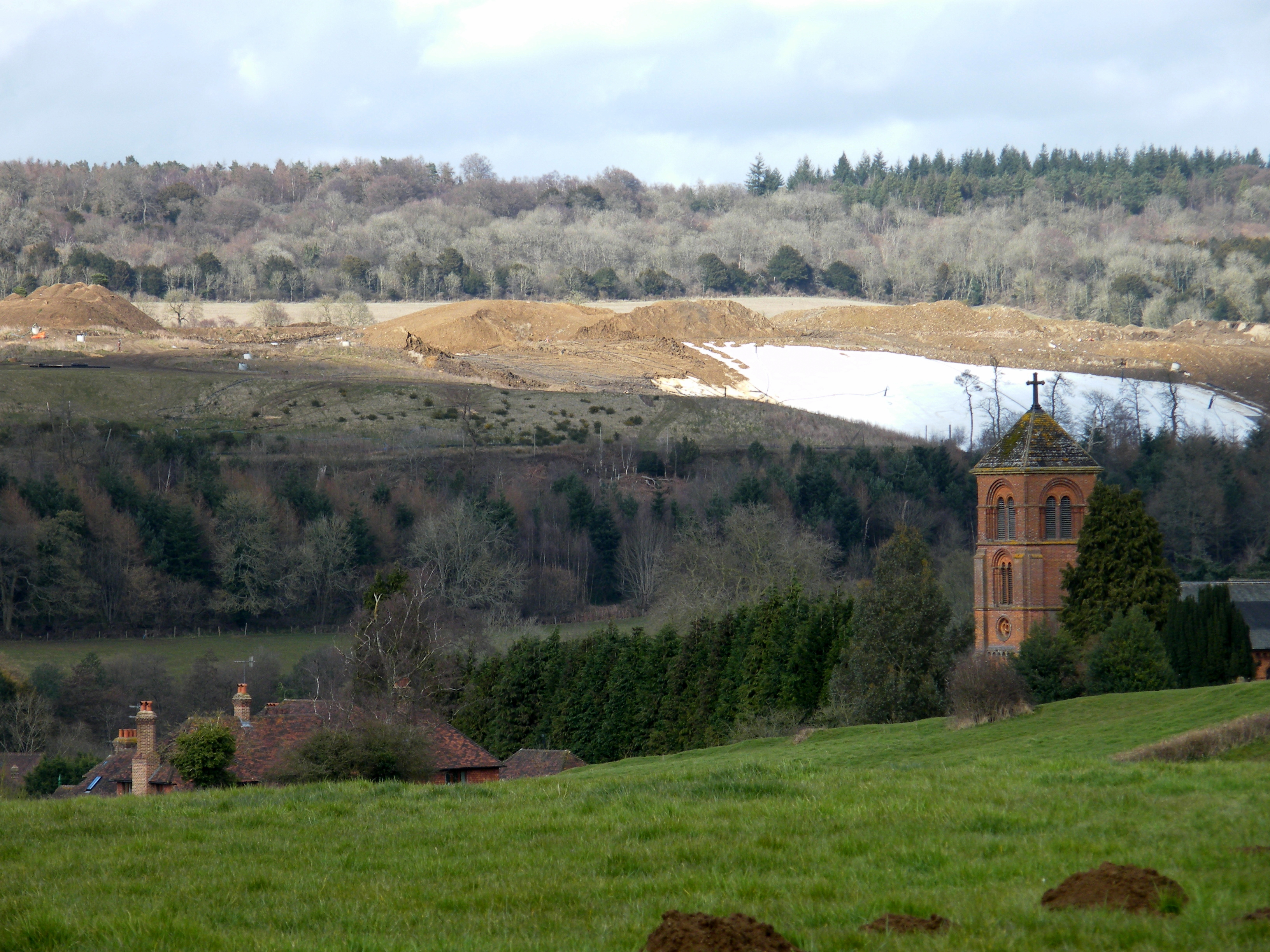
White area is plastic covering on landfill site. The mound would have been just beyond this.

White area is plastic covering on landfill site. The mound would have been just beyond this.

THE MOUND

Weston Wood Mound was recorded as being about 135 feet in diameter and some five feet high.  The top was flat.  It had been thought that it may have been a landscape feature associated with the parkland of Weston House in Albury but no evidence as to its origins had ever been established.  It was destroyed by sand extraction in the late 1990s.

The medieval road from the village of Albury to the south ran over the ridge past the mound towards Newlands Corner in the North West.  The age of the mound had always been a matter of controversy.  In SAS Vol 60 of 1963 W Crawford Knox theorized that the medieval road went around the mound in a manner which suggested that the mound predated the road.  An excavation in 1965 revealed little, but notably, a coin of c1750 was found beneath the clay capping, suggesting the possibility that the ancient structure may have been modified as a landscape feature.

Albury New Church

The site of the mound in the landfill looking over Albury New Church

The most popular website used by enthusiasts of prehistoric monuments is ‘The Megalithic Portal’.  A search for Weston Wood brings up two photographs submitted by Eileen Roche purporting to be the mound shortly before it was destroyed.  In 1999 I began a twice-yearly monitoring of the volumes of sand extraction in the pit and have great familiarity with the site.  Looking at the photographs I feel that the mound shown would have been a soil stock and that the ancient mound would have been further north.  But now we shall never know.

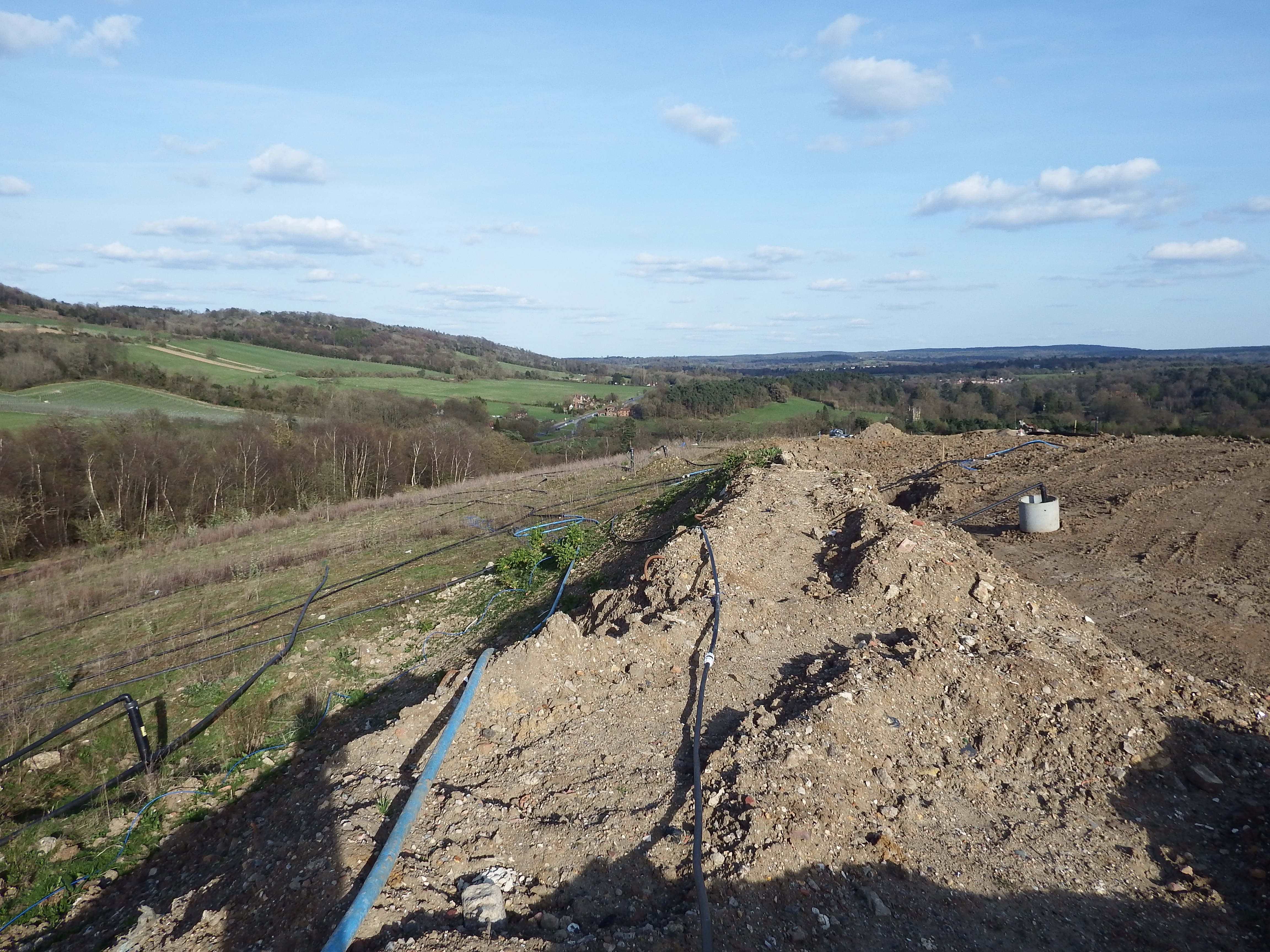
Top of Albury Landfill in the area of the mound

Top of Albury Landfill in the area of the mound


Developments

After sifting through the numerous pages of calculations and speculations accumulated over years of intermittent research it became apparent that a decision must be made to settle on some criterion upon which all this data could be based.   There were two lines which stood out from the others as extraordinary – the Newlands line with its precise alignment and distances, and the Crooksbury line with its newly discovered barrow and precise alignment.   The bearing of the Newlands line was 132.82 degrees and the Crooksbury line 232.32 degrees.   It has already been seen that the rays are around ten degrees apart and by dividing the difference by ten for the intervening rays we have an interval between each ray of 9.95 degrees.   This interval was applied to all rays in the pattern and a list was compiled of the intersections of these revised rays and the distance points at one Druid Mile (DM) intervals from the base point of the rays at Whitmoor Barrow.   These points were then compared with the physical detail as shown on the Ordnance Survey as downloaded to the computer database.   This was straight forward for circular structures such as barrows where the centre point was fairly obvious but when passing through a building a best estimate of the centre was used.

By 2012 the technology of hand held GPS instruments was very advanced with an accuracy good enough to make them a suitable tool for field research, so the decision was made to surf the internet for an instrument with the most suitable specification.   I settled on the Garmin GPSMAP 62 and carried out some field tests to check the accuracy.   Results varied from nearly perfect to, in the worst case, eight metres of error when compared with known Ordnance Survey (OS) co-ordinates established by professional surveying instruments.   Because of these variations it was necessary to revisit critical sites to re-record the co-ordinates and take an average of several readings.

Once a few sites had been visited with the GPS and the results plotted onto the database it became clear that there was a discrepancy between the WASG grid used by the Garmin instrument and the OS  grid titled OSGB36. There is a lot of information on the OS website about how this grid originates and how to use conversion programs to compute very precise coordinates. Although the grid used by Garmin is called OS grid in the format selection, it did not appear to conform to the OS map grid. Therefore it was decided that to check the difference between the two grids.  Check readings would be taken on-site from known points. First chosen was the OS trig pillar at Jacobswell just south of Whitmoor Barrow. Trigonometrical pillars are usually concrete structures, standing around four to five feet high, and constructed on prominent hill tops affording views over long distances and are part of the network of triangulation stations upon which the OS of Britain is based.  Also points were taken on the corners of other sites such as the church and churchyard walls on St Martha’s Hill. When these were plotted into the database it was seen that there was indeed a discrepancy. Due to the inherent inaccuracies of Ordnance Survey detail it is not possible to attain spot-on fitting of data. After meaning out the various results and taking the trig pillar coordinates as being the main data point it was seen that all GPS data needed to be moved 8 metres south and one and a half metres West. It would have been possible to calculate a very precise difference between the two groups but the accuracy of the hand held GPS is no better than about 7 feet or two metres, therefore it would seem that refining the difference between the two groups would be excessive and a waste of time. I have since confirmed these conversion factors by taking readings at other pillars in West Surrey.

The first exercise with the new instrument was a visit to Whitmoor Barrow.   I walked around the ditch taking readings at about five metre intervals.   Each reading was taken after holding the GPS at eye level pointing in several directions until the readout settled down and became constant.   These readings were stored as waypoints in the instrument and transposed onto my AutoCAD base plan in the office.   The Ordnance Survey extract of the barrow were already on this plan and it was seen that the adjusted GPS co-ordinates and the map co-ordinates of the barrow were an excellent match.   This confirmed my intention of using the Whitmoor Barrow as the base point for the overall pattern of rays.   A similar exercise was then undertaken at Culverswell Barrow and at the twin Crooksbury Barrows a short distance away.   The co-ordinates of the Culverswell Barrow confirmed my original theodolite survey of some years ago and the co-ordinates of the Crooksbury Barrows again proved an excellent fit.

Buoyed up by these satisfying results I was keen to use these new-found techniques to discover other lost sites.   The first I looked at was the Mount Pleasant Barrow on Whitmoor Common.   This is marked on The OS as the site of an Ancient Monument no longer existing.   The co-ordinates on the OS were noted as was the co-ordinates of the point on Mount Pleasant line being at a bearing of 252.22 degrees and one Druid Mile from the base point (Whitmoor Barrow).   The common is a flat area of land surrounded by woodland to the north, a railway to the east with roads on the other two sides.   On reaching the supposed site of the Ancient Monument nothing could be made out amidst the rough tussocky grass but on navigating to the point on the pattern some seventeen metres to the north west a circular bank some seven metres in diameter could just be made out beneath the scrubby birch trees (see photos at header MOUNT PLEASANT LINE).


Whitmoor Barrow Extra Pictures

I have been lucky enough to hitch a ride in a neighbour’s De Havilland Chipmunk.  After a tour around the North Downs he asked if there was anywhere special that I would like to see so I took the opportunity to do a few circuits around Whitmoor  Barrow as I was intrigued by the possibility of detecting crop marks.  This monotone photo shows the barrow as a red circle above and to the right of centre.  The large lone oak in the centre of the picture is to the south of the barrow.  The large field is scrubby grass grazed by ponies and shows nothing of any interest that I could make out although there are plenty of variations in tone.

dscf0577bw_whitmoor

In the picture below the barrow can be seen about halfway to the base of the photo  from the lone oak.  The view is looking south over the suburbs  of Guildford.  The only marks visible are old hedge routes and paths.

DSCF0570 from north

THE WAVERLEY LINE Re-examined and Refined


Waverley A3

A re-examination of the Waverley Line has led me to believe that this alignment could be more precise if I abandoned the notion that Point 251/7 at Merrow Church had to be exactly coincidental to Point 132/4, also at Merrow Church but on the crossing of the Newlands Line.     I had stuck to this idea because both points have a remarkable accuracy with the Druid Mile (DM), Point 132/4 being four DM on the 132 degree line from the base point of Whitmoor Barrow, and 251/7 being three DM from East Clandon Church.   A plan of this church from a local history website shows the outline of the original eleventh century building.   If the centre of this structure is taken as the revised start to the alignment  (nothing is currently found to the east) and the termination is taken as the centre of the Monk’s Choir within the nave of Waverley Abbey, then the accuracy of the alignment through six points becomes astonishingly precise.   There is a slight change in the angle from grid north at  251.50 degrees to 251.53.   This has the effect of moving the line from just outside the buildings of East Clandon Church and Merrow Church to the centre of the structures.   I have redrawn the site plans of these six points and revised the respective overall plan and data sheet.

East Clandon Church

251_4 East Clandon Church

The original numbering of this line was to take in the Churches of West Horsley, 251/1 is just beyond to the East, and West Clandon between Points 251/5 and 251/6, but neither of these churches is close enough to the alignment, West Horsley being 30 metres to the south and West Clandon is 45 metres to the north.   It is thought that the rough alignment of these churches is because the hamlets they serve were established upon the spring line of waters issuing from the interface of local clay and the chalk hills to the south.

132_4 Merrrow Church


The orientation of these sites may be of interest; East Clandon at 256.4 degrees is five degrees from the orientation of the line; Merrow Church at 260 degrees is 8.5 degrees, and Guildford Friary at 255.5 is four degrees.   Grid west is 270 degrees so all these sites are some ten to fifteen degrees anti-clockwise from true west and much closer to the orientation of the line.  Waverley Abbey bucks the trend by being thirteen degrees north of due west.

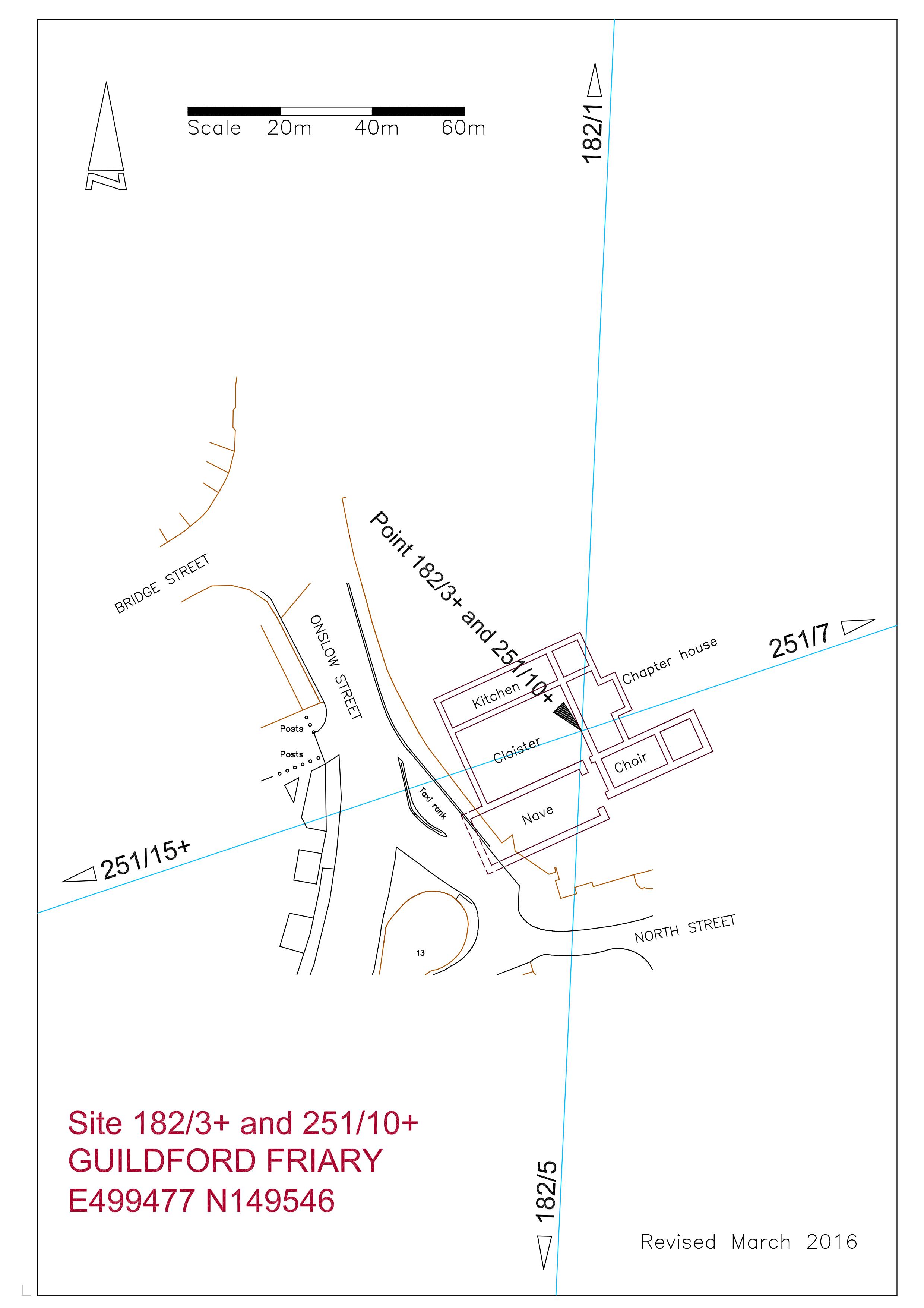
182/3+ Guildford Friary

It has always been interesting to me that the site is on the South Line, being the central spine of the ten degree alignments, but the actual location of the friary is poorly defined on the Ordnance Survey, shown only as a comment “Site of  friary founded 1275′,   therefore the accuracy of any alignment has been unverified, but I have now obtained a copy of the “Research Volume of the Surrey Archaeological Society No 9′ titled “Excavations on the Site of the Dominican Friary at Guildford in 1974 and 1978, by Rob Poulton and Humphrey Woods, published by the SAS in 1984.   By today’s standards the location plan is not brilliant, being more of a sketch than a survey, but with enough information to allow me to enlarge it to 1-200 scale enabling the measurement of the discovered foundations and adjoining streets to be transferred into AutoCAD. This digital drawing was overlaid on my OS database as a block and adjusted to obtain a best fit with the neighbouring streets.   The report also included an aerial photograph of the excavated site which I have used to further enhance the fit, and I now feel that I have the position of the friary buildings to within perhaps three metres of accuracy.

The area of demolition of the old Friary Meux Brewery to facilitate the construction of the Friary Centre shopping mall covers a large area and the excavated foundations take up perhaps about fifteen per cent at the most.   Therefore I was surprised to see that the two alignments passing through the site crossed within the excavated structure, with the South Line passing through the nave at the choir end (see plan).   Once again I am impressed with the coincidence of my findings.   Only the west end of the nave remains unexcavated as it lies just within the roadway of Onslow Street and maybe one day it will be possible to reveal this to accurately survey the location of the complex.  The revision to the line brings it nearer the centre of the excavated foundations.

Frowsbury Barrow from the south

Frowsbury Barrow from the south

The fourth point is Frowsbury Barrow standing next to a fairway of Puttenham Golf Club and is easily accessed from the Pilgrim’s Way long distance footpath just to the north.    The code for this site is 251/15+, the plus sign showing that it is more than 15 DM along the line from the base point.  It is 41 metres across with a ditch bringing the overall width to 47.5 metres, and is 2.4m high.   In 1857 Queen Victoria reviewed her troops from the top and this is commemorated by a stone tablet and a flagpole.   The line passes well within the top of the barrow just south of the flagpole.   The barrow is indistinct on natural raised ground and is only obvious when viewed from the south across a fairway.   There is a large greenkeepers shed close to the north side which seems to be built in a shallow quarry. There are pine trees between the shed and the barrow but the top of the mound is grassy with some bracken and heather to the east side.   Where the surface is exposed it is very sandy.

251_15+ Frowsbury Barrow REV

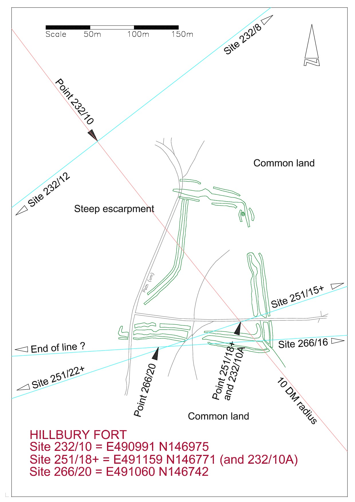
Hillbury Hillfort on Puttenham Common is the fourth point and although this covers a large area Point 251/18+ is positioned on the highest location within the ramparts.  This position being determined by the crossing of Line 293, the Frowsbury line, to Compton Church in the south east and Hogs Back Barrow to the north west.  This point is precisely ten DM from the base point at Whitmoor Barrow.  Line 266, the Deerleap Line, also passes through this point at 20 DM from Deerleap Barrow.


site-plan-of-hillbury-fort

Hillbury to Hogs Back looking NE

This photograph is taken from near the top of the site looking north across the fort to the Hogs Back on the horizon.

The sixth and currently final site on this alignment is at Waverley Abbey.  As with Guildford Friary I originally did not know where the line would fall within the site and it wasn’t until I found a ground plan of the structures that the pieces fell into place with startling accuracy.

Extract from visitor information board

Extract from visitor information board

The above plan shows the end of the line to be in the centre of the Monk;s Choir at the east end of the nave.

251/22 Waverley Abbey

In summary, we have six sites in extremely precise alignment; multiples of the Druid Mile with intersections with other lines; and coinciding orientation of three churches suggesting a possible astronomical alignment.  I would need a lot of convincing that this is all coincidence, especially as I cannot at the moment discover any even vaguely similar  findings outside of this area .

More information on these sites may be found under the respective headings, or will be soon.