Tag Archives: megalithic

A Possible Standing Stone on High Curley Hill

https://leylinesdecoded.co.uk/2019/07/19/a-possible-standing-stone-on-high-curley-hill/

It has recently been pointed out to me by a fellow researcher, David Fernleigh, that if my NEWLANDS LINE is extended as a backsight from my base point at Whitmoor Barrow, there is a clear line of sight for some 7.2 miles across flat countryside to High Curley Hill near Lightwater village.   This line is orientated to the mid-winter sunrise in the south-east and the backsight is to the mid-summer sunset in the north-west. The two opposing bearings align because they fall within the critical band of latitude which passes through the site of Stonehenge where a similar coincidence of sighting may be found.

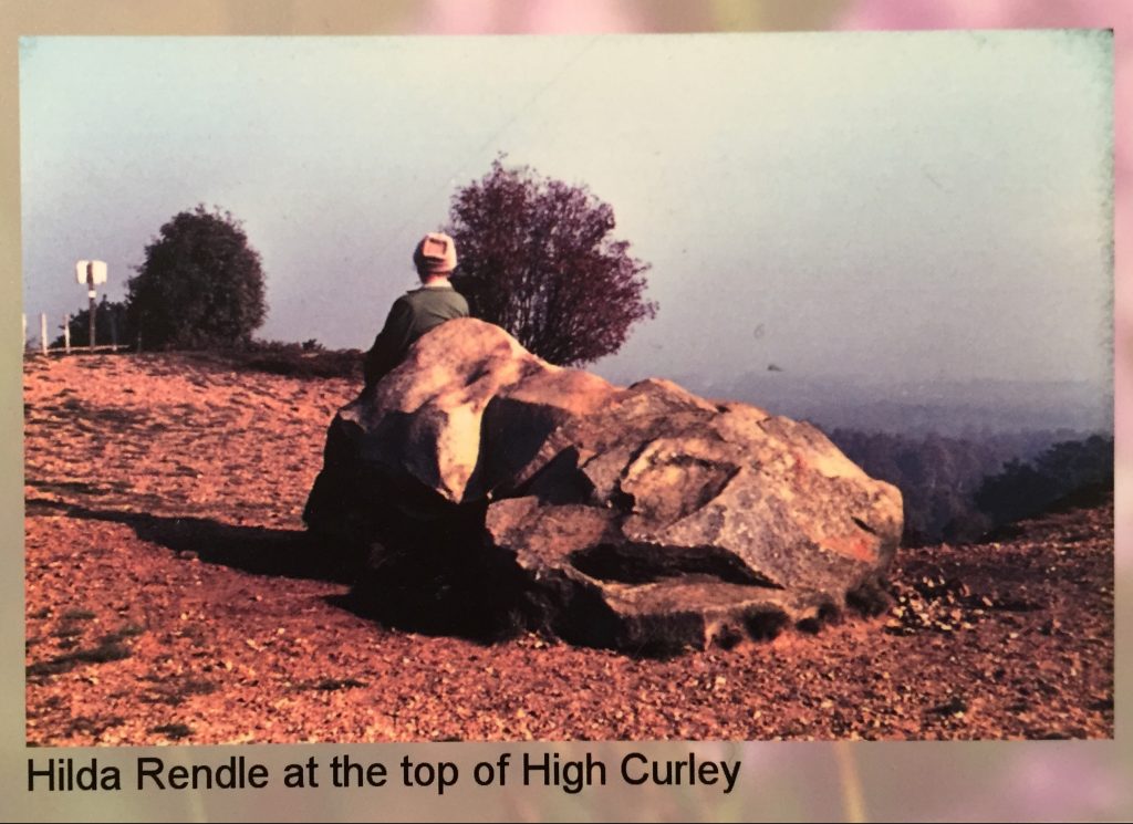
It is unfortunate that the view toward Whitmoor is now obscured by mature trees, many of which are evergreen pines.   The old photograph below is copied from a notice board at the Surrey Heath Museum and shows that there were once uninterrupted views to the far horizon.   This sarsen stone is unusual; although there are other sarsens in this area this is the most outstanding example.

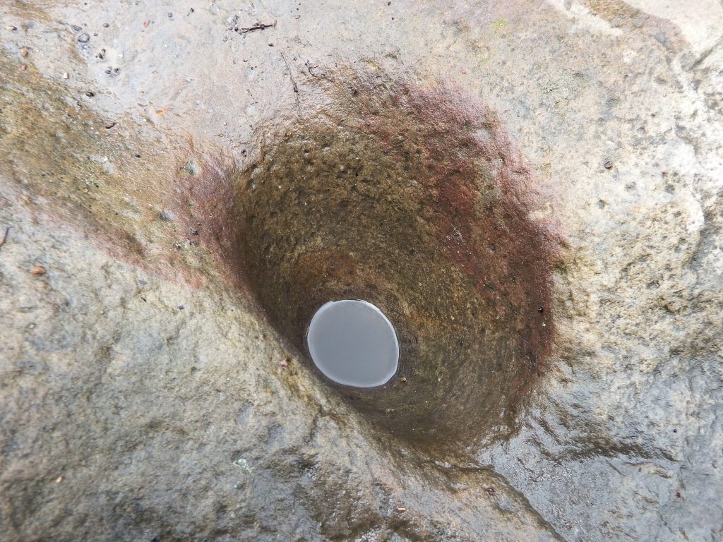
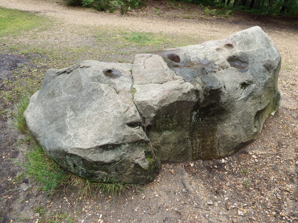
On my second visit to the hill, I noticed a strange indentation in the sarsen; in the photograph below a conical depression can be seen in the centre.   There are other depressions but I believe these were created by root growth when the sandstone was being formed and had not yet solidified into the hard rock we now see.


This depression is obviously man-made.   It is very smooth and regular, unlike any of the natural features.   The remaining rainwater conceals an evenly dished base.   At the surface it is about 15 centimetres in diameter and is some 16 cm deep.   I have no idea of the age or purpose of this feature.

But this stone, although interesting, is not on the alignment, so further site investigation was required.   The summit of the hill is a flat plateau at a height above sea level of around 420 feet. The summit is at the end of a ridge extending from the west and there are views to the horizon in all directions apart from along this ridge.   It would surely have been of significance to prehistoric peoples with its flat top measuring approximately 140 metres by 40 metres wide offering panoramic views to horizons some thirty or more miles away.

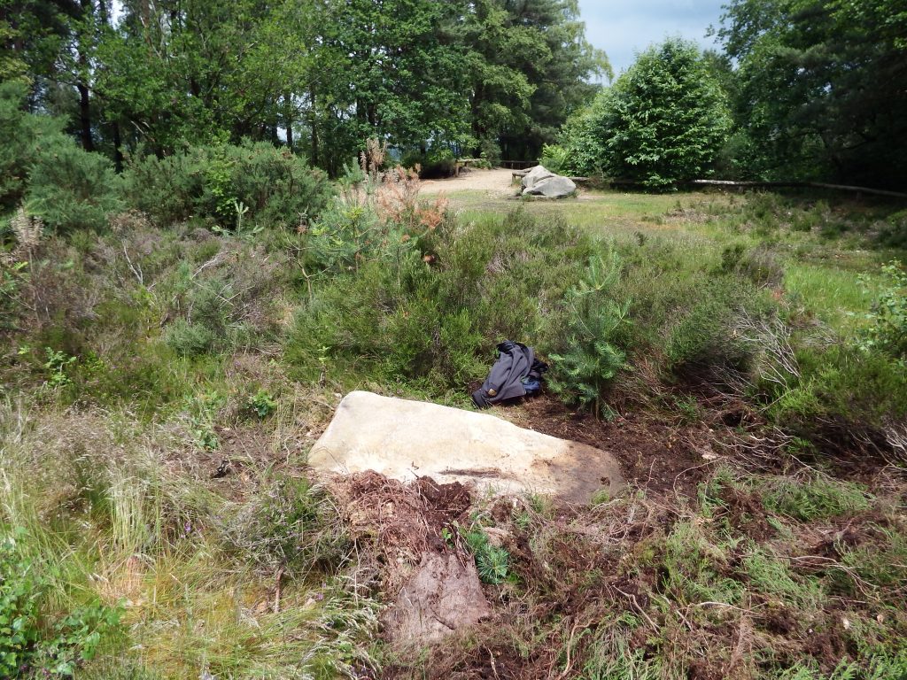
Taking a ranging rod; a trowel; and a pruning saw; my next visit was concentrated on the area where the backsight of the alignment crossed the hill about 44 metres from the sarsen.   The area around the sarsen and out to the viewing point in the north-west is well-trodden and clear of scrub, but coming back towards the south-east the ground has a dense covering of heather and gorse.   Working my way from the alignment back north-west towards the sarsen I stumbled across the corner of another sarsen just visible through the growth.   The pruning saw proved ideal for ripping through the covering of heather roots to reveal a large recumbent stone.   The next photograph shows the relationship between the two sarsens, the distance between them is about 21 metres, and the recumbent stone is about 27 metres from the alignment, a very small error over seven miles and without investigation of the rising and setting of the sun at this elevation.

This photograph below is all I have been able to expose to date.   This is a public country park and I did not want to be seen digging around the stone to ascertain its extent, besides which at my age, the effort to get this far was quite crippling.   The exposed surface measured some six feet long by 2.5 feet wide (1.8m x 1.2m).   Probing the edges did not help in determining the depth or limits of the stone.

As it is so close to the mid-summer sunset alignment, I am going to be so bold as to suggest the possibility that this sarsen was once a standing stone fallen in antiquity.

The pale corner is just visible on Google Earth at   51°20’45.41″N    0°41’30.92″W.   The altitude is given as 411 feet which gives a clear line of sight back to Whitmoor Barrow.   This is best viewed in Google Earth by selecting June 2018 in the ‘Historic Imagery’ option.

It now needs younger and fitter researchers, and with the permission of Surrey Heath Borough Council, to undertake a proper archaeological dig.   I would love to see the whole plateau subjected to examination, at the very least by ground penetration radar.

Best access to this site is from the public car park in the Lightwater Country Park off High View Road, Lightwater, postcode GU18 5YF.
 

Weston Wood Mound and Settlement

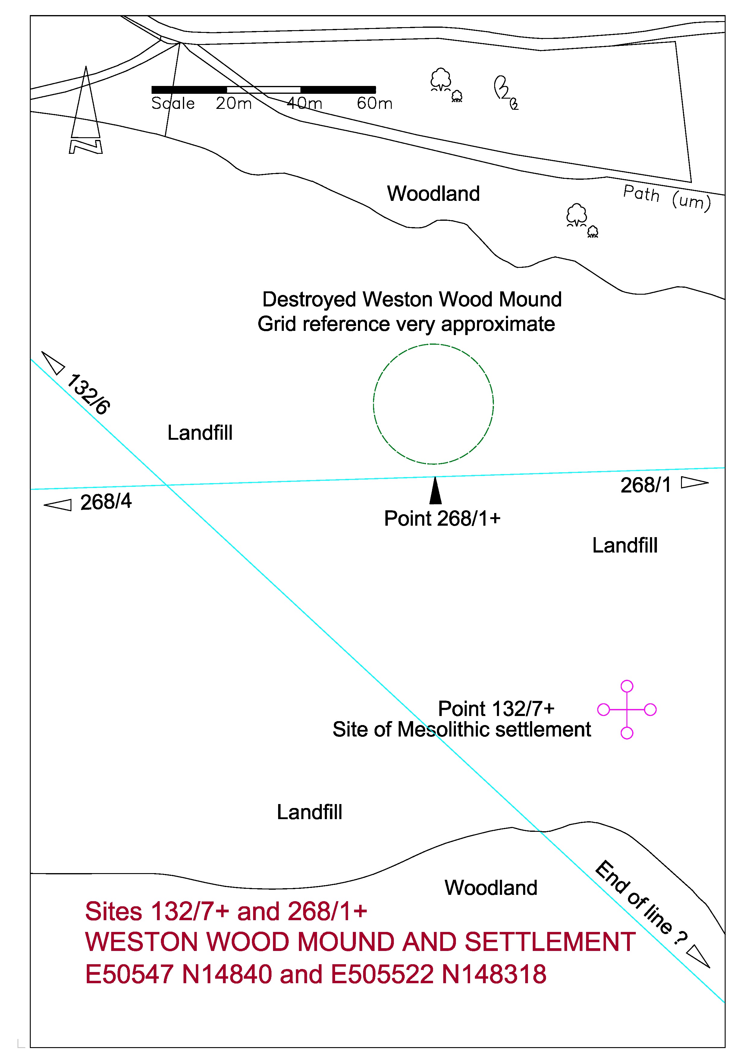
The NEWLANDS LINE, at 132° is 100 °  from the Crooksbury Line, and again starts from Whitmoor Barrow.  At 4 Druid Miles (DM) it passes through St John’s Church at Merrow and carries on to Newlands Corner Barrow at 6 DM.  These distances are very precise and have been used as the decided criterion of the Druid Mile.  In Weston Wood the line brushes the side of the reported position of a disputed barrow, now completely destroyed by sand extraction, and then passes through the site of a Mesolithic settlement.  At 9 DM passes close by Shere Heath Barrow but not close enough to be taken as an alignment.

268_1+ Weston Wood Mound

268_1+ Weston Wood Mound-page-0

The path at the top of the above plan is the main prehistoric trackway through Surrey, popularly known as the Pilgrims Way, which followed the North Downs from Kent through to Salisbury Plain.

THE MESOLITHIC SETTLEMENT

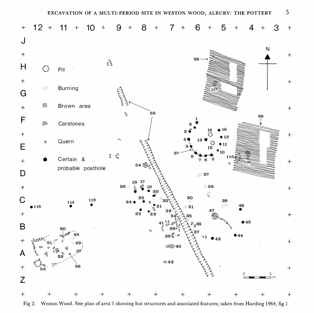
I have recently unearthed a sketch plan from the Surrey Archaeological Society archives of the excavation in Weston Wood of the Mesolithic settlement carried out c1961-3. The plan covers an area fifty metres square. It shows a trackway running from the south-east towards the north-west; with various post holes and points of interest; and with two areas of ploughed field to the east side. The excavation was carried out by an amateur team and appears rather inadequate by today’s standards and indeed I believe that the notes for this excavation have still not been published after half a century. Unfortunately this site has long been eaten away by sand extraction and is now a landfill site.

Weston Wood Excavation 1964

The Newlands Line is on a bearing of 132 degrees from Grid North. The trackway on the plan is at the bearing of about 152 degrees using the given North point. The excavation plan is a fairly poor sketch, not drawn very carefully by today’s standards, and is located with very approximate Ordnance Survey co-ordinates, and I suspect that the site of excavation was located very approximately in this area of scrubby land near the edge of the encroaching sand extraction with no local detail to tie in to the Ordnance Survey. The excavators set out a five metre grid as shown by the reference marks on the edges of the plan and it is possible that they located north using a compass. The plan is dated 1964 and at this time Magnetic North was some 13 degrees west of Grid North. We have about a 20 degree difference between the path on the plan and the Newlands Line, but if the North point was established using a magnetic compass then we only have a difference between the Newlands Line and the path of some 7 degrees. The Line is some 40 metres to the west of the given OS co-ordinates for the site but these are only to ten metres accuracy indicating a lack of precision.

This is certainly all very speculative and I would like to emphasize that I include this site, not because I have much faith in the validity of my findings, but because I have tried to include as much information as I can to help any possible future research.   There are obvious problems, such as the time period involved.   The Mesolithic period ended some five thousand years ago, so any relationship to the alignments would appear to be coincidental.   The most likely factor for the positioning of a settlement here would be the proximity of the natural spring at the Silent Pool.

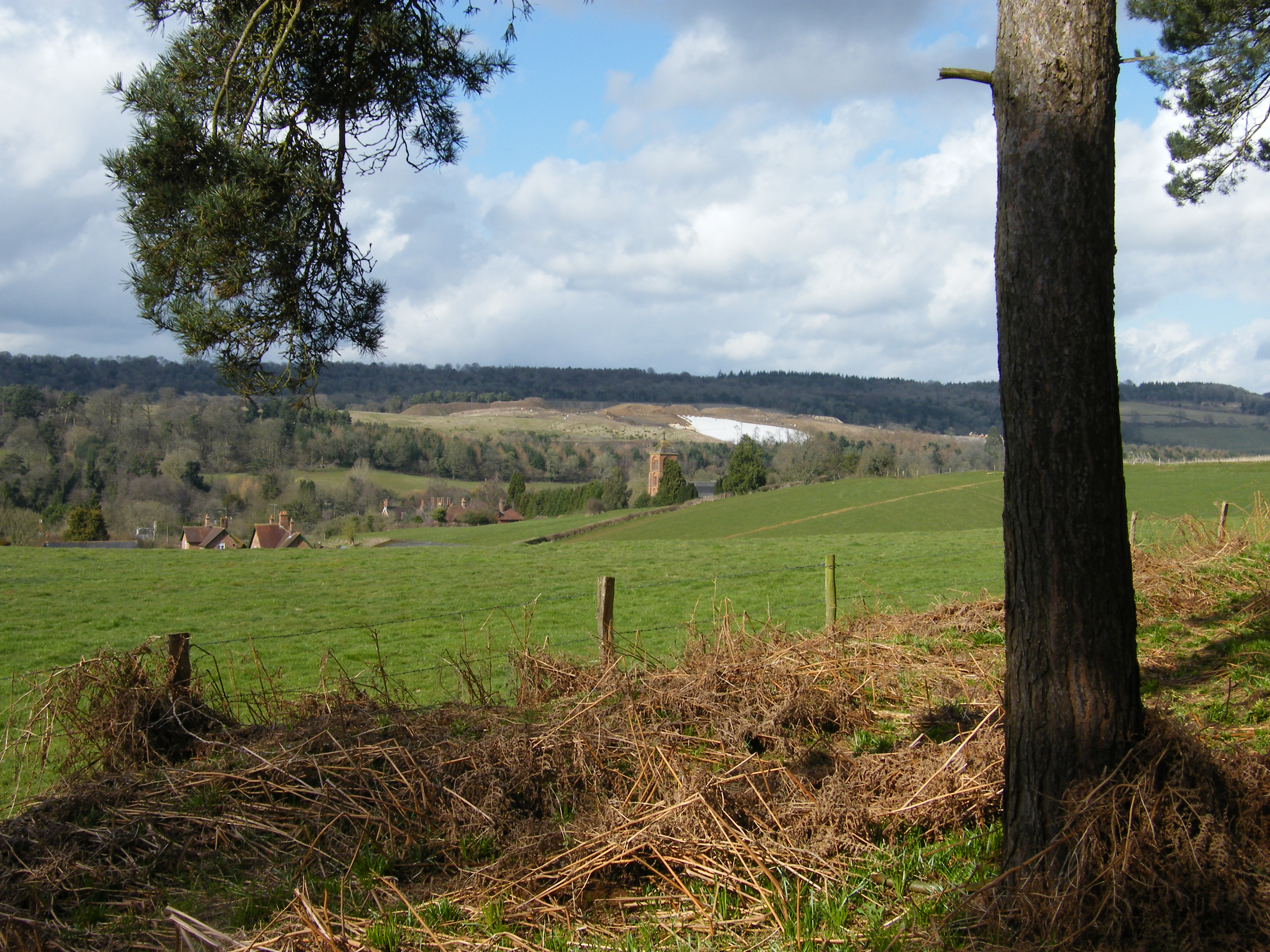
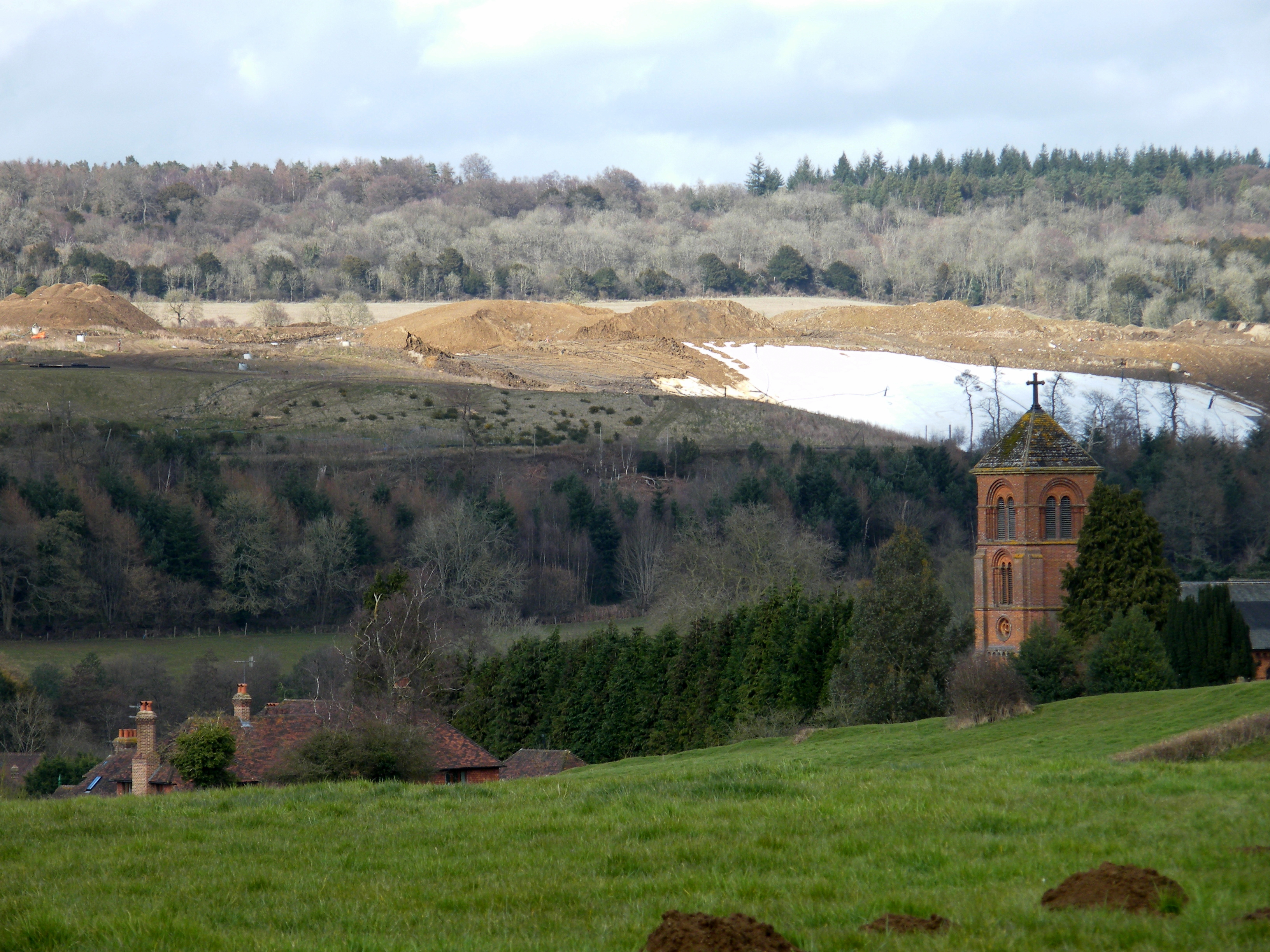
White area is plastic covering on landfill site. The mound would have been just beyond this.

White area is plastic covering on landfill site. The mound would have been just beyond this.

THE MOUND

Weston Wood Mound was recorded as being about 135 feet in diameter and some five feet high.  The top was flat.  It had been thought that it may have been a landscape feature associated with the parkland of Weston House in Albury but no evidence as to its origins had ever been established.  It was destroyed by sand extraction in the late 1990s.

The medieval road from the village of Albury to the south ran over the ridge past the mound towards Newlands Corner in the North West.  The age of the mound had always been a matter of controversy.  In SAS Vol 60 of 1963 W Crawford Knox theorized that the medieval road went around the mound in a manner which suggested that the mound predated the road.  An excavation in 1965 revealed little, but notably, a coin of c1750 was found beneath the clay capping, suggesting the possibility that the ancient structure may have been modified as a landscape feature.

Albury New Church

The site of the mound in the landfill looking over Albury New Church

The most popular website used by enthusiasts of prehistoric monuments is ‘The Megalithic Portal’.  A search for Weston Wood brings up two photographs submitted by Eileen Roche purporting to be the mound shortly before it was destroyed.  In 1999 I began a twice-yearly monitoring of the volumes of sand extraction in the pit and have great familiarity with the site.  Looking at the photographs I feel that the mound shown would have been a soil stock and that the ancient mound would have been further north.  But now we shall never know.

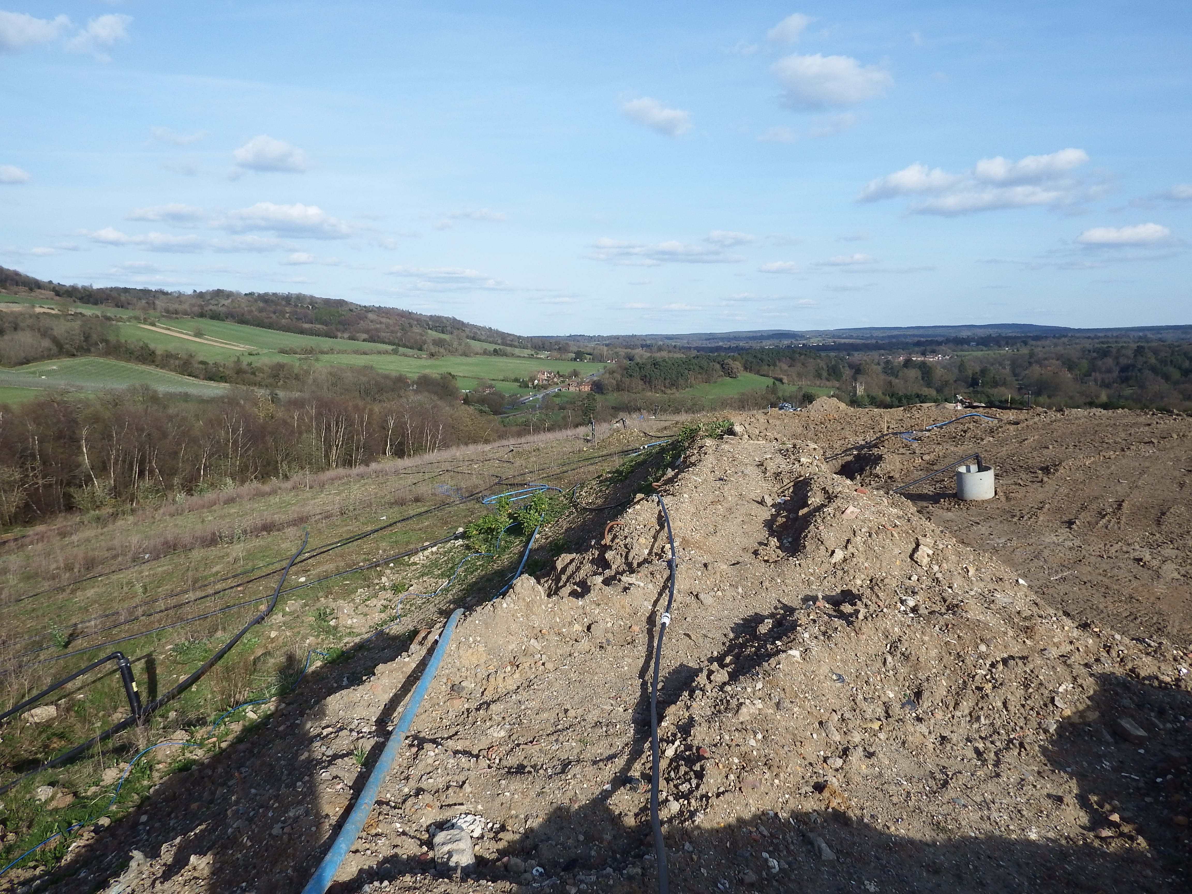
Top of Albury Landfill in the area of the mound

Top of Albury Landfill in the area of the mound