The NEWLANDS LINE, at 132° is 100 ° from the Crooksbury Line, and again starts from Whitmoor Barrow. At 4 Druid Miles (DM) it passes through St John’s Church at Merrow and carries on to Newlands Corner Barrow at 6 DM. These distances are very precise and have been used as the decided criterion of the Druid Mile. In Weston Wood the line brushes the side of the reported position of a disputed barrow, now completely destroyed by sand extraction, and then passes through the site of a Mesolithic settlement. At 9 DM passes close by Shere Heath Barrow but not close enough to be taken as an alignment.
268_1+ Weston Wood Mound
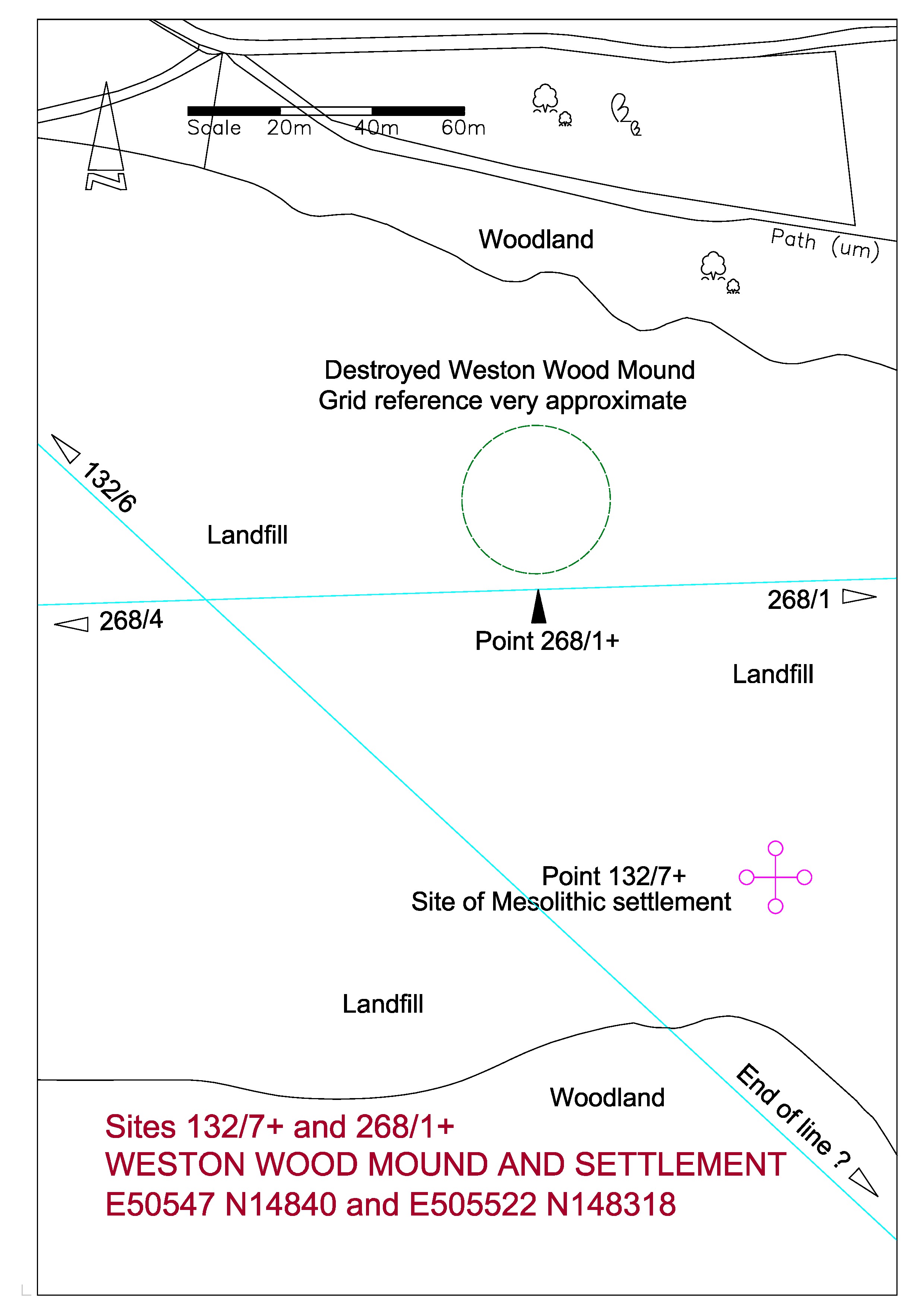
The path at the top of the above plan is the main prehistoric trackway through Surrey, popularly known as the Pilgrims Way, which followed the North Downs from Kent through to Salisbury Plain.
THE MESOLITHIC SETTLEMENT
I have recently unearthed a sketch plan from the Surrey Archaeological Society archives of the excavation in Weston Wood of the Mesolithic settlement carried out c1961-3. The plan covers an area fifty metres square. It shows a trackway running from the south-east towards the north-west; with various post holes and points of interest; and with two areas of ploughed field to the east side. The excavation was carried out by an amateur team and appears rather inadequate by today’s standards and indeed I believe that the notes for this excavation have still not been published after half a century. Unfortunately this site has long been eaten away by sand extraction and is now a landfill site.
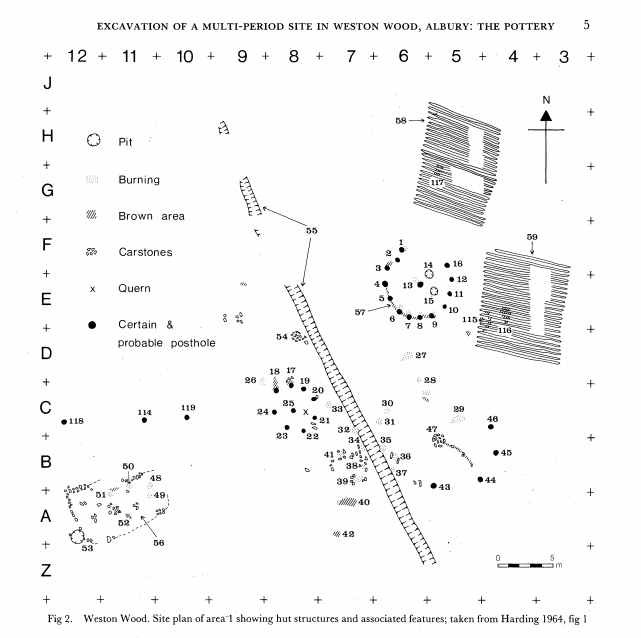
The Newlands Line is on a bearing of 132 degrees from Grid North. The trackway on the plan is at the bearing of about 152 degrees using the given North point. The excavation plan is a fairly poor sketch, not drawn very carefully by today’s standards, and is located with very approximate Ordnance Survey co-ordinates, and I suspect that the site of excavation was located very approximately in this area of scrubby land near the edge of the encroaching sand extraction with no local detail to tie in to the Ordnance Survey. The excavators set out a five metre grid as shown by the reference marks on the edges of the plan and it is possible that they located north using a compass. The plan is dated 1964 and at this time Magnetic North was some 13 degrees west of Grid North. We have about a 20 degree difference between the path on the plan and the Newlands Line, but if the North point was established using a magnetic compass then we only have a difference between the Newlands Line and the path of some 7 degrees. The Line is some 40 metres to the west of the given OS co-ordinates for the site but these are only to ten metres accuracy indicating a lack of precision.
This is certainly all very speculative and I would like to emphasize that I include this site, not because I have much faith in the validity of my findings, but because I have tried to include as much information as I can to help any possible future research. There are obvious problems, such as the time period involved. The Mesolithic period ended some five thousand years ago, so any relationship to the alignments would appear to be coincidental. The most likely factor for the positioning of a settlement here would be the proximity of the natural spring at the Silent Pool.
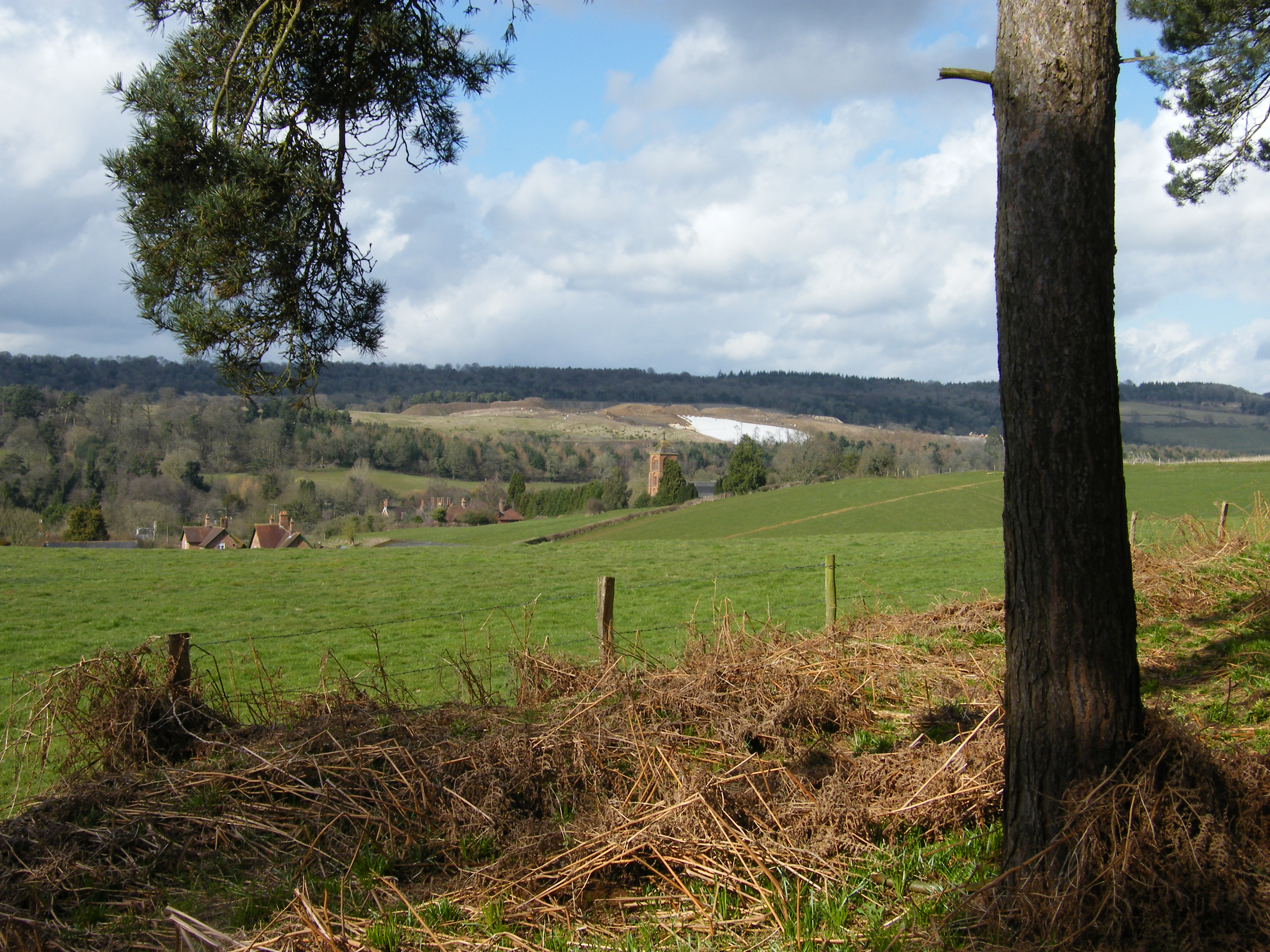
White area is plastic covering on landfill site. The mound would have been just beyond this.
THE MOUND
Weston Wood Mound was recorded as being about 135 feet in diameter and some five feet high. The top was flat. It had been thought that it may have been a landscape feature associated with the parkland of Weston House in Albury but no evidence as to its origins had ever been established. It was destroyed by sand extraction in the late 1990s.
The medieval road from the village of Albury to the south ran over the ridge past the mound towards Newlands Corner in the North West. The age of the mound had always been a matter of controversy. In SAS Vol 60 of 1963 W Crawford Knox theorized that the medieval road went around the mound in a manner which suggested that the mound predated the road. An excavation in 1965 revealed little, but notably, a coin of c1750 was found beneath the clay capping, suggesting the possibility that the ancient structure may have been modified as a landscape feature.
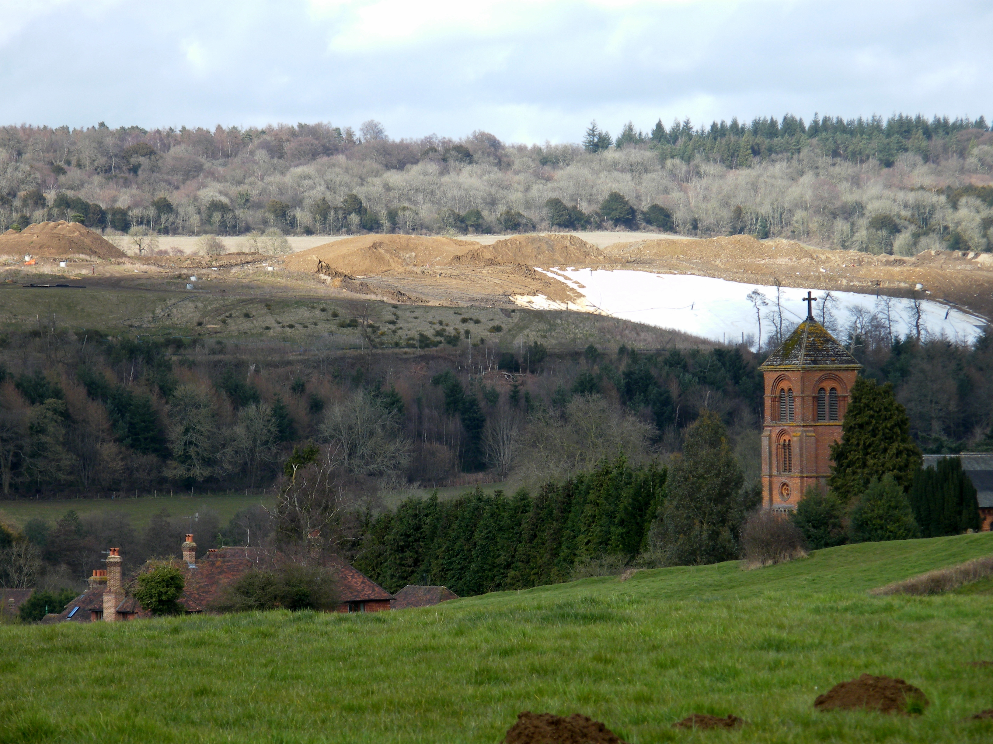
The site of the mound in the landfill looking over Albury New Church
The most popular website used by enthusiasts of prehistoric monuments is ‘The Megalithic Portal’. A search for Weston Wood brings up two photographs submitted by Eileen Roche purporting to be the mound shortly before it was destroyed. In 1999 I began a twice-yearly monitoring of the volumes of sand extraction in the pit and have great familiarity with the site. Looking at the photographs I feel that the mound shown would have been a soil stock and that the ancient mound would have been further north. But now we shall never know.
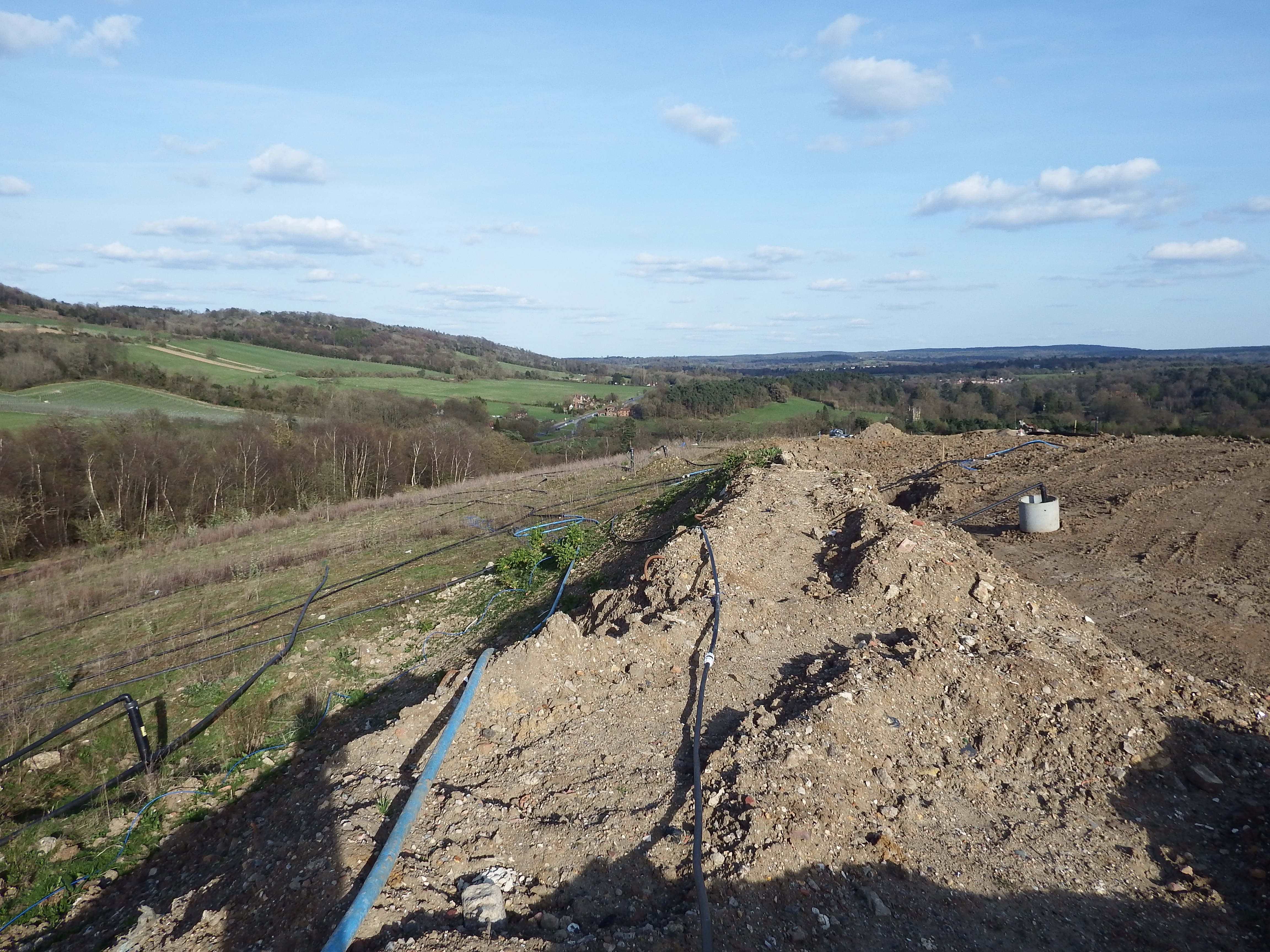
Top of Albury Landfill in the area of the mound


