Tag Archives: Hog’s Back

Church Croft added to DEERLEAP LINE

I have in my library a copy of  “Puttenham under the Hog’s Back’ by Ruth Dugmore. Published in 1972 by Philimore Press.  At long last it has risen to the top of the pile of my required reading and I was interested to find the following:

“In the seventh century England was divided up into vast dioceses. And each of these dioseces would have a minster. And from these minsters priests and laymen would penetrate the rough countryside evangelising. They would stop at a cross which was possibly erected on an old pagan site and would preach to those who came to hear them. As they evangelised they would push further afield and chapels would be set up where once there was only a preacher’s cross. The minster however would remain the mother church. There was a minster at Tuesley and it is almost certain that the area would have been Christianised from the minster there. One of the duties of the travelling priests would be to discover sites dedicated to heathen gods. Here the priest would set up a cross and substitute a Christian service for a pagan one’.

Another extract from Mrs Dugmore’s book:

“In Puttenham there is a possibility of a heathen centre which became a Christian place of worship at Church Croft; a small hill not far from the village, which is approached by a network of tracks and paths. The name Church Croft has no significance in later times and was never church property, but there must have been a reason for it. Could it have been an altar which had been erected to some god and where a preaching cross was later set up?’

And an extract from the highly recommended website “Surrey Medieval’ by Robert Briggs.

“Another piece of evidence of a very different kind (but whose record we again have Rev. Kerry to thank for) suggests a more complex chronology. Local folklore maintained that the first church in Puttenham was sited almost a mile to the southwest of the village in a location known as Church Croft. Kerry told the story thus: “In the plantation near Mr Hewettʼs Barn [no longer in existence; its site lies west of present-day Gores Farm] is a spot where it is said by the old people that the church was to have been erected, but that their pious intention was frustrated by the fairies who removed in the night what had been erected in the day to the place where the church now stands”. It is not hard to be captivated by such a tale, and Knox interpreted it as signifying the destruction of an early church on a site of pagan worship by Ê»supporters of the old religionʼ’.

“In the case of Puttenham, the name Church Croft may hold the key. We know a new rectory at the east end of the church – effectively in Ê»the place where the church now standsʼ to repeat Kerryʼs words – was provided for in the will of Richard Lussher who died in 1502. Its previous site is undocumented, but a decent case can be made for it to have stood atop Church Croft. For one thing, this would mesh with John Blairʼs observation that many medieval Surrey rectories were isolated from their churches. A simple explanation of the fairy story, one which accommodates its key components, is that it was the rectory removed from its original site at Church Croft and re-established on a site so close to the church as to count as being “where it stands”.’

Many of the barrows in the area of Puttenham, Seale, and around were dug into by the above mentioned reverend Charles Kerry, curator of Puttenham church from 1868 to 1877, and indeed it may be him responsible for the cross trench on the crown of Culverswell Barrow. Unfortunately he seems to have been a “hobby archaeologist’ and was lax in recording his finds. After spells in various livings from Bedfordshire to Northumberland, he ended his career in Derbyshire with all his notebooks. Upon his death these were left to Derby Public Library. There may be something of interest there but probably a long shot.

screenshot-church-croft-1

Church Croft appears to fall upon the DEERLEAP LINE, shown crossing as a red line above, it is   at the nineteen Druid Mile (DM) point in private land being used as a pheasantry. Last week I visited this point using my hand-held GPS to locate the precise location.  From the rough track, visible running up the left side of this Google Earth image, I navigated through mixed woodland to an unkempt field knee deep in weeds, seen in the centre of the image.  The point is in the north east corner of the field and is the edge of the top of this high ground.  The land to the east falls downhill on a shallow gradient towards the village.  It was difficult to judge but this area would appear to be at the highest point on the ridge which extends all the way back to Hillbury Hillfort.  In the LIDAR image below the red circle marks the 19 DM point and the shape of the field above can be made out.

puttenham-common-lidar_edited-1

In this image the high ridge of common land runs from Hillbury (266 degrees and 20 DM), outlined in red, through to the red circle of 266/19.  An ancient field system can be seen all over the high ground, little known before the introduction of LIDAR, with valleys running downhill on the north and south sides.  A trackway can be seen running from point 266/20 inside the south east corner of the fort fairly straight towards point 266/19.

Hillbury to Hogs Back looking NE  View from 266/20 inside the fort looking north east to show the terrain.

Culverswell Barrow

The following Page is copied into Posts because it seems very few visitors look beyond the Posts and therefore miss this important finding which is crucial to the credibility of the  pattern.

The CROOKSBURY LINE at 232.32 degrees from North would appear to be aligned to the mid-winter sunset.  At just over 7 Druid Miles (DM) the line passes through St Bartholomew’s Church at Wanborough.  At just over 8 DM, and on the extremity of visibility, lies the site of the Hogs Back Barrow on a high ridge which appears to be the aiming point for the midwinter sunset.  The line then passes close by Hillbury Hillfort at 10 DM, but it is other alignments which pass through the fort itself, and then carries on to Culverswell Barrow.   Although precisely on the line it is slightly beyond the 12 DM point at the crest of the hill. Carrying on down the hill the alignment terminates between two very close tumuli known as Crooksbury Barrows. Nothing has so far been found beyond this point.

Culverswell Barrow

Culverswell Barrow ditch with mound on right side viewed from the south before the removal of trees.

232_12 Culverswell Barrow


RED LETTER DAY

On 25 July 1979 I finally proved to my own satisfaction that at least one of the alignments was laid out intentionally by prehistoric peoples. I had always realised that my case would be greatly enhanced by the discovery of a previously unrecorded barrow in a precise location predetermined by myself prior to a site visit.

It had seemed logical that one would be more likely to find a prehistoric site on the highest point of an alignment and so profiles were produced using the contours shown on the Ordnance Survey six inch to the mile maps. These proved very useful for the demonstration of sightlines and showed several high points where no ancient site was recorded. One of the most prominent of these was at Culverswell Hill on Crooksbury Common at the south western end of the CROOKSBURY LINE. The alignment was followed on a compass bearing from the well-preserved bowl barrow about 300 m to the South West. After negotiating some dense rhododendron bushes I emerged onto the pine covered plateau to the North West of the bluff to be confronted by a large mound surrounded by a shallow ditch. It was so obviously a barrow that it was quite beyond me that it was unknown to the Surrey Archaeological Society. The top was deeply cut by a badly eroded cross- trench indicating that it had been dug into at some time in the distant past but had remained unrecorded. The following weekend a tacheometric traverse was carried out from Littleworth Cross to the mound through the nearby Crooksbury barrows and back to the road thus establishing a grid reference for my survey pegs by the barrow to 1m of accuracy. When plotted onto the 1 to 1250 Ordnance Survey sheet it would seem to be in alignment as predicted.

The barrow has since been visited by the County Archaeologist who requested the county’s foremost expert on the Bronze Age. Mr Stuart Needham, to give his opinion. Mr Needham ruled out the alternatives such as a windmill stead, or landscaping and concluded his report by expressing great surprise that such a fine prehistoric monument had remained unrecorded in an area well known for its earthworks. I suspect that one reason is that most people walking in this area of Scots pine covered sandy hills would use the established paths. The path which crosses below the bluff affords a view up to the barrow but as no ditch is visible from the south side owing to the erosion of the slope, the earthwork appears to be merely the top of the small hill. The ditch and mound are only obvious when viewed from the North, the least accessible direction.

Letter to Dr D G Bird, County Archaeological Officer, from Stuart Needham.

‘Dear David

ROUND MOUND ON CULVERSWELL HILL C. SU 89234561.

Thank you for notifying of this earthwork;   I have recently had the opportunity of visiting the site.   I found a sizeable round mound approximately 24.8m diameter and perhaps approaching 2m in height.

The top of the mound has been mutilated in the past by the digging of a cross-shaped trench, now much silted.   Around roughly half of the mound’s base may be detected traces of a ditch 2.8m across and at present barely 0.2m deep.   The mound is sited on the end of an eastward facing spur with steep slopes on three sides.   The ditch peters out here, perhaps there having been no necessity for it, or otherwise it has been removed or concealed by a greater degree of erosion down the slopes.   Inspection of the side of a foxhole suggested a possible composite mound structure, but as usual such evidence is ambiguous.   The ground to the west rises gently and evenly with no indications of undulations frequent in this sort of sandy terrain resulting from natural agencies, or extractive disturbance.   There are some rhododendron clumps immediately to the west of the mound, but no sign of any associated landscaping.

In my opinion the extant features – the size, circular plan, evidence for a ditch, and its siting – are strongly in favour of it being a genuine ditched bowl barrow, which would of course normally be referable to the earlier Bronze Age.   Other possibilities such as a natural mound, a feature of relatively recent landscaping, or the base of a post windmill, can I think be reasonably dismissed for the present.

It really is astonishing that that such a fine upstanding monument should have escaped notice for so long in view of the proximity of the triple (sic) bell barrow on Crooksbury Common!

Best wishes

Stuart Needham’

In the summer of 2015 the site was visited with the purpose of carrying out a GPS survey and the resultant coordinates were added to the AutoCAD database.  This showed that the original survey was accurate and that the barrow was indeed perfectly on the alignment.

St Nicholas Church, Compton

I now turn my attention to one of the most interesting sites – the church of St Nicholas in the village of Compton.

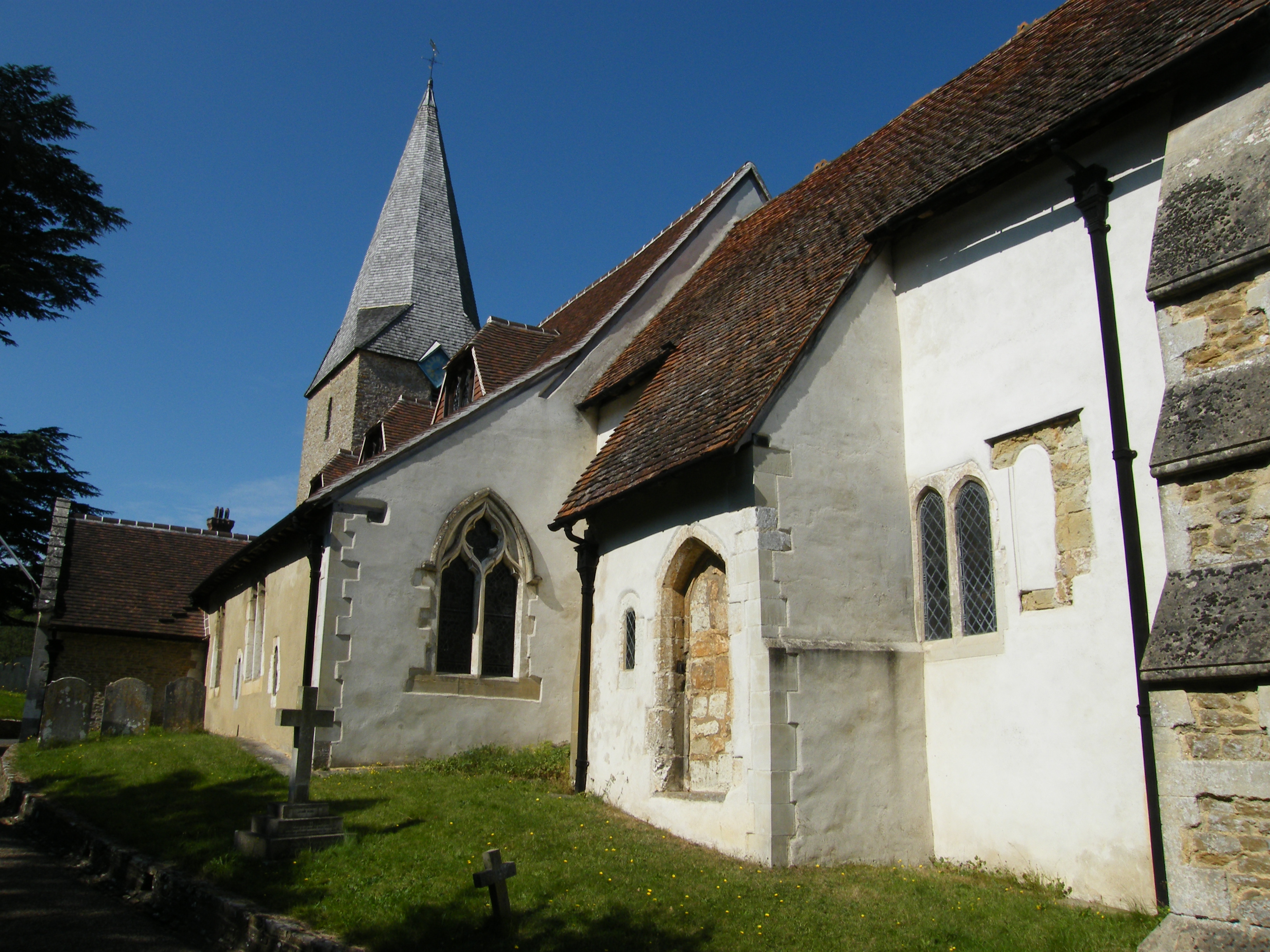
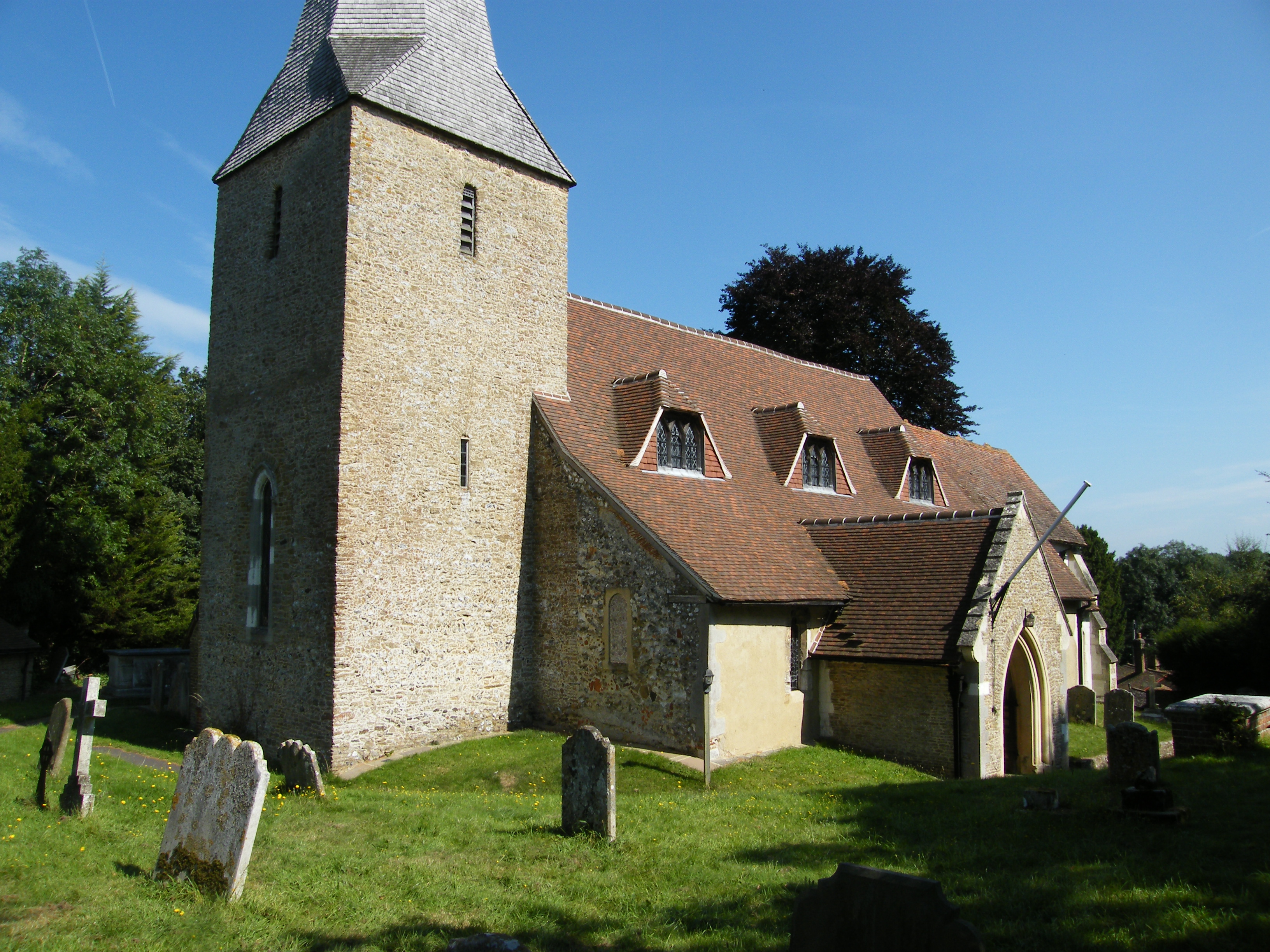
The church is mainly Norman in construction with a Saxon tower to the West end. This church is unique in having a two-storey sanctuary above the chancel built in the 12th century. The purpose of this arrangement is a puzzle.   The Saxon wall to the north side of the chancel has a small window believed to have belonged to a hermit’s cell.

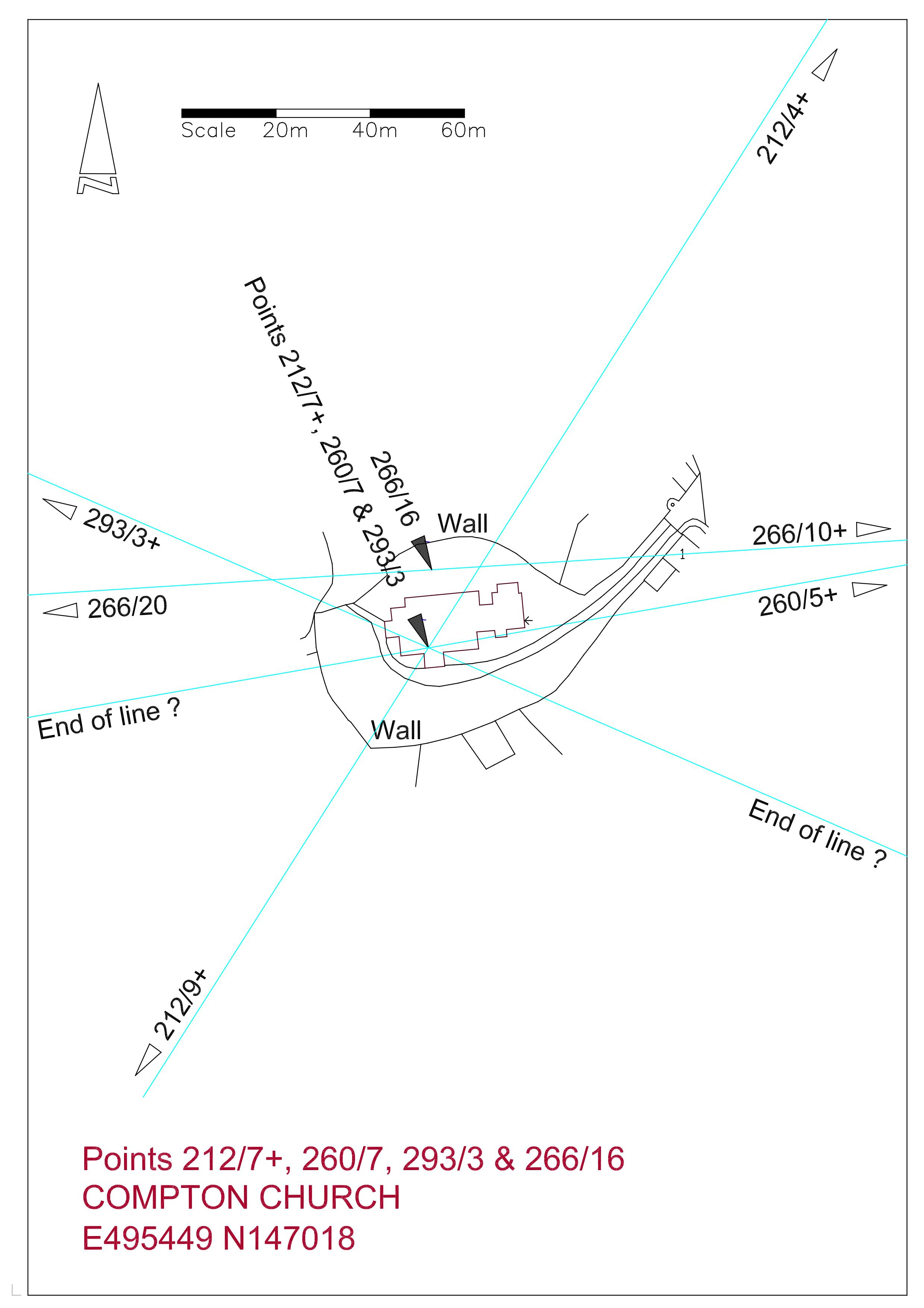
212_7+ Compton Church212_7-compton-church-rev

217_7-compton-church-rev

Uniquely there are four alignments passing through this site.   Beginning with the FROWSBURY LINE; there are only three sites on this alignment.   Starting at the church the line heads north-west at 293 degrees and passes through Frowsbury Barrow at just over 1.5 Druid Miles.   In just under 1.5 DM it ends at the Ancient Monument sign marking the Hog’s Back Barrow.  This barrow is also on the CROOKSBURY LINE.   The churchyard at Compton is very roughly circular and it can be demonstrated that a circle of the same diameter as Frowsbury can be fitted within this area suggesting the possibility that the church is evolved from a similar site.

The COMPTON LINE passing through the church at 219 degrees mirrors the TYTING LINE, both being 30 degrees east and west of the SOUTH LINE.   It is strange that the site to the north-east on the line is a medieval moat and the site to the south-west is a Victorian church, and yet the alignment of these sites is extraordinarily precise.

The ARTINGTON LINE through the body of the church also has dubious sites which need further research.

The fourth line, the DEERLEAP LINE at 260 degrees, has six points although one is a moat and another is a Victorian church, but once again the precision is exceptional.  Refinement of this line brings it to the north side of the church but well within the churchyard.  The distance  from  Deerleap Barrow to the churchyard  is 16 Druid Miles.

Compton Church from South East

Compton Church from south-east

Compton Church from South West

Compton Church from south-west

In the above picture, three alignments meet inside the door from the porch.

THE WAVERLEY LINE Re-examined and Refined


Waverley A3

A re-examination of the Waverley Line has led me to believe that this alignment could be more precise if I abandoned the notion that Point 251/7 at Merrow Church had to be exactly coincidental to Point 132/4, also at Merrow Church but on the crossing of the Newlands Line.     I had stuck to this idea because both points have a remarkable accuracy with the Druid Mile (DM), Point 132/4 being four DM on the 132 degree line from the base point of Whitmoor Barrow, and 251/7 being three DM from East Clandon Church.   A plan of this church from a local history website shows the outline of the original eleventh century building.   If the centre of this structure is taken as the revised start to the alignment  (nothing is currently found to the east) and the termination is taken as the centre of the Monk’s Choir within the nave of Waverley Abbey, then the accuracy of the alignment through six points becomes astonishingly precise.   There is a slight change in the angle from grid north at  251.50 degrees to 251.53.   This has the effect of moving the line from just outside the buildings of East Clandon Church and Merrow Church to the centre of the structures.   I have redrawn the site plans of these six points and revised the respective overall plan and data sheet.

East Clandon Church

251_4 East Clandon Church

The original numbering of this line was to take in the Churches of West Horsley, 251/1 is just beyond to the East, and West Clandon between Points 251/5 and 251/6, but neither of these churches is close enough to the alignment, West Horsley being 30 metres to the south and West Clandon is 45 metres to the north.   It is thought that the rough alignment of these churches is because the hamlets they serve were established upon the spring line of waters issuing from the interface of local clay and the chalk hills to the south.

132_4 Merrrow Church


The orientation of these sites may be of interest; East Clandon at 256.4 degrees is five degrees from the orientation of the line; Merrow Church at 260 degrees is 8.5 degrees, and Guildford Friary at 255.5 is four degrees.   Grid west is 270 degrees so all these sites are some ten to fifteen degrees anti-clockwise from true west and much closer to the orientation of the line.  Waverley Abbey bucks the trend by being thirteen degrees north of due west.

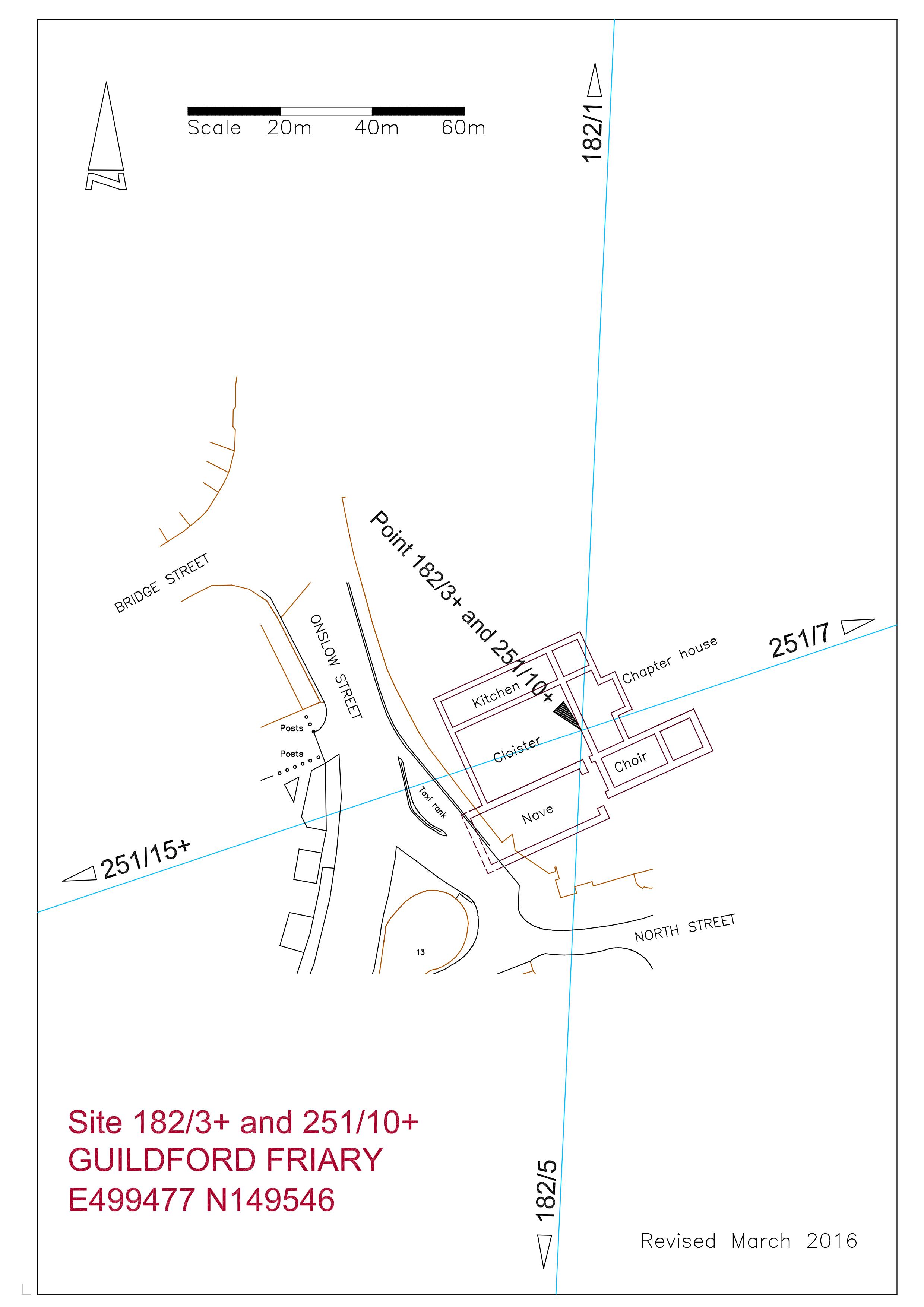
182/3+ Guildford Friary

It has always been interesting to me that the site is on the South Line, being the central spine of the ten degree alignments, but the actual location of the friary is poorly defined on the Ordnance Survey, shown only as a comment “Site of  friary founded 1275′,   therefore the accuracy of any alignment has been unverified, but I have now obtained a copy of the “Research Volume of the Surrey Archaeological Society No 9′ titled “Excavations on the Site of the Dominican Friary at Guildford in 1974 and 1978, by Rob Poulton and Humphrey Woods, published by the SAS in 1984.   By today’s standards the location plan is not brilliant, being more of a sketch than a survey, but with enough information to allow me to enlarge it to 1-200 scale enabling the measurement of the discovered foundations and adjoining streets to be transferred into AutoCAD. This digital drawing was overlaid on my OS database as a block and adjusted to obtain a best fit with the neighbouring streets.   The report also included an aerial photograph of the excavated site which I have used to further enhance the fit, and I now feel that I have the position of the friary buildings to within perhaps three metres of accuracy.

The area of demolition of the old Friary Meux Brewery to facilitate the construction of the Friary Centre shopping mall covers a large area and the excavated foundations take up perhaps about fifteen per cent at the most.   Therefore I was surprised to see that the two alignments passing through the site crossed within the excavated structure, with the South Line passing through the nave at the choir end (see plan).   Once again I am impressed with the coincidence of my findings.   Only the west end of the nave remains unexcavated as it lies just within the roadway of Onslow Street and maybe one day it will be possible to reveal this to accurately survey the location of the complex.  The revision to the line brings it nearer the centre of the excavated foundations.

Frowsbury Barrow from the south

Frowsbury Barrow from the south

The fourth point is Frowsbury Barrow standing next to a fairway of Puttenham Golf Club and is easily accessed from the Pilgrim’s Way long distance footpath just to the north.    The code for this site is 251/15+, the plus sign showing that it is more than 15 DM along the line from the base point.  It is 41 metres across with a ditch bringing the overall width to 47.5 metres, and is 2.4m high.   In 1857 Queen Victoria reviewed her troops from the top and this is commemorated by a stone tablet and a flagpole.   The line passes well within the top of the barrow just south of the flagpole.   The barrow is indistinct on natural raised ground and is only obvious when viewed from the south across a fairway.   There is a large greenkeepers shed close to the north side which seems to be built in a shallow quarry. There are pine trees between the shed and the barrow but the top of the mound is grassy with some bracken and heather to the east side.   Where the surface is exposed it is very sandy.

251_15+ Frowsbury Barrow REV

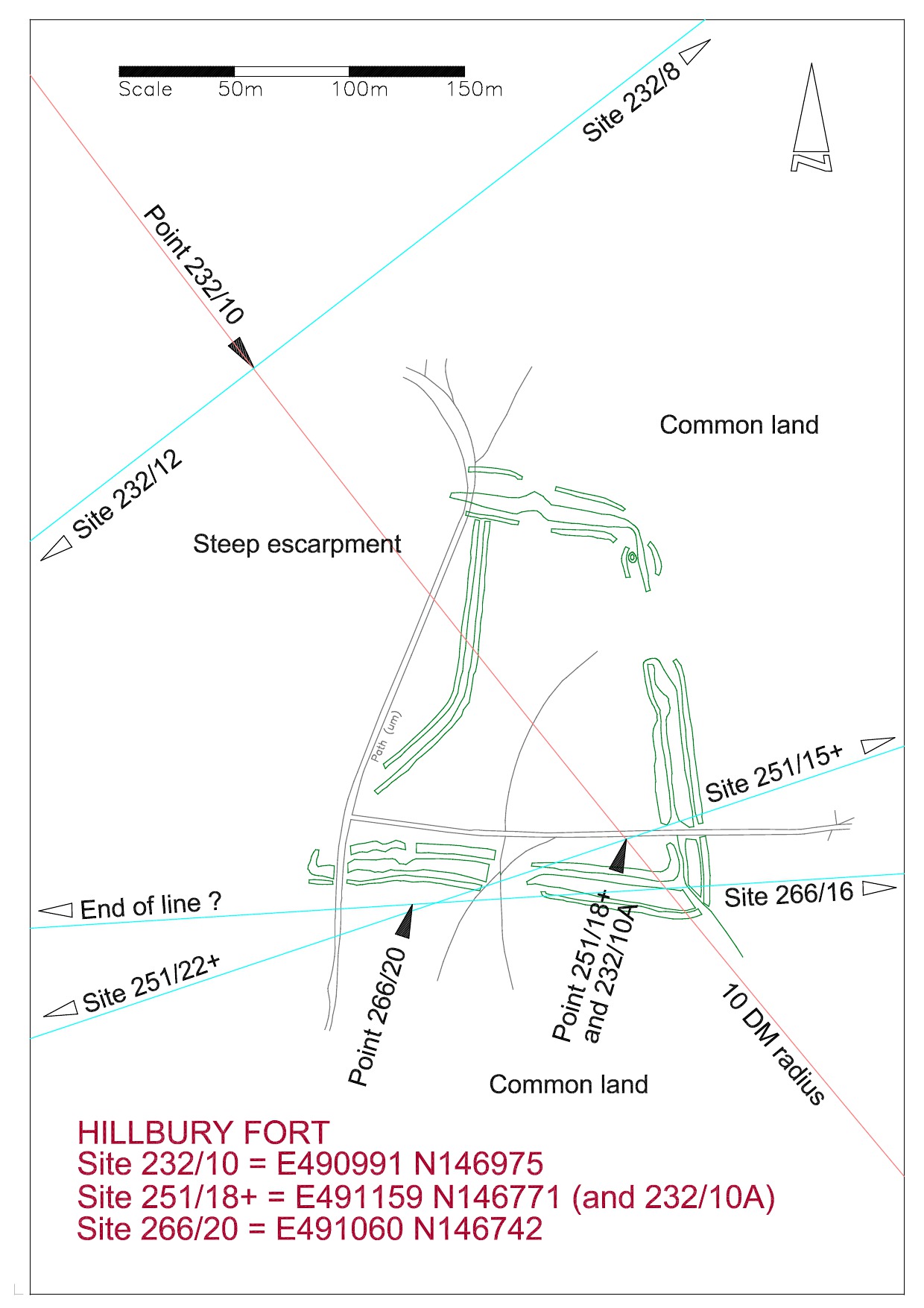
Hillbury Hillfort on Puttenham Common is the fourth point and although this covers a large area Point 251/18+ is positioned on the highest location within the ramparts.  This position being determined by the crossing of Line 293, the Frowsbury line, to Compton Church in the south east and Hogs Back Barrow to the north west.  This point is precisely ten DM from the base point at Whitmoor Barrow.  Line 266, the Deerleap Line, also passes through this point at 20 DM from Deerleap Barrow.


site-plan-of-hillbury-fort

Hillbury to Hogs Back looking NE

This photograph is taken from near the top of the site looking north across the fort to the Hogs Back on the horizon.

The sixth and currently final site on this alignment is at Waverley Abbey.  As with Guildford Friary I originally did not know where the line would fall within the site and it wasn’t until I found a ground plan of the structures that the pieces fell into place with startling accuracy.

Extract from visitor information board

Extract from visitor information board

The above plan shows the end of the line to be in the centre of the Monk;s Choir at the east end of the nave.

251/22 Waverley Abbey

In summary, we have six sites in extremely precise alignment; multiples of the Druid Mile with intersections with other lines; and coinciding orientation of three churches suggesting a possible astronomical alignment.  I would need a lot of convincing that this is all coincidence, especially as I cannot at the moment discover any even vaguely similar  findings outside of this area .

More information on these sites may be found under the respective headings, or will be soon.


To be added to Seale Church on the SEALE LINE

Churches dedicated to St Laurence are quite rare.  He was a christian saint who was martyred in Rome in AD 285 under the emperor Valerian.  It is basically a Norman structure dating to the late 11th century.  Extensive restoration in 1861 has not detracted from the very pretty facades and the church is certainly one of the most pleasant in Surrey, enjoying a perfect position just below the south slopes of the Hogs Back.  It may have enjoyed a vista all the way down the valley to the east to Puttenham Church before vegetation obscured the view.

Although the the Seale line currently has only four points it is of some interest as the distance from Shalford Church to Puttenham Church is six Druid Miles and the distances between Puttenham Church to Seale Church and from Seale Church to Badshot Lea Long Barrow are both 3627 metres (11900 feet).  It also has an orientation almost exactly east  to west.

This line has some attraction to me and I think investigation of the intermediate DM points may be worthwhile.


Hillbury Fort added under CROOKSBURY LINE

Puttenham is a very special place for me with fond childhood memories of weekend visits to my father’s family home in the high street. It is a pretty village, linear with the church at the east end, lying at the foot of the south slope of the Hogs Back, now favoured by commuters enjoying the country life.  Puttenham Common is just to the south side of the village on a greensand ridge with extensive views to the chalk ridge of the South Downs.

Hillbury Fort sits on the west end of the central ridge across the common abutting a steep natural escarpment created by the small river flowing north to south through a series of millponds below.  It relates to three alignments; Crooksbury, Waverley and Deerleap. The alignment point on the Crooksbury line is near the foot of the pine-covered escarpment near the edge of the water in dense rhododendron scrub, making site inspection extremely difficult. The atmosphere of this spot prompts images of sacred groves and it would surely have been the source of water for the fort above.  This point is 10 DM along the alignment, as is the fort itself (see plan).

The Waverley line appears to pass through two distinct gaps in the east and south ramparts.  The 10 DM point on this line tucks neatly into the high point of the northeast corner of the fort. This area is rough ground covered in bracken and nothing out of the ordinary can be seen.

Badshot Lea Long Barrow

5/11/2014

The SEALE LINE at 270.5 degrees begins near Shere Church and passes close to Chilworth Priory. The true alignment begins at Shalford Church, which is on two other alignments, and passes through Puttenham Church and on to Seale Church.  The line terminates at Badshot Lea Long Barrow which is marked on the Ordnance Survey as the site of an Ancient Monument.  I have used the coordinates of the barrow as given in Surrey Archaeological Society archives. The distance between Shalford Church and Puttenham Church is precisely 6 Druid Miles.  An interesting coincidence on this line is that the distance between Puttenham Church and Seale Church and between Seale Church and Badshot Lea Long Barrow are identical at 11,840 feet.

270_13+ Badshot Lea

The only long barrow known to exist between the Kent and Wessex tombs and now completely destroyed. It was first discovered and excavated by the archaeologist William Rankine in 1936 not long before the surviving remains were removed by quarrying. It was thought that the barrow was originally some 140 feet long and orientated slightly north of east.

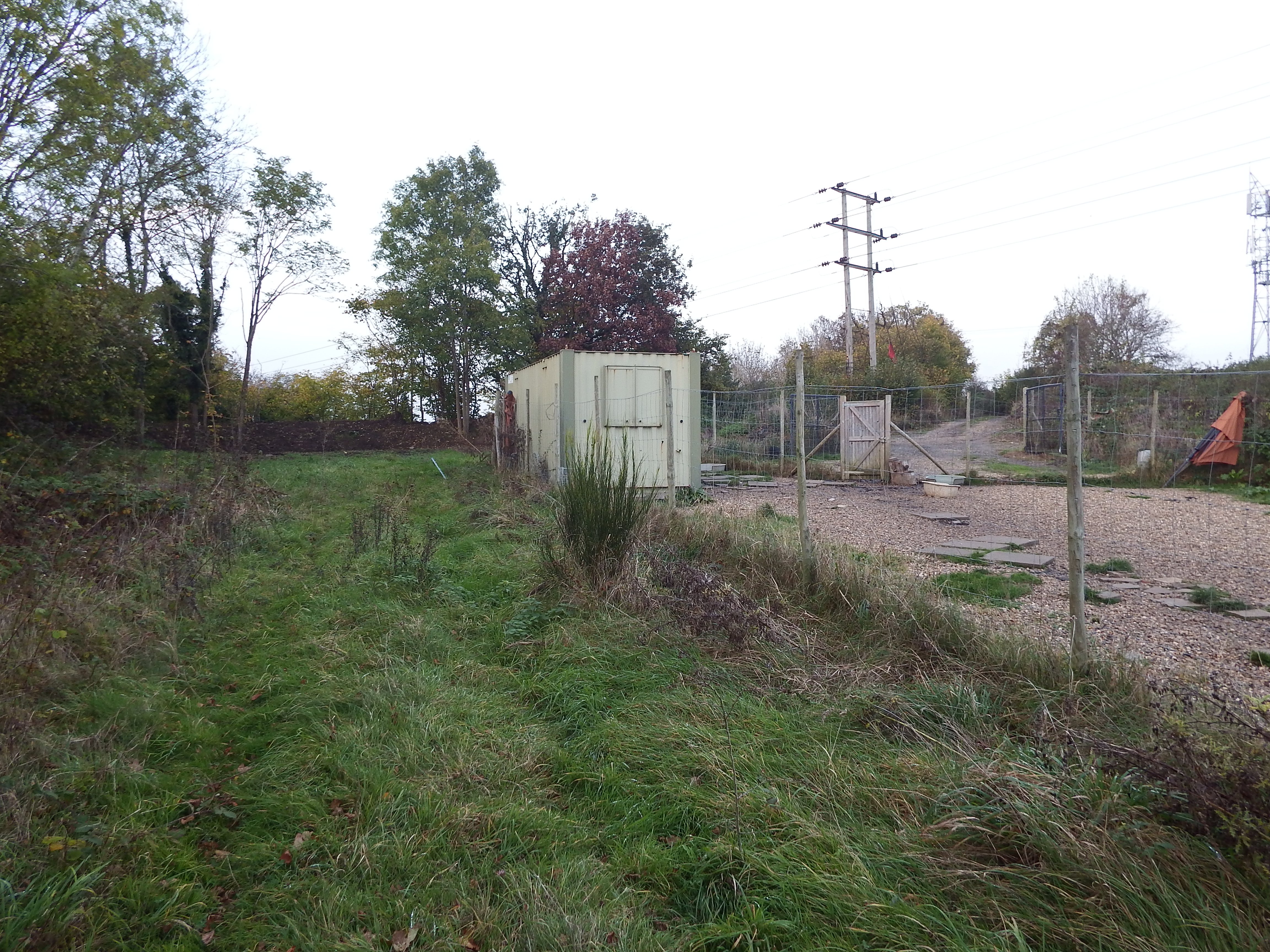
Looking north. The site is behind container with bund beyond. Access track is to right of Electricity poles.

Looking north. The site is behind container with bund beyond. Access track is to right of Electricity poles.

The site is accessed by parking in Hurlands Place (Sat Nav Farnham not Badshot) just beyond the entrance to Sainsbury’s superstore, and parking near the entrance to Hurlands Business Centre. A public footpath can now be seen at the end of the road heading east. Once the railway bridge is crossed the path comes out into the open and a container in a fenced compound can be seen on the left. The site is just the other side of this container. Although this is private land the chap running a dog-minding business in the compound proved very amicable although the mention of the long barrow left him looking rather blank.

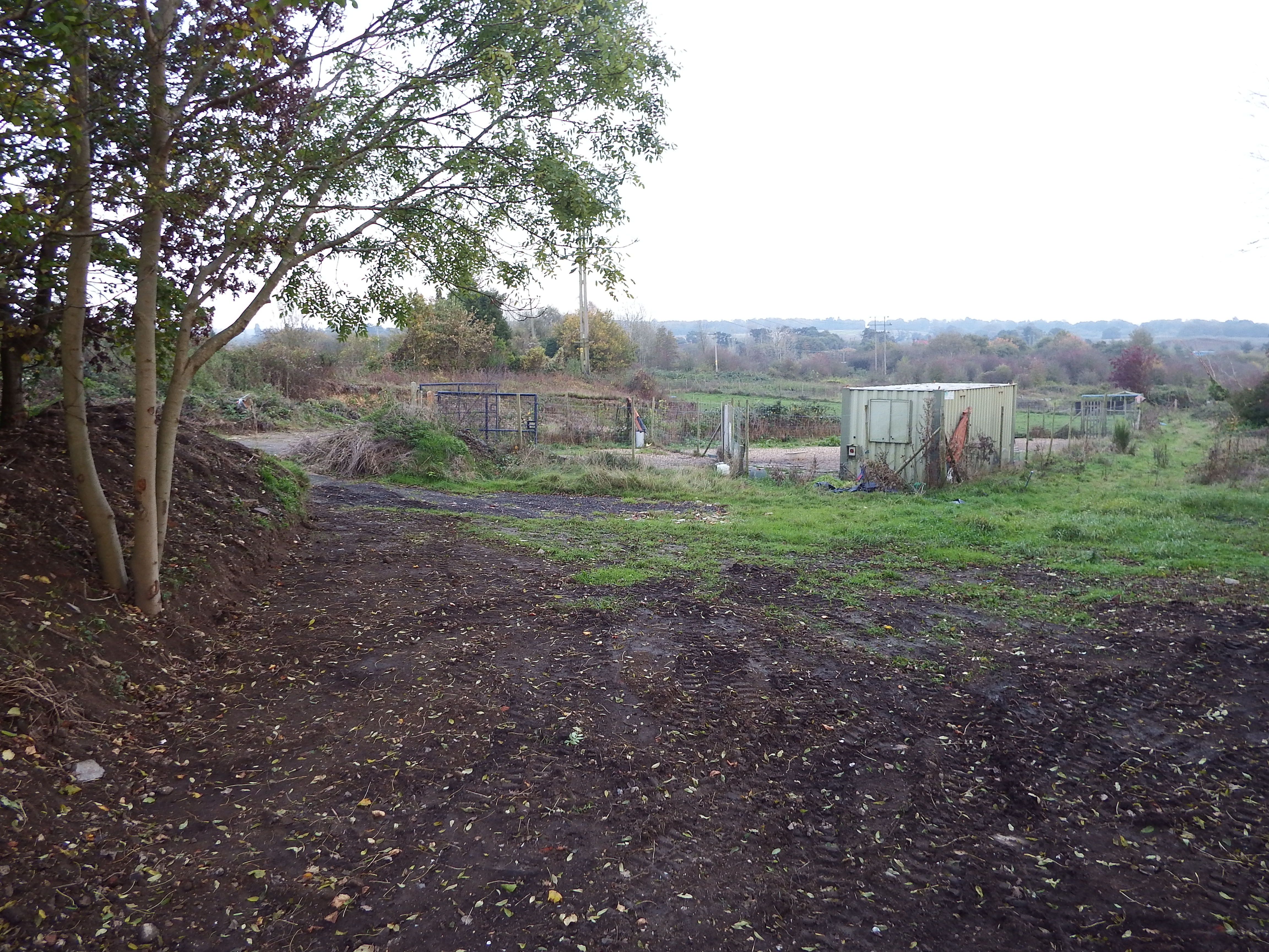
Site co-ordinates are halfway to container. Hogs Back on horizon. Bund on left and behind camera shielding quarry.

Site co-ordinates are halfway to container. Hogs Back on horizon. Bund on left and behind camera shielding quarry.

The ground here has a slight slope to the south. The site is on high ground with views in all directions apart from a segment to the east where the ground rises even higher. To the south the Hogs Back is visible with the South Downs just being visible beyond.  To the south east Crooksbury Hill is prominent, and to the west and north the horizon is some miles distant. Without the current tree cover this would have been a pleasant spot but now it is in an area of rough scrub and small fields overshadowed by power lines and a radio mast.

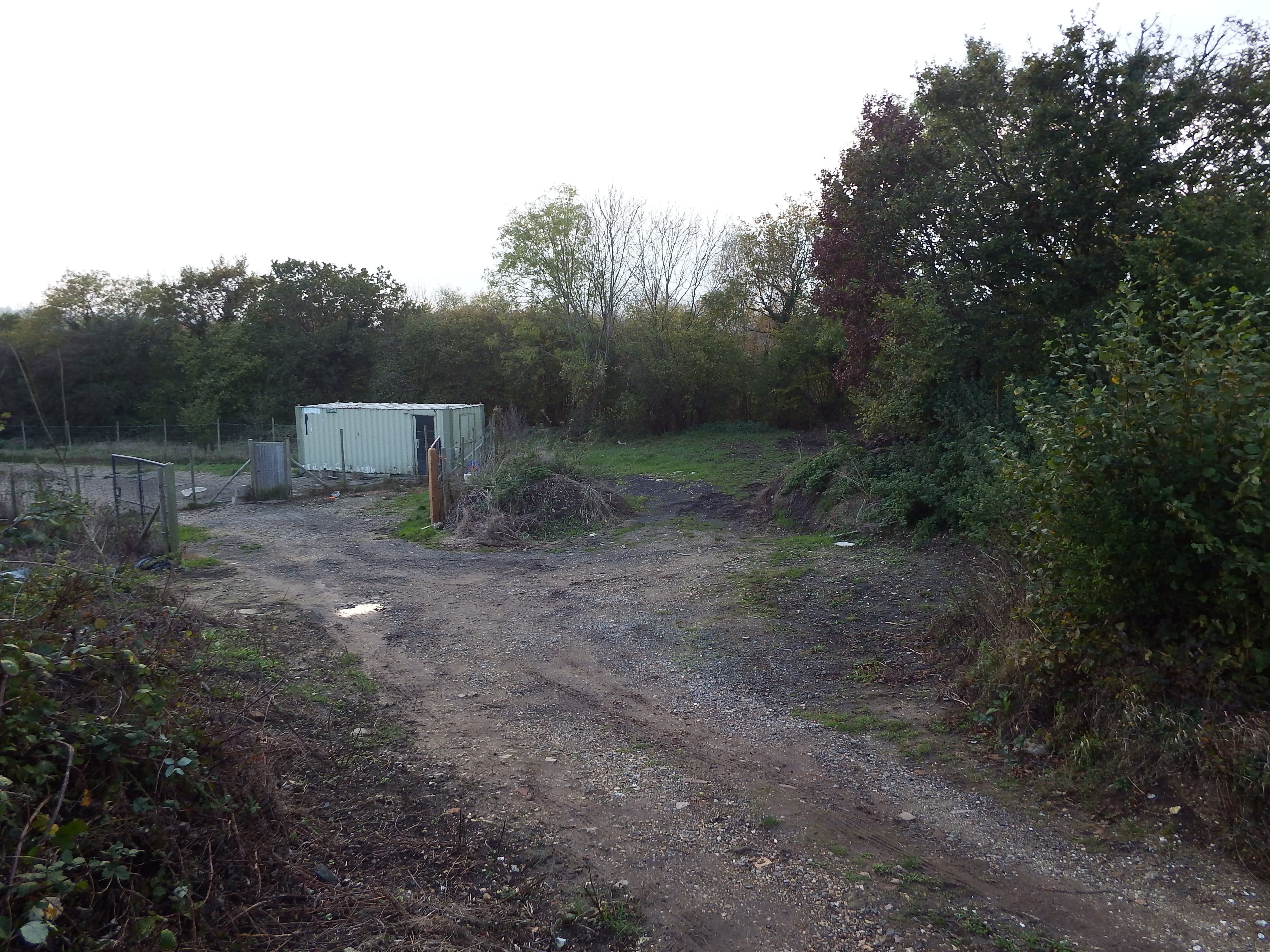
Site co-ordinates are on green patch in centre of view. Railway boundary hedge behind.

Site co-ordinates are on green patch in centre of view. Railway boundary hedge behind.

The site of the barrow is now a patch of scraped rubble and soils with a soil bund a few yards on the north edge beyond which is a disused quarry. There is a railway embankment to the western edge, heavily overgrown.  Immediately to the south edge of the barrow site is a fenced compound housing the container.  A rough metalled track provides access from the north east.
The site is so damaged by industrial activity that it is difficult to make out the original ground levels. My impression was that so much scraping of the ground in association with earth moving and storing activities had taken place that the current levels are below the original landform and that consequently no evidence of the barrow would be found by excavation. This assumption is backed up by the proximity of a small cliff some 25m to the south east. The face of the cliff, which is some two to three metres high, is virgin chalk showing that cutting into the landscape has occurred in the past.

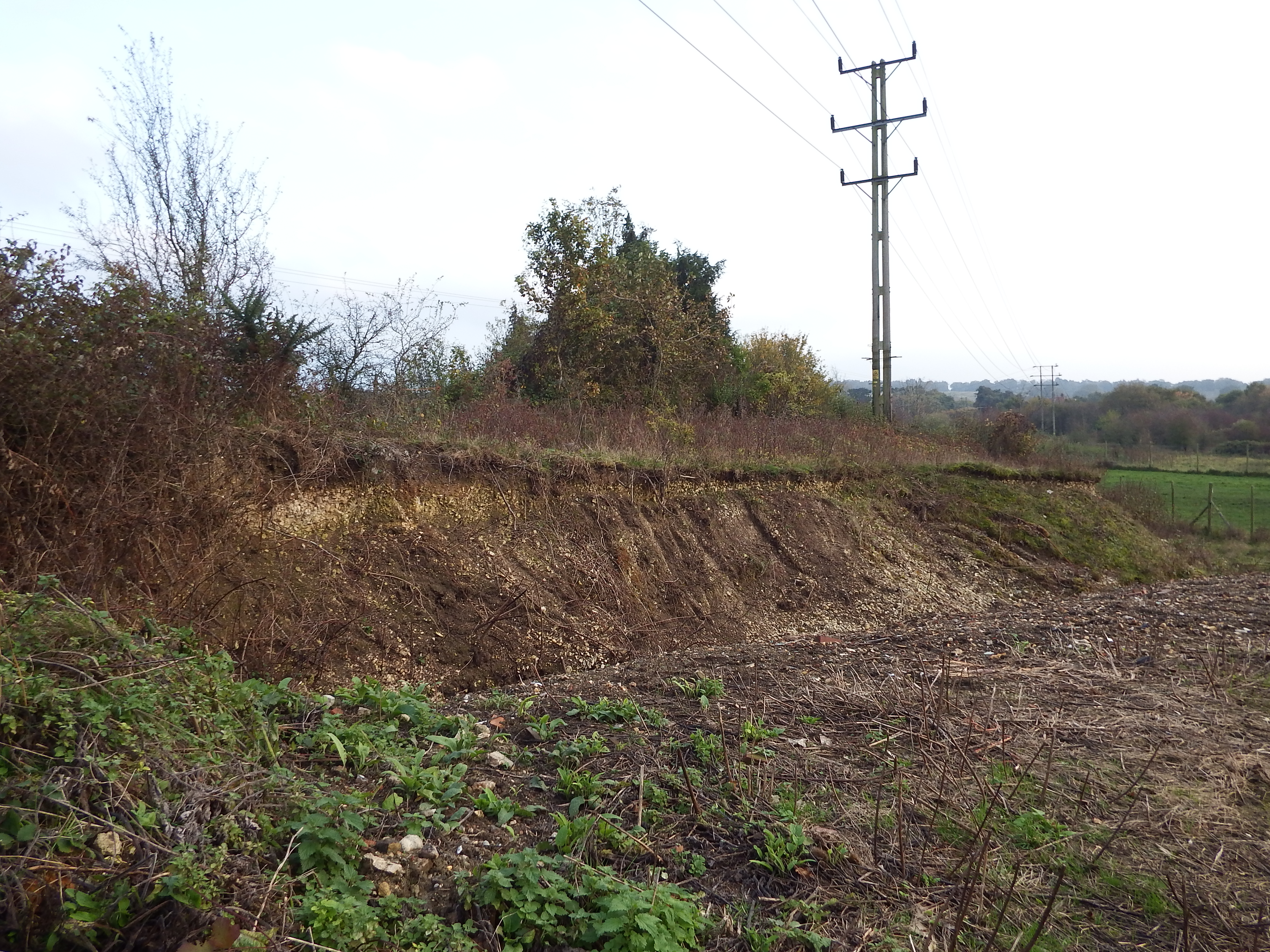
Chalk cliff showing how much the landform has been lowered.

Chalk cliff showing how much the landform has been lowered.