Tag Archives: Compton

Church Croft added to DEERLEAP LINE

I have in my library a copy of  “Puttenham under the Hog’s Back’ by Ruth Dugmore. Published in 1972 by Philimore Press.  At long last it has risen to the top of the pile of my required reading and I was interested to find the following:

“In the seventh century England was divided up into vast dioceses. And each of these dioseces would have a minster. And from these minsters priests and laymen would penetrate the rough countryside evangelising. They would stop at a cross which was possibly erected on an old pagan site and would preach to those who came to hear them. As they evangelised they would push further afield and chapels would be set up where once there was only a preacher’s cross. The minster however would remain the mother church. There was a minster at Tuesley and it is almost certain that the area would have been Christianised from the minster there. One of the duties of the travelling priests would be to discover sites dedicated to heathen gods. Here the priest would set up a cross and substitute a Christian service for a pagan one’.

Another extract from Mrs Dugmore’s book:

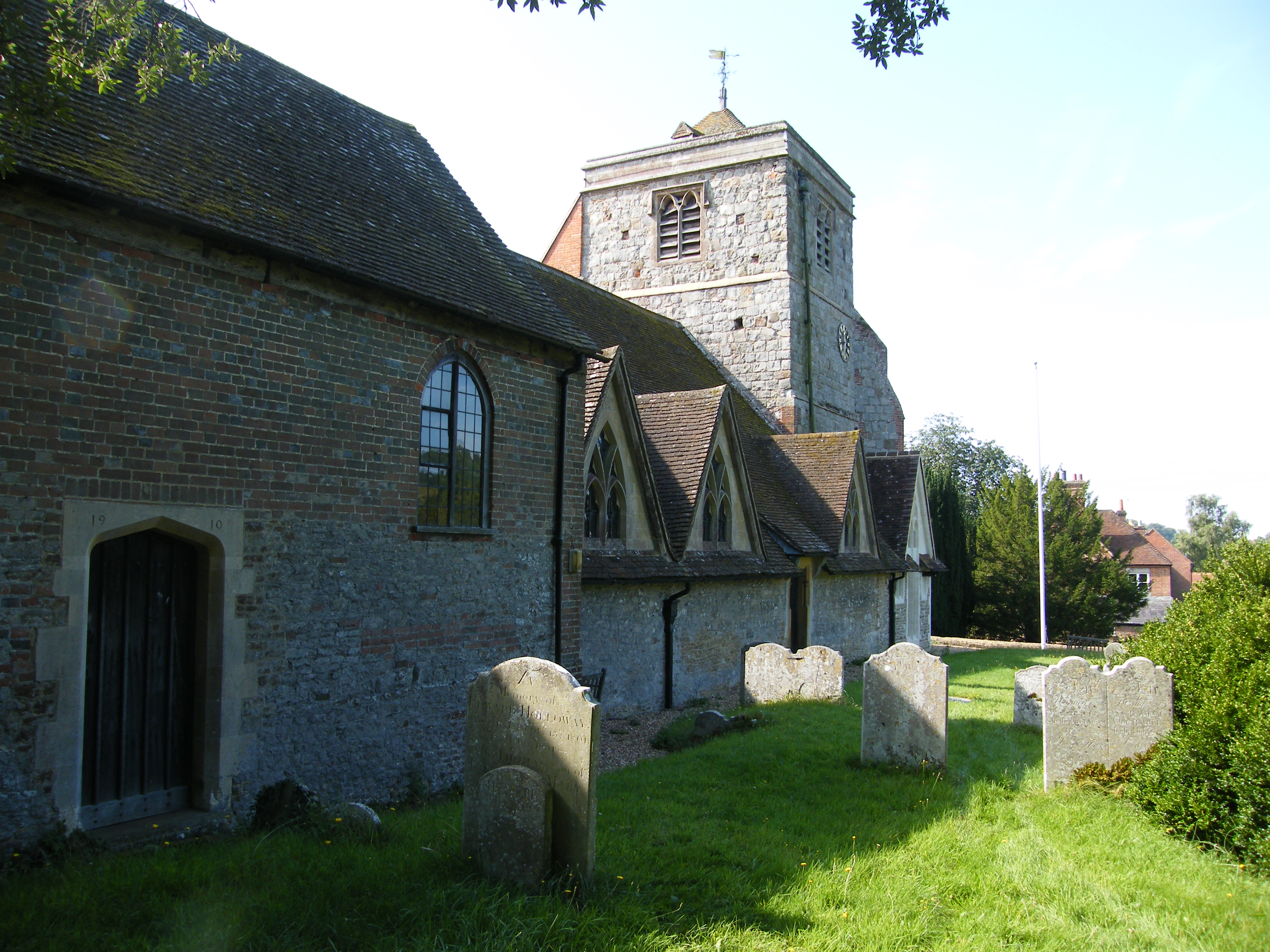
“In Puttenham there is a possibility of a heathen centre which became a Christian place of worship at Church Croft; a small hill not far from the village, which is approached by a network of tracks and paths. The name Church Croft has no significance in later times and was never church property, but there must have been a reason for it. Could it have been an altar which had been erected to some god and where a preaching cross was later set up?’

And an extract from the highly recommended website “Surrey Medieval’ by Robert Briggs.

“Another piece of evidence of a very different kind (but whose record we again have Rev. Kerry to thank for) suggests a more complex chronology. Local folklore maintained that the first church in Puttenham was sited almost a mile to the southwest of the village in a location known as Church Croft. Kerry told the story thus: “In the plantation near Mr Hewettʼs Barn [no longer in existence; its site lies west of present-day Gores Farm] is a spot where it is said by the old people that the church was to have been erected, but that their pious intention was frustrated by the fairies who removed in the night what had been erected in the day to the place where the church now stands”. It is not hard to be captivated by such a tale, and Knox interpreted it as signifying the destruction of an early church on a site of pagan worship by Ê»supporters of the old religionʼ’.

“In the case of Puttenham, the name Church Croft may hold the key. We know a new rectory at the east end of the church – effectively in Ê»the place where the church now standsʼ to repeat Kerryʼs words – was provided for in the will of Richard Lussher who died in 1502. Its previous site is undocumented, but a decent case can be made for it to have stood atop Church Croft. For one thing, this would mesh with John Blairʼs observation that many medieval Surrey rectories were isolated from their churches. A simple explanation of the fairy story, one which accommodates its key components, is that it was the rectory removed from its original site at Church Croft and re-established on a site so close to the church as to count as being “where it stands”.’

Many of the barrows in the area of Puttenham, Seale, and around were dug into by the above mentioned reverend Charles Kerry, curator of Puttenham church from 1868 to 1877, and indeed it may be him responsible for the cross trench on the crown of Culverswell Barrow. Unfortunately he seems to have been a “hobby archaeologist’ and was lax in recording his finds. After spells in various livings from Bedfordshire to Northumberland, he ended his career in Derbyshire with all his notebooks. Upon his death these were left to Derby Public Library. There may be something of interest there but probably a long shot.

screenshot-church-croft-1

Church Croft appears to fall upon the DEERLEAP LINE, shown crossing as a red line above, it is   at the nineteen Druid Mile (DM) point in private land being used as a pheasantry. Last week I visited this point using my hand-held GPS to locate the precise location.  From the rough track, visible running up the left side of this Google Earth image, I navigated through mixed woodland to an unkempt field knee deep in weeds, seen in the centre of the image.  The point is in the north east corner of the field and is the edge of the top of this high ground.  The land to the east falls downhill on a shallow gradient towards the village.  It was difficult to judge but this area would appear to be at the highest point on the ridge which extends all the way back to Hillbury Hillfort.  In the LIDAR image below the red circle marks the 19 DM point and the shape of the field above can be made out.

puttenham-common-lidar_edited-1

In this image the high ridge of common land runs from Hillbury (266 degrees and 20 DM), outlined in red, through to the red circle of 266/19.  An ancient field system can be seen all over the high ground, little known before the introduction of LIDAR, with valleys running downhill on the north and south sides.  A trackway can be seen running from point 266/20 inside the south east corner of the fort fairly straight towards point 266/19.

Hillbury to Hogs Back looking NE  View from 266/20 inside the fort looking north east to show the terrain.

Puttenham Church added to SEALE LINE


270_7-puttenham-church-rev

270_7-puttenham-church-rev

Taking advantage of the glorious sunshine of the last few days, and ignoring the bitter cold, I visited Puttenham to revisit the church and look at Bury Hill. I had downloaded the Ordnance Survey of the area around the church to include Bury Hill to the immediate east and to show more detail around the church. The church itself is a very conventional restoration of 1861 with little to see of its origins. Only the Norman pillars between the aisle and the nave being of interest. The original street ran around the south of the churchyard, through the grounds of Puttenham Priory, and was diverted by the Lord of the Manor around the north side in the 1820s. Although the church stands on rising ground from the village, it does not stand at the highest point, this being the knoll behind the church to the east known as Bury Hill. It has been suggested that the name originates from the existence of a Bronze Age round barrow on the crown. Bury Hill is now in the grounds of Puttenham Priory, currently the home of Roger Taylor the Queen guitarist, and is not accessible. It is possible to walk the north and east limits along the road and it can be seen that the top of the hill is some five metres above road level and would have been a prominent landscape feature before the present dense vegetation developed. Once again we see the possibility of a religious site evolving from pagan origins.

screenshot-bury-hill-promap

Ordnance Survey extract of area

Puttenham Church from The Street

Puttenham Church from The Street looking East

The LIDAR image below, with the church outlined in red, shows very distinctly the extent of Bury Hill in the centre.

bury-hill-lidar_edited-1

dscf9801

Referring to the plan at the top of the post it will be seen that the SEALE LINE passes through the inside of the above wall to the Manor Chapel on the left.  More clearly understood by comparing with the floor plan below.  The seven Druid Mile point is just off the east corner of the Manor Chapel.

plan-of-puttenham-church

Manor Farm Moat added to the COMPTON LINE

There are only four points on this alignment which is 30 degrees west of the SOUTH LINE reflecting the TYTING LINE which is 30 degrees east of the SOUTH LINE.   Unfortunately two of these points have relevance problems, this being one of them, but the alignment is of extraordinary accuracy.

Plan of Manor Farm Moat

Manor Farm Moat on COMPTON LINE

Manor Farm Moat on COMPTON LINE

Guildford Park Manor was excavated by the University of Surrey Archaeological Society over four seasons from 1972 to 1975. The moated site was found to be a substantial house from the 13th century, the house occupying the southern end of the moated area. At the point where the alignment passes through the island within the moat the stone foundations of a small building were excavated. The manor house was the home of the keeper of Guildford Park, a position created by Henry II at the beginning of his reign in 1154. A hedge survey gave results which are consistent with the park boundary and road to the house being established in the 12th century and most of the field boundaries surrounding the house dates to about 1700 when the park was divided into farms.

Manor Farm looking west from the site of the medieval manor

Manor Farm looking west from the site of the medieval manor

Just before Christmas 2016 I decided to try and find this site, which is surprisingly remote despite being within the grounds of the University of Surrey. Parking at the university sport centre I walked around rugby fields and navigated to a wooded area surrounded by more playing fields in the course of construction. The site is adjacent to derelict farm buildings and is quite a little oasis circled by scrubby growth. The moat is difficult to see but can be made out with a little exploration. Happily it has been proposed that this Scheduled Monument should be enhanced with appropriate planting in consultation with English Heritage.

The moat viewed from the northern end

The moat viewed from the northern end

St Nicholas Church, Compton

I now turn my attention to one of the most interesting sites – the church of St Nicholas in the village of Compton.

The church is mainly Norman in construction with a Saxon tower to the West end. This church is unique in having a two-storey sanctuary above the chancel built in the 12th century. The purpose of this arrangement is a puzzle.   The Saxon wall to the north side of the chancel has a small window believed to have belonged to a hermit’s cell.

212_7+ Compton Church212_7-compton-church-rev

217_7-compton-church-rev

Uniquely there are four alignments passing through this site.   Beginning with the FROWSBURY LINE; there are only three sites on this alignment.   Starting at the church the line heads north-west at 293 degrees and passes through Frowsbury Barrow at just over 1.5 Druid Miles.   In just under 1.5 DM it ends at the Ancient Monument sign marking the Hog’s Back Barrow.  This barrow is also on the CROOKSBURY LINE.   The churchyard at Compton is very roughly circular and it can be demonstrated that a circle of the same diameter as Frowsbury can be fitted within this area suggesting the possibility that the church is evolved from a similar site.

The COMPTON LINE passing through the church at 219 degrees mirrors the TYTING LINE, both being 30 degrees east and west of the SOUTH LINE.   It is strange that the site to the north-east on the line is a medieval moat and the site to the south-west is a Victorian church, and yet the alignment of these sites is extraordinarily precise.

The ARTINGTON LINE through the body of the church also has dubious sites which need further research.

The fourth line, the DEERLEAP LINE at 260 degrees, has six points although one is a moat and another is a Victorian church, but once again the precision is exceptional.  Refinement of this line brings it to the north side of the church but well within the churchyard.  The distance  from  Deerleap Barrow to the churchyard  is 16 Druid Miles.

Compton Church from South East

Compton Church from south-east

Compton Church from South West

Compton Church from south-west

In the above picture, three alignments meet inside the door from the porch.

Shackleford Church added to COMPTON LINE

Plan of Shackleford Church

Site plan Shackleford Church

In 1862 the Reverend Archdall Buttermer purchased a site for a church and parsonage in the hamlet of Norney.  The site was chosen as being equidistant from the villages of Shackleford, Eashing and Hurtmore.  The church, designed by George Gilbert Scott, was consecrated in 1865 and dedicated to St Mary.

The accuracy of the location, being on one of the ten degree rays, is extraordinary but there seems no evidence that the positioning can be anything but coincidental.  Clutching at straws – Scott, as a famous architect, would almost certainly have been a freemason.  Was there a secret knowledge of alignments?  As I said – clutching at straws!

Shackleford Church from the SE

Shackleford Church from the SE

Shackleford Church from the West

Shackleford Church from the West


To be added to TYTING LINE

Although the TYTING LINE has only two points, both of dubious provenance, it is of interest in that it is thirty degrees east of the SOUTH LINE mirroring the COMPTON LINE which is thirty degrees west of the SOUTH LINE. And the point 152/5 within the building of Chilworth Manor is 5DM from Whitmoor, as is Newlands Corner Barrow twenty degrees east at 132/5 on the NEWLANDS LINE.