Tag Archives: ancient monument

St Nicholas Church, Compton

I now turn my attention to one of the most interesting sites – the church of St Nicholas in the village of Compton.

The church is mainly Norman in construction with a Saxon tower to the West end. This church is unique in having a two-storey sanctuary above the chancel built in the 12th century. The purpose of this arrangement is a puzzle.   The Saxon wall to the north side of the chancel has a small window believed to have belonged to a hermit’s cell.

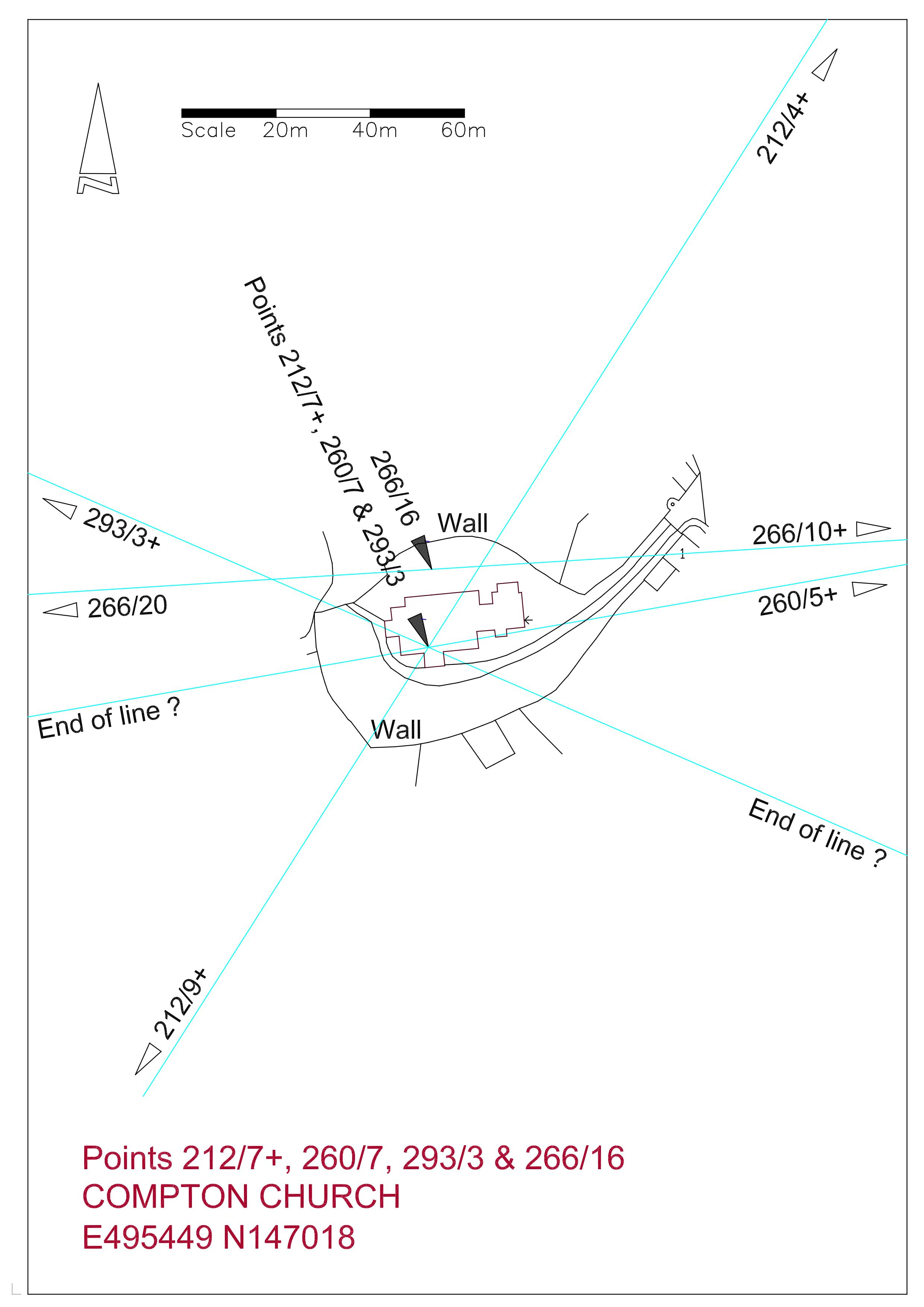
212_7+ Compton Church212_7-compton-church-rev

217_7-compton-church-rev

Uniquely there are four alignments passing through this site.   Beginning with the FROWSBURY LINE; there are only three sites on this alignment.   Starting at the church the line heads north-west at 293 degrees and passes through Frowsbury Barrow at just over 1.5 Druid Miles.   In just under 1.5 DM it ends at the Ancient Monument sign marking the Hog’s Back Barrow.  This barrow is also on the CROOKSBURY LINE.   The churchyard at Compton is very roughly circular and it can be demonstrated that a circle of the same diameter as Frowsbury can be fitted within this area suggesting the possibility that the church is evolved from a similar site.

The COMPTON LINE passing through the church at 219 degrees mirrors the TYTING LINE, both being 30 degrees east and west of the SOUTH LINE.   It is strange that the site to the north-east on the line is a medieval moat and the site to the south-west is a Victorian church, and yet the alignment of these sites is extraordinarily precise.

The ARTINGTON LINE through the body of the church also has dubious sites which need further research.

The fourth line, the DEERLEAP LINE at 260 degrees, has six points although one is a moat and another is a Victorian church, but once again the precision is exceptional.  Refinement of this line brings it to the north side of the church but well within the churchyard.  The distance  from  Deerleap Barrow to the churchyard  is 16 Druid Miles.

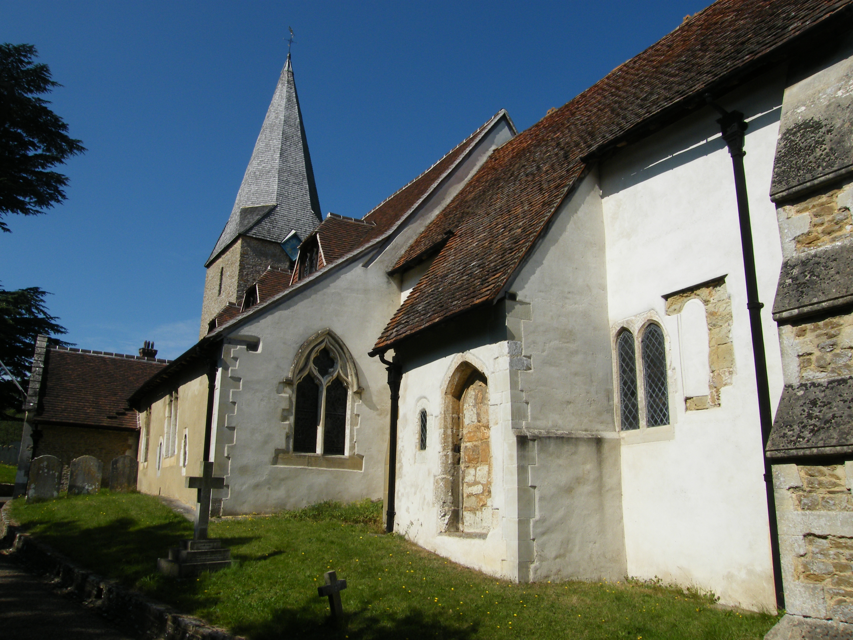
Compton Church from South East

Compton Church from south-east

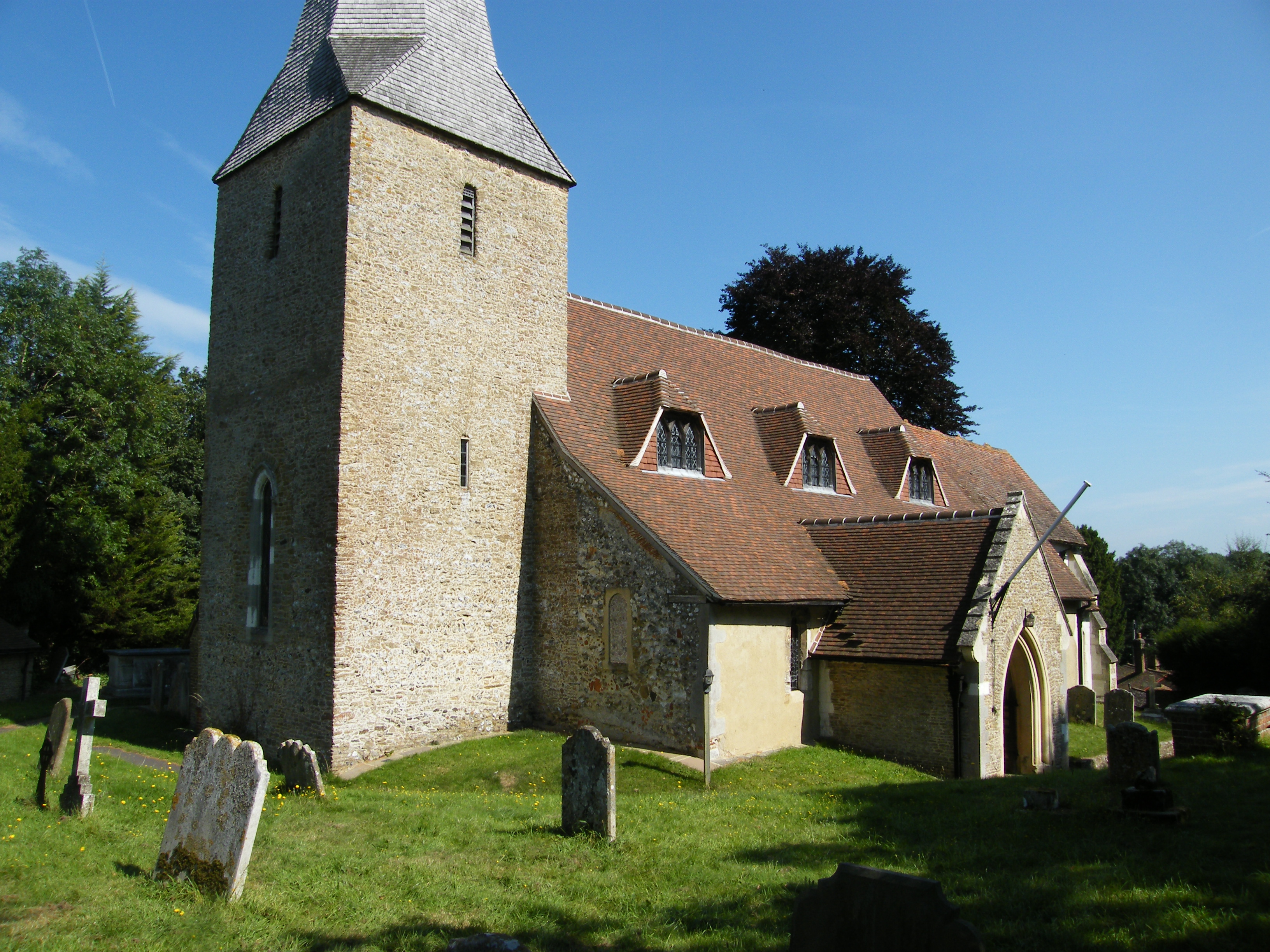
Compton Church from South West

Compton Church from south-west

In the above picture, three alignments meet inside the door from the porch.
To be added to Newlands Corner Barrow on the NEWLANDS LINE

Newlands Corner is a well known beauty spot sitting on the chalk ridge of the North Downs to the south east of Guildford.  it enjoyed a brief moment of international fame when the author Agatha Christie disappeared and her car was found abandoned here in 1926.  She later turned up in Harrogate having suffered a mental breakdown.  These days it is mainly a large car park with a cafe much favoured by bikers.  The ancient drove road runs along the ridge and through the car park, crossing the A25 road between Guildford and Dorking.  Near this crossing, in nondescript woodland, sits the barrow.  It is indistinct and one could walk over it without realising that it is an Ancient Monument.  It does not appear to have been investigated in recent times, the last and possibly only excavation being by General Pitt-Rivers who lived in Merrow from 1873 t0 1877.  He excavated some half a dozen Saxon barrows in the area and a round barrow south east of his home on the northern slope dropping away from Newlands Corner.  This barrow contained a ‘British urn’ containing bone fragments but it is thought that he found the Newlands Corner Barrow already damaged and assuming that nothing could be gained  from further investigation did not spend further time on it.  The site of the Merrow Downs Barrow, also excavated by Pitt-Rivers, is now lost and no finds are recorded.

This barrow was instrumental in first determining the value of the Druid Mile (DM).  It is six DM from Whitmoor Barrow with Merrow Church being on the four DM point.  The two DM point on this alignment is now in the pavement of Marlyn Drive on a housing estate in Burpham.  This point is close to a Romano British settlement site.

Badshot Lea Long Barrow

5/11/2014

The SEALE LINE at 270.5 degrees begins near Shere Church and passes close to Chilworth Priory. The true alignment begins at Shalford Church, which is on two other alignments, and passes through Puttenham Church and on to Seale Church.  The line terminates at Badshot Lea Long Barrow which is marked on the Ordnance Survey as the site of an Ancient Monument.  I have used the coordinates of the barrow as given in Surrey Archaeological Society archives. The distance between Shalford Church and Puttenham Church is precisely 6 Druid Miles.  An interesting coincidence on this line is that the distance between Puttenham Church and Seale Church and between Seale Church and Badshot Lea Long Barrow are identical at 11,840 feet.

270_13+ Badshot Lea

The only long barrow known to exist between the Kent and Wessex tombs and now completely destroyed. It was first discovered and excavated by the archaeologist William Rankine in 1936 not long before the surviving remains were removed by quarrying. It was thought that the barrow was originally some 140 feet long and orientated slightly north of east.

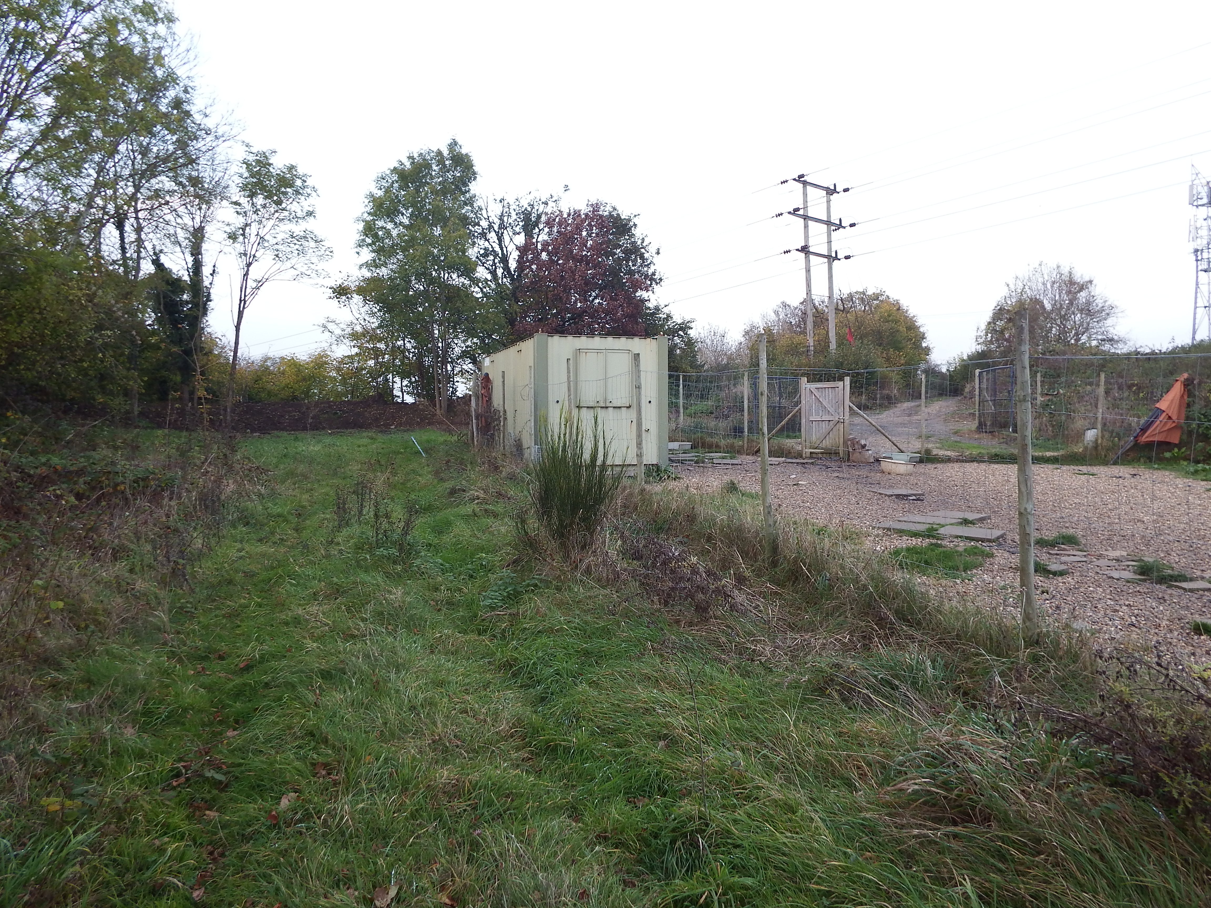
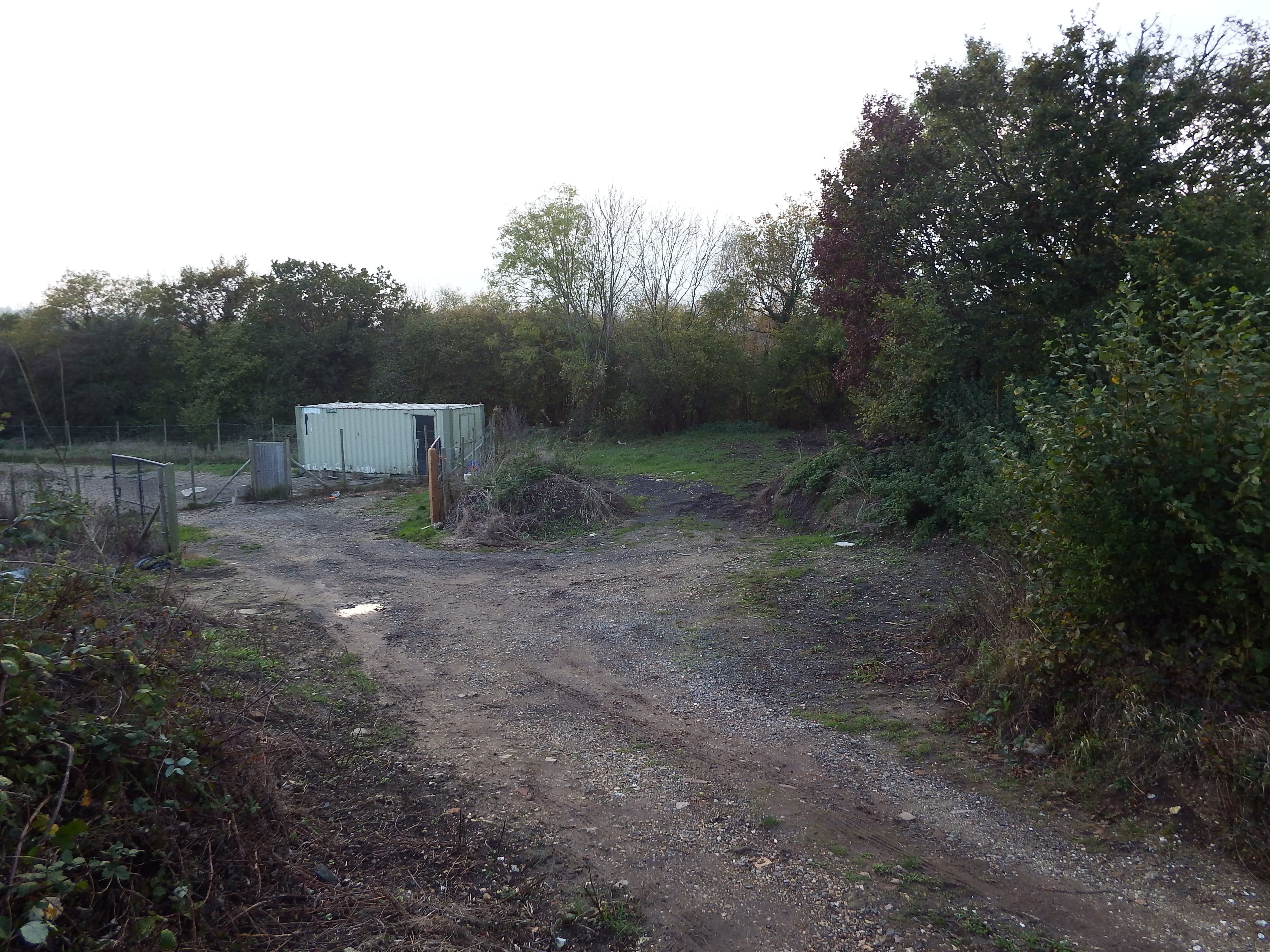
Looking north. The site is behind container with bund beyond. Access track is to right of Electricity poles.

Looking north. The site is behind container with bund beyond. Access track is to right of Electricity poles.

The site is accessed by parking in Hurlands Place (Sat Nav Farnham not Badshot) just beyond the entrance to Sainsbury’s superstore, and parking near the entrance to Hurlands Business Centre. A public footpath can now be seen at the end of the road heading east. Once the railway bridge is crossed the path comes out into the open and a container in a fenced compound can be seen on the left. The site is just the other side of this container. Although this is private land the chap running a dog-minding business in the compound proved very amicable although the mention of the long barrow left him looking rather blank.

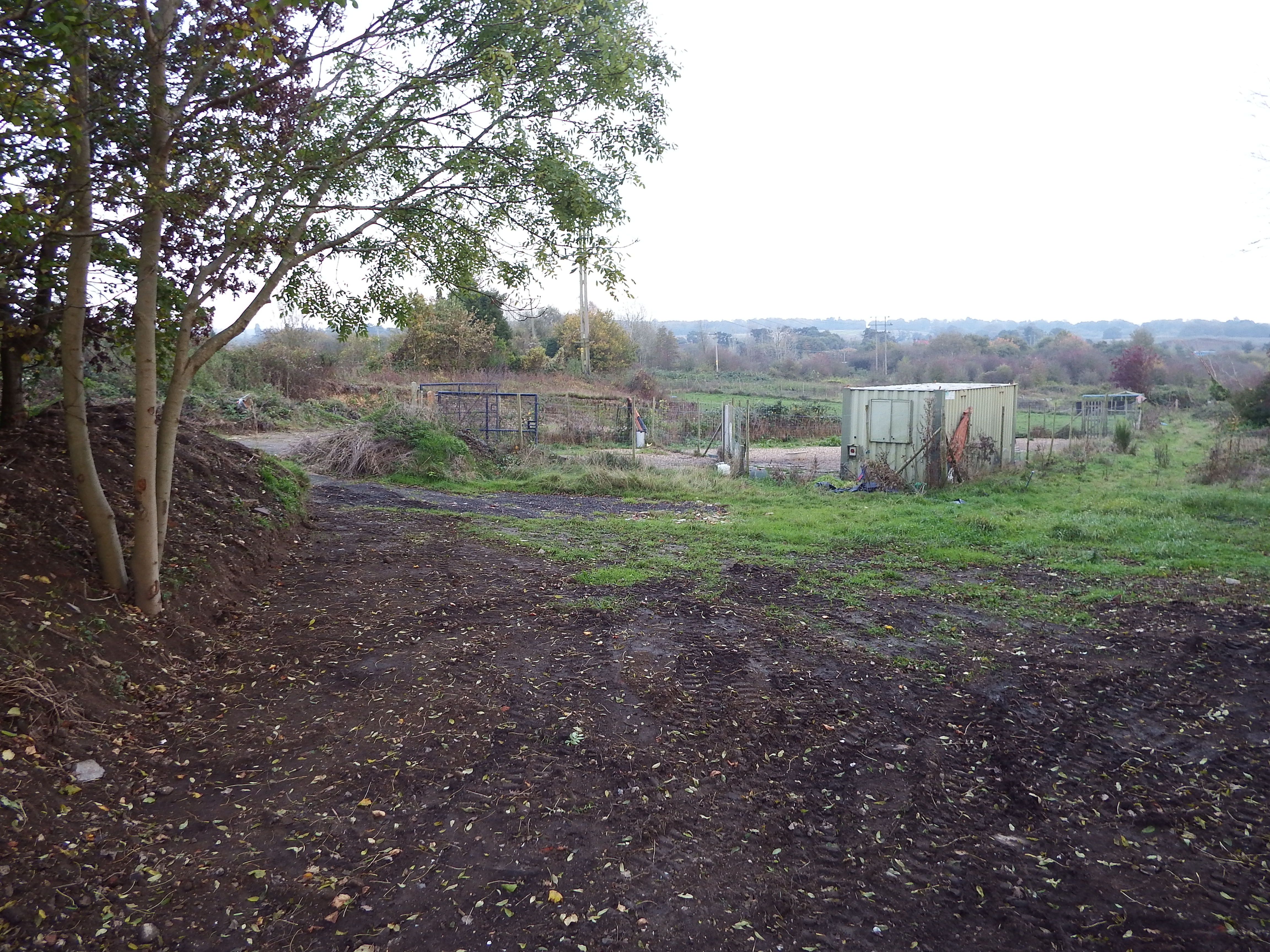
Site co-ordinates are halfway to container. Hogs Back on horizon. Bund on left and behind camera shielding quarry.

Site co-ordinates are halfway to container. Hogs Back on horizon. Bund on left and behind camera shielding quarry.

The ground here has a slight slope to the south. The site is on high ground with views in all directions apart from a segment to the east where the ground rises even higher. To the south the Hogs Back is visible with the South Downs just being visible beyond.  To the south east Crooksbury Hill is prominent, and to the west and north the horizon is some miles distant. Without the current tree cover this would have been a pleasant spot but now it is in an area of rough scrub and small fields overshadowed by power lines and a radio mast.

Site co-ordinates are on green patch in centre of view. Railway boundary hedge behind.

Site co-ordinates are on green patch in centre of view. Railway boundary hedge behind.

The site of the barrow is now a patch of scraped rubble and soils with a soil bund a few yards on the north edge beyond which is a disused quarry. There is a railway embankment to the western edge, heavily overgrown.  Immediately to the south edge of the barrow site is a fenced compound housing the container.  A rough metalled track provides access from the north east.
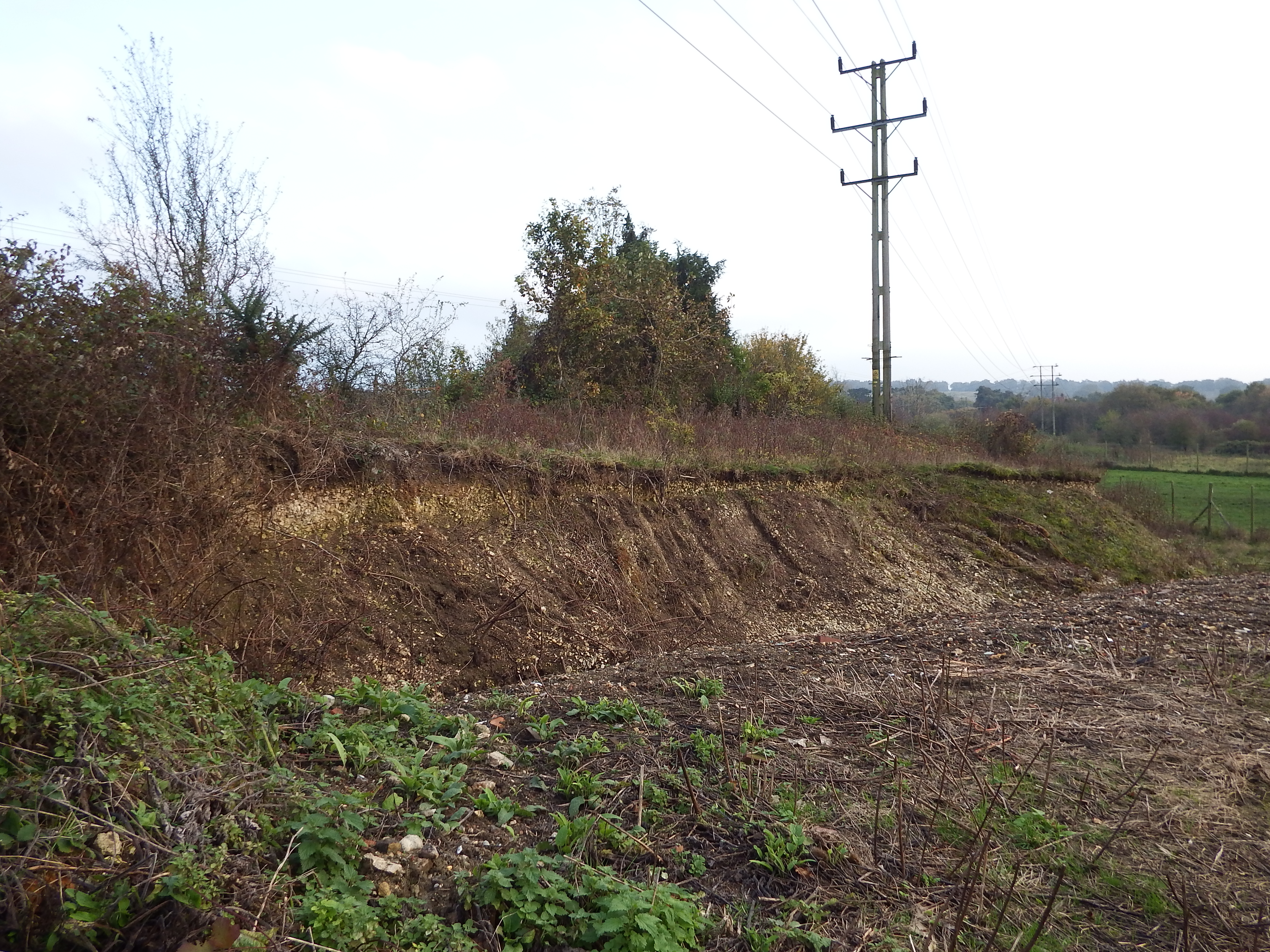
The site is so damaged by industrial activity that it is difficult to make out the original ground levels. My impression was that so much scraping of the ground in association with earth moving and storing activities had taken place that the current levels are below the original landform and that consequently no evidence of the barrow would be found by excavation. This assumption is backed up by the proximity of a small cliff some 25m to the south east. The face of the cliff, which is some two to three metres high, is virgin chalk showing that cutting into the landscape has occurred in the past.

Chalk cliff showing how much the landform has been lowered.

Chalk cliff showing how much the landform has been lowered.