Tag Archives: Albury

Weston Wood Mound and Settlement

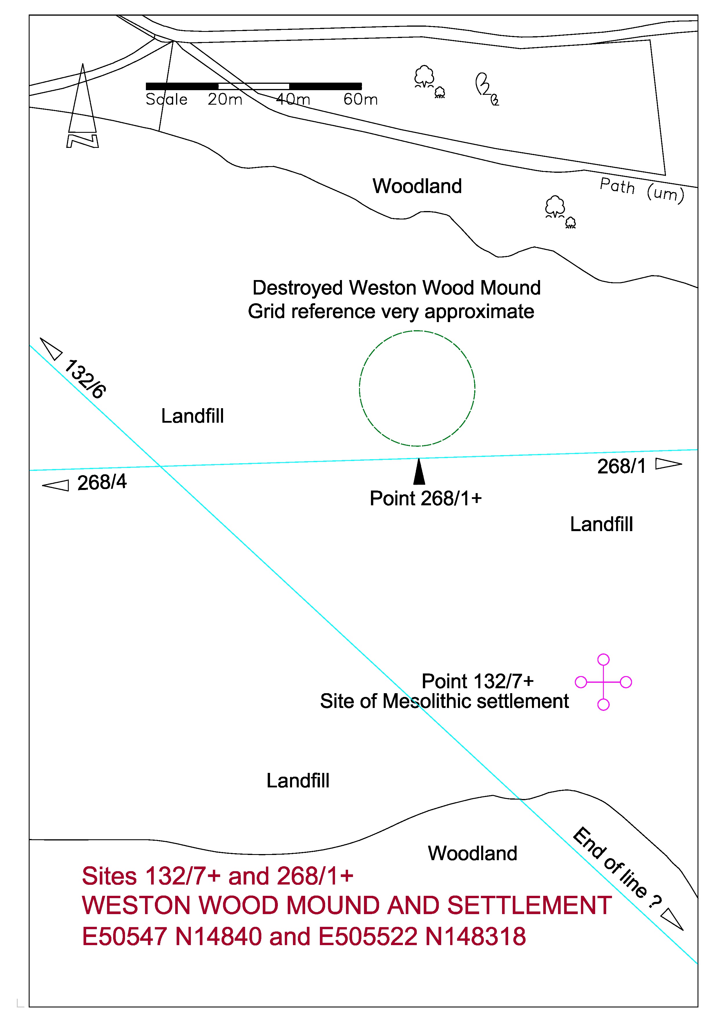
The NEWLANDS LINE, at 132° is 100 °  from the Crooksbury Line, and again starts from Whitmoor Barrow.  At 4 Druid Miles (DM) it passes through St John’s Church at Merrow and carries on to Newlands Corner Barrow at 6 DM.  These distances are very precise and have been used as the decided criterion of the Druid Mile.  In Weston Wood the line brushes the side of the reported position of a disputed barrow, now completely destroyed by sand extraction, and then passes through the site of a Mesolithic settlement.  At 9 DM passes close by Shere Heath Barrow but not close enough to be taken as an alignment.

268_1+ Weston Wood Mound

268_1+ Weston Wood Mound-page-0

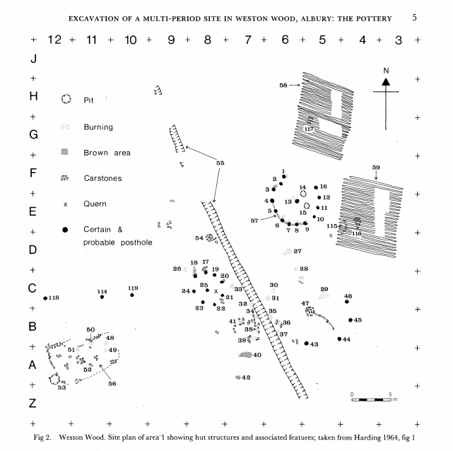
The path at the top of the above plan is the main prehistoric trackway through Surrey, popularly known as the Pilgrims Way, which followed the North Downs from Kent through to Salisbury Plain.

THE MESOLITHIC SETTLEMENT

I have recently unearthed a sketch plan from the Surrey Archaeological Society archives of the excavation in Weston Wood of the Mesolithic settlement carried out c1961-3. The plan covers an area fifty metres square. It shows a trackway running from the south-east towards the north-west; with various post holes and points of interest; and with two areas of ploughed field to the east side. The excavation was carried out by an amateur team and appears rather inadequate by today’s standards and indeed I believe that the notes for this excavation have still not been published after half a century. Unfortunately this site has long been eaten away by sand extraction and is now a landfill site.

Weston Wood Excavation 1964

The Newlands Line is on a bearing of 132 degrees from Grid North. The trackway on the plan is at the bearing of about 152 degrees using the given North point. The excavation plan is a fairly poor sketch, not drawn very carefully by today’s standards, and is located with very approximate Ordnance Survey co-ordinates, and I suspect that the site of excavation was located very approximately in this area of scrubby land near the edge of the encroaching sand extraction with no local detail to tie in to the Ordnance Survey. The excavators set out a five metre grid as shown by the reference marks on the edges of the plan and it is possible that they located north using a compass. The plan is dated 1964 and at this time Magnetic North was some 13 degrees west of Grid North. We have about a 20 degree difference between the path on the plan and the Newlands Line, but if the North point was established using a magnetic compass then we only have a difference between the Newlands Line and the path of some 7 degrees. The Line is some 40 metres to the west of the given OS co-ordinates for the site but these are only to ten metres accuracy indicating a lack of precision.

This is certainly all very speculative and I would like to emphasize that I include this site, not because I have much faith in the validity of my findings, but because I have tried to include as much information as I can to help any possible future research.   There are obvious problems, such as the time period involved.   The Mesolithic period ended some five thousand years ago, so any relationship to the alignments would appear to be coincidental.   The most likely factor for the positioning of a settlement here would be the proximity of the natural spring at the Silent Pool.

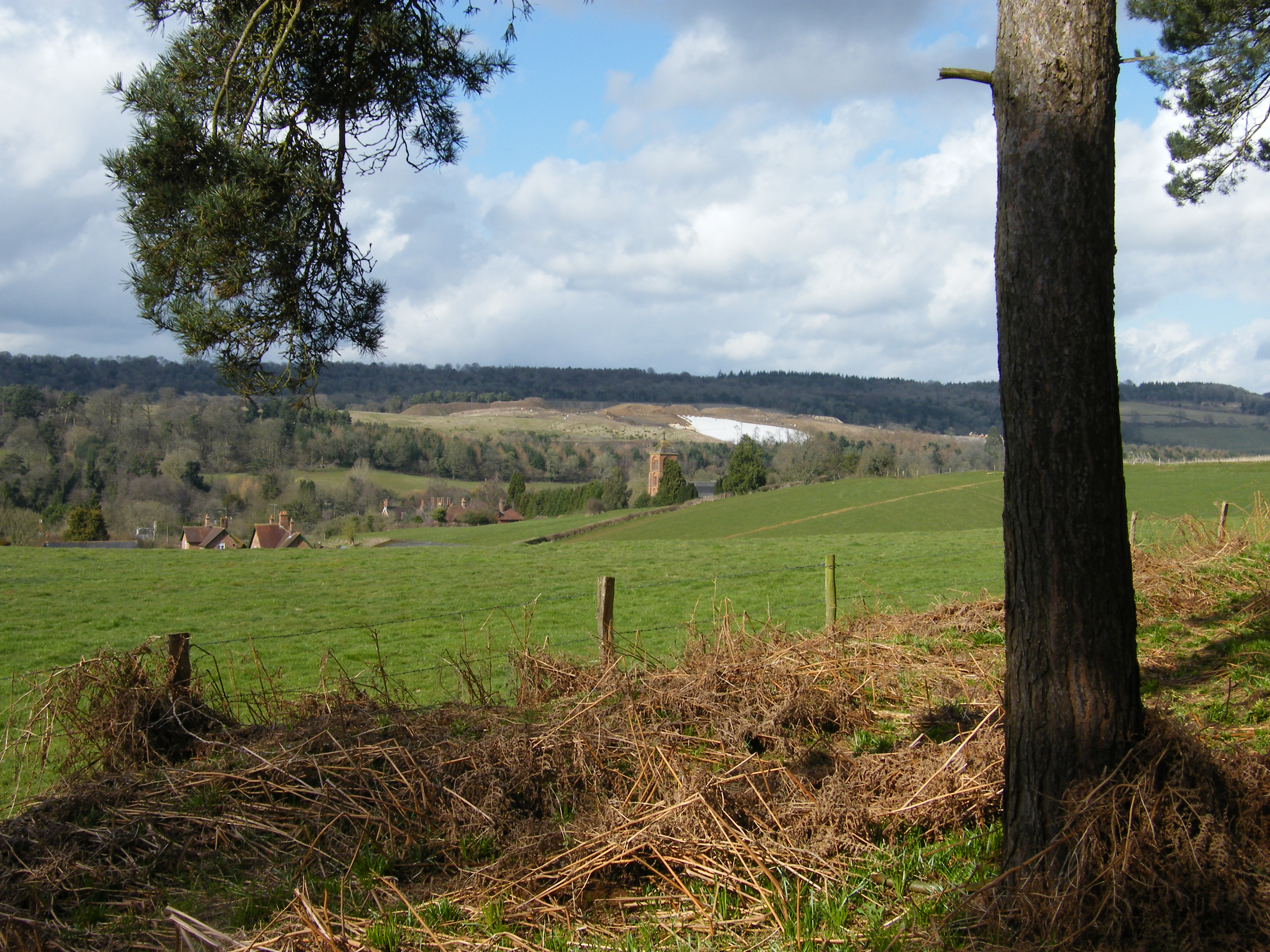
White area is plastic covering on landfill site. The mound would have been just beyond this.

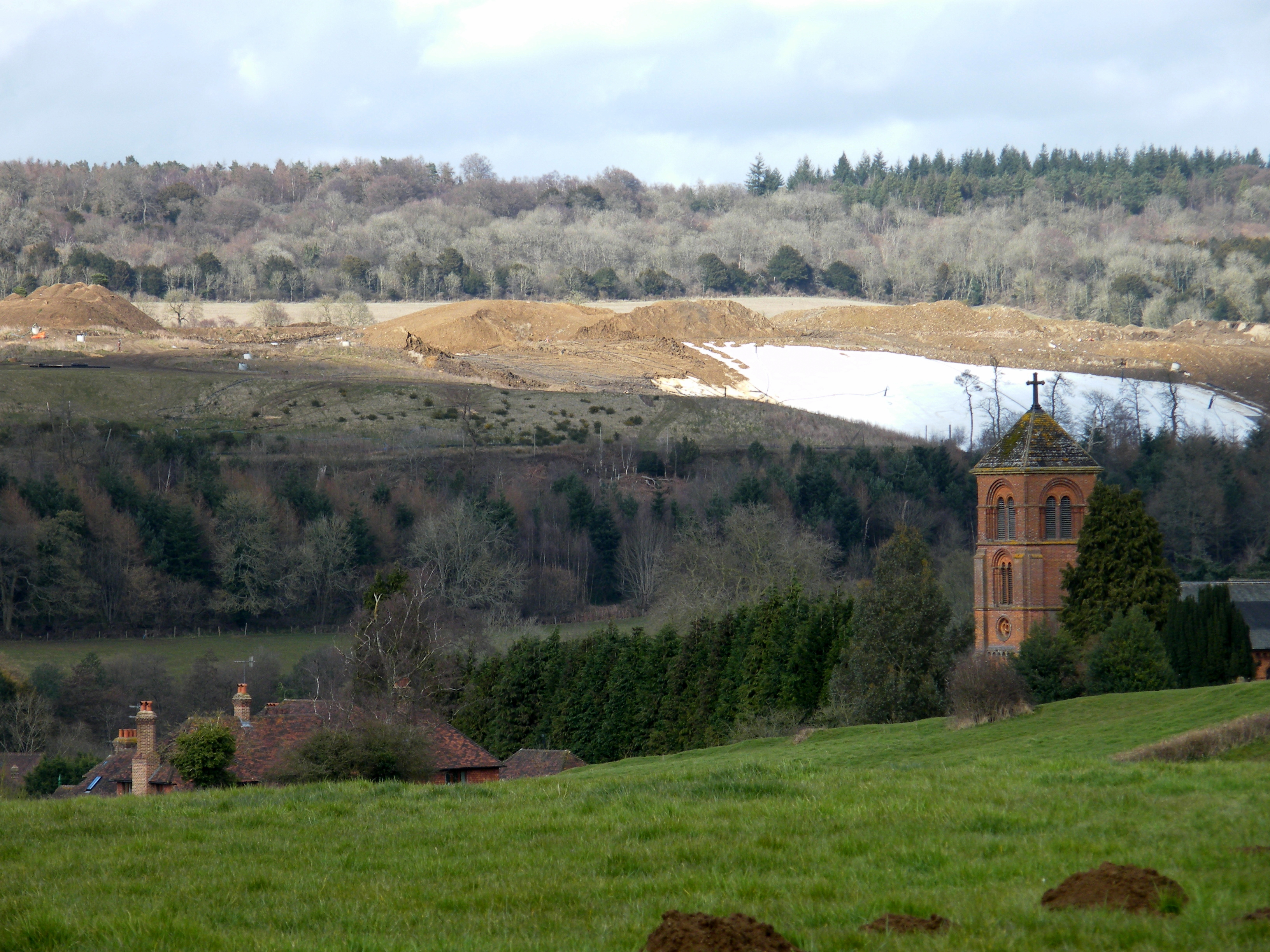
White area is plastic covering on landfill site. The mound would have been just beyond this.

THE MOUND

Weston Wood Mound was recorded as being about 135 feet in diameter and some five feet high.  The top was flat.  It had been thought that it may have been a landscape feature associated with the parkland of Weston House in Albury but no evidence as to its origins had ever been established.  It was destroyed by sand extraction in the late 1990s.

The medieval road from the village of Albury to the south ran over the ridge past the mound towards Newlands Corner in the North West.  The age of the mound had always been a matter of controversy.  In SAS Vol 60 of 1963 W Crawford Knox theorized that the medieval road went around the mound in a manner which suggested that the mound predated the road.  An excavation in 1965 revealed little, but notably, a coin of c1750 was found beneath the clay capping, suggesting the possibility that the ancient structure may have been modified as a landscape feature.

Albury New Church

The site of the mound in the landfill looking over Albury New Church

The most popular website used by enthusiasts of prehistoric monuments is ‘The Megalithic Portal’.  A search for Weston Wood brings up two photographs submitted by Eileen Roche purporting to be the mound shortly before it was destroyed.  In 1999 I began a twice-yearly monitoring of the volumes of sand extraction in the pit and have great familiarity with the site.  Looking at the photographs I feel that the mound shown would have been a soil stock and that the ancient mound would have been further north.  But now we shall never know.
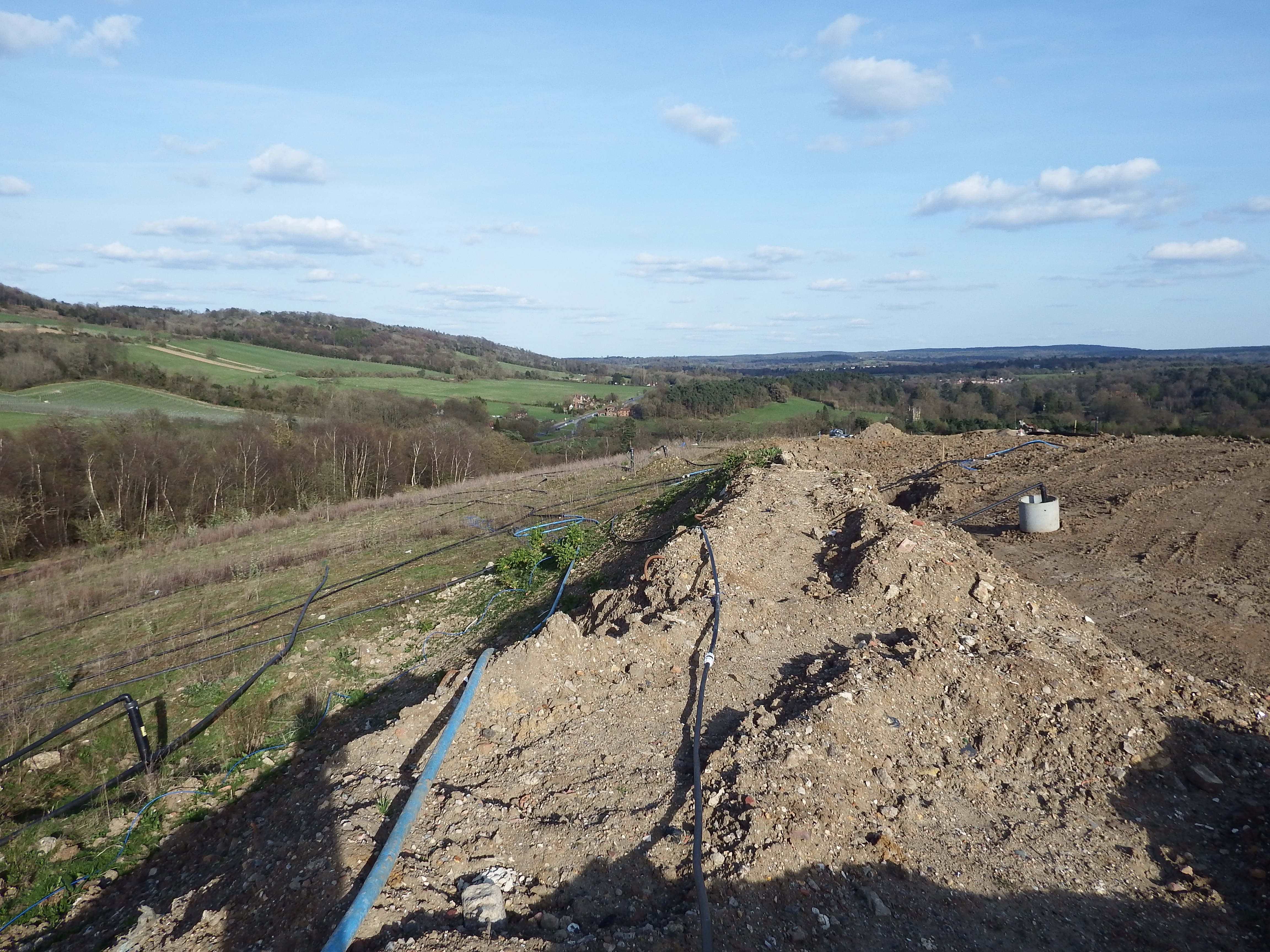
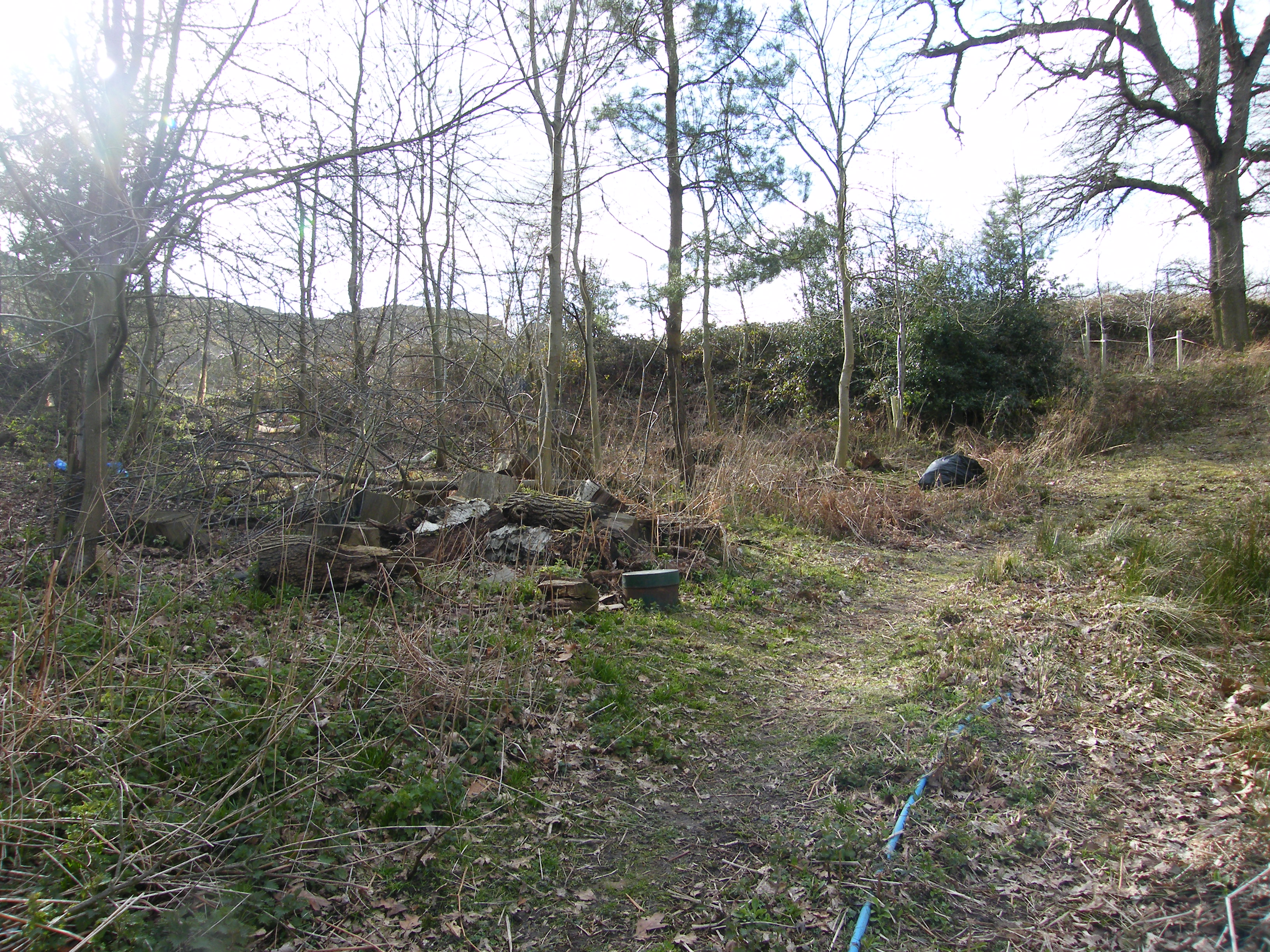
Top of Albury Landfill in the area of the mound

Top of Albury Landfill in the area of the mound


Developments

After sifting through the numerous pages of calculations and speculations accumulated over years of intermittent research it became apparent that a decision must be made to settle on some criterion upon which all this data could be based.   There were two lines which stood out from the others as extraordinary – the Newlands line with its precise alignment and distances, and the Crooksbury line with its newly discovered barrow and precise alignment.   The bearing of the Newlands line was 132.82 degrees and the Crooksbury line 232.32 degrees.   It has already been seen that the rays are around ten degrees apart and by dividing the difference by ten for the intervening rays we have an interval between each ray of 9.95 degrees.   This interval was applied to all rays in the pattern and a list was compiled of the intersections of these revised rays and the distance points at one Druid Mile (DM) intervals from the base point of the rays at Whitmoor Barrow.   These points were then compared with the physical detail as shown on the Ordnance Survey as downloaded to the computer database.   This was straight forward for circular structures such as barrows where the centre point was fairly obvious but when passing through a building a best estimate of the centre was used.

By 2012 the technology of hand held GPS instruments was very advanced with an accuracy good enough to make them a suitable tool for field research, so the decision was made to surf the internet for an instrument with the most suitable specification.   I settled on the Garmin GPSMAP 62 and carried out some field tests to check the accuracy.   Results varied from nearly perfect to, in the worst case, eight metres of error when compared with known Ordnance Survey (OS) co-ordinates established by professional surveying instruments.   Because of these variations it was necessary to revisit critical sites to re-record the co-ordinates and take an average of several readings.

Once a few sites had been visited with the GPS and the results plotted onto the database it became clear that there was a discrepancy between the WASG grid used by the Garmin instrument and the OS  grid titled OSGB36. There is a lot of information on the OS website about how this grid originates and how to use conversion programs to compute very precise coordinates. Although the grid used by Garmin is called OS grid in the format selection, it did not appear to conform to the OS map grid. Therefore it was decided that to check the difference between the two grids.  Check readings would be taken on-site from known points. First chosen was the OS trig pillar at Jacobswell just south of Whitmoor Barrow. Trigonometrical pillars are usually concrete structures, standing around four to five feet high, and constructed on prominent hill tops affording views over long distances and are part of the network of triangulation stations upon which the OS of Britain is based.  Also points were taken on the corners of other sites such as the church and churchyard walls on St Martha’s Hill. When these were plotted into the database it was seen that there was indeed a discrepancy. Due to the inherent inaccuracies of Ordnance Survey detail it is not possible to attain spot-on fitting of data. After meaning out the various results and taking the trig pillar coordinates as being the main data point it was seen that all GPS data needed to be moved 8 metres south and one and a half metres West. It would have been possible to calculate a very precise difference between the two groups but the accuracy of the hand held GPS is no better than about 7 feet or two metres, therefore it would seem that refining the difference between the two groups would be excessive and a waste of time. I have since confirmed these conversion factors by taking readings at other pillars in West Surrey.

The first exercise with the new instrument was a visit to Whitmoor Barrow.   I walked around the ditch taking readings at about five metre intervals.   Each reading was taken after holding the GPS at eye level pointing in several directions until the readout settled down and became constant.   These readings were stored as waypoints in the instrument and transposed onto my AutoCAD base plan in the office.   The Ordnance Survey extract of the barrow were already on this plan and it was seen that the adjusted GPS co-ordinates and the map co-ordinates of the barrow were an excellent match.   This confirmed my intention of using the Whitmoor Barrow as the base point for the overall pattern of rays.   A similar exercise was then undertaken at Culverswell Barrow and at the twin Crooksbury Barrows a short distance away.   The co-ordinates of the Culverswell Barrow confirmed my original theodolite survey of some years ago and the co-ordinates of the Crooksbury Barrows again proved an excellent fit.

Buoyed up by these satisfying results I was keen to use these new-found techniques to discover other lost sites.   The first I looked at was the Mount Pleasant Barrow on Whitmoor Common.   This is marked on The OS as the site of an Ancient Monument no longer existing.   The co-ordinates on the OS were noted as was the co-ordinates of the point on Mount Pleasant line being at a bearing of 252.22 degrees and one Druid Mile from the base point (Whitmoor Barrow).   The common is a flat area of land surrounded by woodland to the north, a railway to the east with roads on the other two sides.   On reaching the supposed site of the Ancient Monument nothing could be made out amidst the rough tussocky grass but on navigating to the point on the pattern some seventeen metres to the north west a circular bank some seven metres in diameter could just be made out beneath the scrubby birch trees (see photos at header MOUNT PLEASANT LINE).


Shere Church added to SHERE LINE

Shere Church, dedicated to St James, is lucky to be a rare example of a medieval structure relatively unspoilt by Victorian restoration.   It is thought that the earliest parts date from the late 11th century. It almost certainly has Saxon origins, as has Albury Old Church 1DM west.

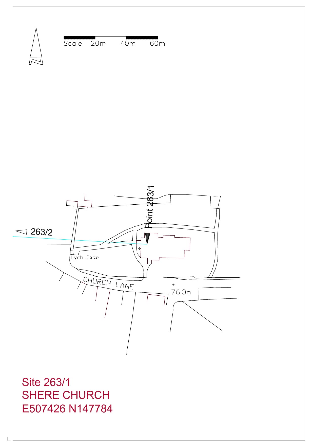
Site plan Shere Church

Shere Church

Shere Church from the south

Shere graveyard

From the west end of the church looking down Church Lane in line with Albury Old Church.

Albury New Church added to DEERLEAP LINE

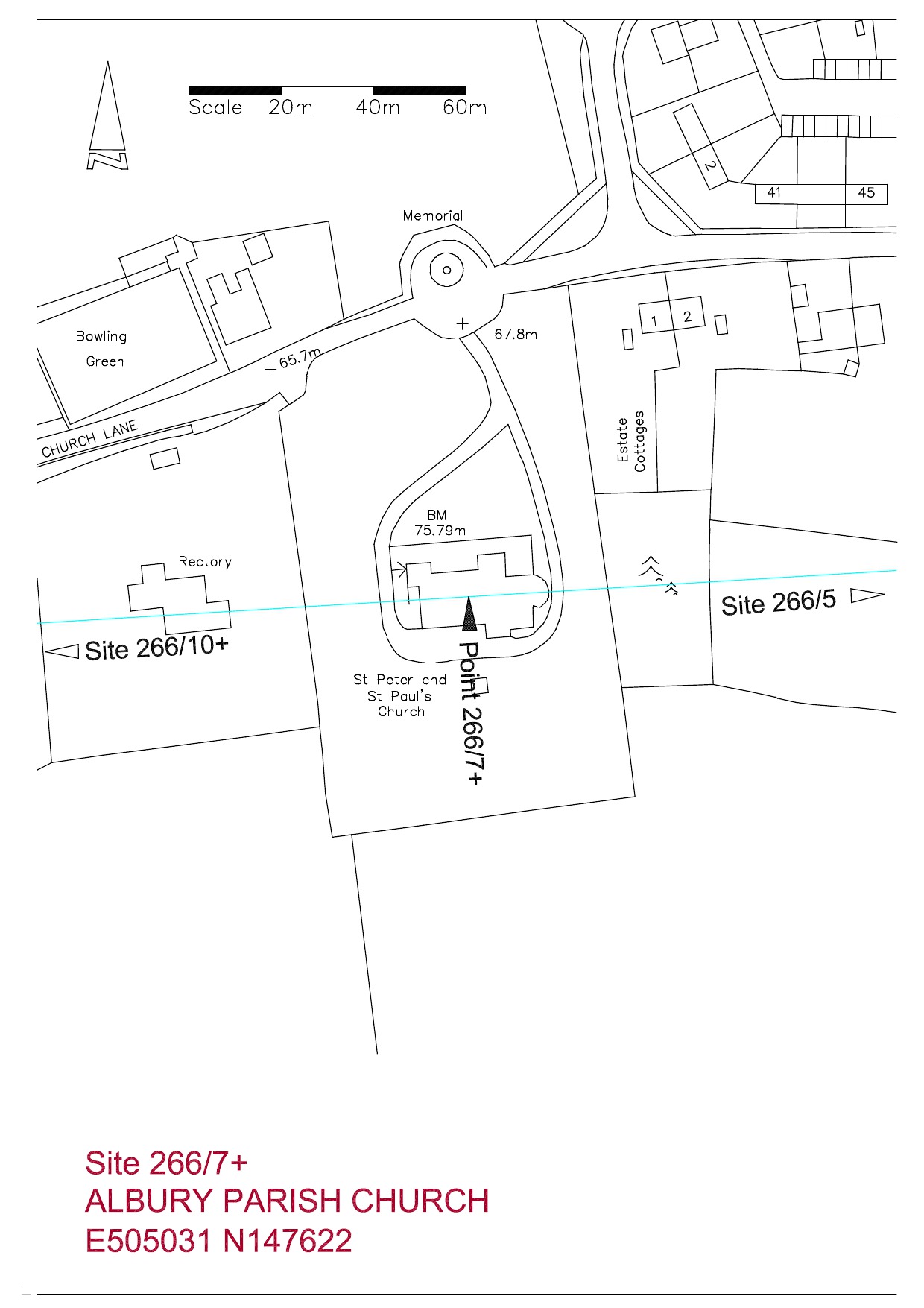
266_7+ Albury New Church

The parish church was built in 1842 by McIntosh Brooks based upon a romanesque building in Normandy.  Although a recent site it is remarkably accurate in alignment and orientation as can be seen in the plan below.  Could the builders have known this when choosing the site?  Or could it be built upon an earlier structure?

Albury New Church

The church from the south east with St Martha’s Church just visible on the hilltop to the left side266_7+ Albury Parish Church


Sherbourne Stone Circle added under ST CATHERINE’S LINE

Approximate location from memory of the buried recumbent stone to left of black bin bag

This circle was mentioned in “The History and Antiquities of Surrey’ by Manning and Bray, 1809 volume 2 page 123 as follows ‘In the field are five stones, three together, the other two a small distance apart. Largest of the three is 10 foot long, 5’8″ wide and four foot four inches out of the ground. One in the next field is 10’10” by 4’9″ and flat to the ground. Also in Weston Wood’.  And elsewhere, ‘There do indeed appear to have been stones in the field south of the road opposite the entrance to the Silent Pool but they have been destroyed by successive farmers and various pieces are scattered in the area’.

The fields in question  belong to the Duke of Northumberland’s Albury Estate and lie between the large landfill site on the west side and Sherbourne Lane, the main road into Albury, on the east side, with the A25 road from Guildford to Dorking on the north side. They can be seen on Google Earth at 51’13’29″N 0’29’09″W.  Until a few years ago these fields were open pasture but heavy tree planting has taken place to screen the landfill from view, and this activity may well have destroyed any evidence of the circle.  In these fields was held the Sherborne Palm Sunday fair, which may have pagan origin, until 1811 when it was banned by the Rector William Polhill. Just across the A25 is the Silent Pool, steeped in legend and reputed to be bottomless although in the drought of 1976 the bottom was revealed.

Many years ago, whilst working in my capacity as monitoring surveyor of the adjoining landfill site, I came across a large recumbent rectangular stone lying right on the edge of the landfill workings at the western end of the aforementioned field.   Unfortunately I neglected to measure it or record the exact location.   A topsoil stock stood to the west side and I believe this has eroded and covered the stone.