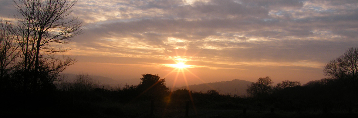
I have been corresponding with Harry Sivertsen. Harry is an amateur archeo-astronomer and writer who uses the astronomy programs Skymap Pro and Starry Night Pro to analyse the rising and setting of the sun, moon and stars at different dates in antiquity. It is early days, but the results are pointing towards a date of around 2500 BCE, the transition from the Neolithic to the Early Bronze Age, for the establishment of these alignments.
Category Archives: General
Culvers Well – a sacred site?
Now that this land has been cleared of pine trees, this feature is at last exposed to view. It is some two hundred metres to the south-east and downhill of the barrow on Culverswell Hill. The water’s main body is a shallow pond separated by an earth dam from a smaller upper pond. The water level in the upper pond is some centimetres higher than the main pond and is presumably the spring source. In the photograph below the spring is not visible to the top left of the water.
In the centre of the photograph below the dam can be seen, and my first thoughts were that the larger pond was constructed as a cattle pond at some unknown time in the distant past, fed by the overflow from the spring. Probing with a ranging rod gave a depth of about half a metre around the edge, but as I was on my own, I was reluctant to try and wade in despite wearing wellingtons.
I have been intrigued by the name of this spring; why give a name to something so obscure in a landscape devoid of habitation or occupation? The oldest Ordnance Survey map I can find is the 1-2500 scale edition of 1871. The title ‘Culvers Well’ is clearly shown and is seen in every edition since. Presumably, it had some significance in the past.
When the nearby barrows were constructed there would have been peoples settled in the area, and this spring would have had great importance as their only source of fresh water. It seems logical that it would have been venerated and protected, and it surely warrants being classed as sacred spring.
Work in progress
It is over a month since my last post but I have not been idle. Further snippets of information have been added to some pages, and a lot of reading and researching has been done. The website is probably as good now as I can get it – It has cost me quite a bit to get this far but, as hobbies go, it is a lot cheaper than playing golf!
I spend a lot of time viewing Google Earth, scanning the historic imagery in the hope of finding crop marks, and yesterday noticed that a new yellow ‘Place of Worship’ symbol had been added to a large building, the corner of which measured nine metres from the COMPTON LINE. Clicking on the symbol revealed that it was the residence of the Bishop of Guildford, the attached photograph displayed a large country mansion of early 20th-century style called Willow Grange at Jacobs Well. The half Druid Mile point fell upon the parking area just to the east side of the house. It is extremely unlikely that this house was evolved from an ancient religious site and I mention this to show that if one is not careful one can find coincidences where nothing of importance exists.
Incidentally, on the COMPTON LINE, the ‘Place of Worship’ symbol for Compton Church has been moved to a large house 230 metres to the north.
Northbrook LBA Site to be added to ARTINGTON LINE
The October 2019 edition of the Surrey Archaeological Society Bulletin contains an article on the recent discovery from aerial photographs of a possible Late Bronze Age (LBA) ringwork or fort, some 85 metres in diameter, adjacent to the A31 trunk road between Farnham and Alton at Northbrook, near the village of Bentley. It has been suggested that the earthwork is some 3000 years old and by comparison to the eleven other similar earthworks in England which have been investigated, to be a site of very high status, I am not sure how this conclusion was reached and have been unable at this time to find any clarification on the internet. The aerial photographs in the article show a very faint darker circle bisected by a boundary hedge. I have looked through all the historic imagery on Google Earth and can see no trace of it. Surveys by gradiometer and resistance meter were carried out in September 2019 and found a ditch some 10m wide within the bend of a silted-up river course on the western side.
This monument is some way out to the west of my area of interest, but I thought it worth checking the Ordnance Survey coordinates (E 480703 N 144423) out of curiosity and was surprised to find that it fell precisely on an extension of my ARTINGTON LINE which ran through it a few metres north of the centre. At a distance of twelve miles from Guildford, it is beyond my working parameter but the accuracy is extraordinary, although at the moment I will assume coincidence until proved otherwise.
Dragon Hill latest news
This is an addition to the page on St Catherine’s Hill at Guildford.
Following news of the discovery of a cave on the hill, as shown in my post on St Catherine’s Chapel, our local online newspaper, the Guildford Dragon, published this telephoto shot of the progress of the work to stabilize the railway cutting. The cave is now presumably buried and fully recorded and presumably an archaeological investigation was carried out prior to this work as this is a Mesolithic site of some importance. Also in the Guildford Dragon, is a letter from Graham Dean, who I believe is a retired geologist from the oil industry, putting forward an interesting explanation for the naming of this hill in medieval times as Drake Hull, meaning Dragon Hill. Deep below the hill is a stratum of Kimmeridge Oil Shale. This shale gives off oil and gas which sometimes rises to the surface. Indeed there is a spring in a neighbouring garden which often has an oil sheen on the water. In medieval times the oil from seepages was collected for its medicinal properties. It occasionally combusts and burns continuously and would perhaps give rise to the idea of a fire-breathing dragon.
Discovery of a cave on St Catherine’s Hill
- Cave believed to be dated from the 14thcentury
- Considered to be a later medieval shrine or hermitage.
- Thought to have associations with the nearby chapel of St Catherine
Although this discovery has no relevance to the alignments I have included it as St Catherine’s Chapel is this website’s most visited page and there is clearly much interest. It reinforces the importance of this hill from the Mesolithic era through to Medieval times.
The text in italics below is copied and credited to the newsletter of Network Rail. It is virtually the same text as found on other sources and at the time of writing is the only information available. The pictures are credited to Archaeology South East.
A team of rail workers delivering landslip repair works near Guildford have uncovered a small cave believed to be from the 14th century.
The sandstone cave was discovered during work to stabilise and protect the railway embankment. The cave may once have been much larger, but only this small piece survived the digging of the railway cutting through the hill in the early 1840s.
Initial findings by a specialist archaeological contractor suggest that it was a later medieval shrine or hermitage associated with the early 14th century chapel of St Catherine, the ruins of which are situated on the hill nearby. It may even have earlier origins as a site of cult activity, due to its pre-14th century name of Drakehull – “Hill of the Dragon’.
Images taken from the site show the presence of a Gothic niche decorated in dots with a Calvery cross nearby.
Upon first inspection I thought that the carving below was in raised relief but looking at the way the light is coming in from the left it can be seen that the strange shapes are carved into the sandstone and what looks like little knobs around it are in fact pits. This is quite difficult to see and is a classic optical illusion.
I am not sure but I think the reference rod is one metre long which would make the carving about 0.8m high (2.6 feet).
There are a total of around seven or eight further niches and experts found considerable evidence of writing and other markings across the cave ceiling. The cave is partially covered in deposits of black dust, which is believed to be soot from lamps. The remains of two suspected fire-pits were also uncovered in the cave floor. The hope is that radiocarbon dating can be used to establish the period when the cave was in use.
Mark Killick, Network Rail Wessex route director, said: ‘This is an unexpected and fascinating discovery that helps to visualise and understand the rich history of the area’.
A full and detailed record of the cave has been made and every effort will be made to preserve elements where possible during the regrading of the delicate and vulnerable sandstone cutting.
Tony Howe, historic environment planning manager and county archaeologist at Surrey County Council, said: ‘The discovery of this cavern is tremendously exciting. It is very early in the process of understanding its full significance, but the potential for knowledge acquisition is huge. We’re looking forward to learning an awful lot more about the site as studies progress’.
A spokesperson from Archaeology South East, said: ‘The cave contained what appear to be shrines or decorative niches, together with carved initials and other markings. The old name for St Catherine’s Hill is Drakehull ‘The Hill of the Dragon’, so this has obviously been a site of ritual significance long before the construction of the church on the top of the hill in the late 13th century. Work is underway to analyse soot and charcoal found inside the cave, which will hopefully tell us more about how and when it was used’.
The only access to the cave is by abseiling and no attempt should be made to reach it on foot.
A Possible Standing Stone on High Curley Hill
https://leylinesdecoded.co.uk/2019/07/19/a-possible-standing-stone-on-high-curley-hill/
It has recently been pointed out to me by a fellow researcher, David Fernleigh, that if my NEWLANDS LINE is extended as a backsight from my base point at Whitmoor Barrow, there is a clear line of sight for some 7.2 miles across flat countryside to High Curley Hill near Lightwater village. This line is orientated to the mid-winter sunrise in the south-east and the backsight is to the mid-summer sunset in the north-west. The two opposing bearings align because they fall within the critical band of latitude which passes through the site of Stonehenge where a similar coincidence of sighting may be found.
It is unfortunate that the view toward Whitmoor is now obscured by mature trees, many of which are evergreen pines. The old photograph below is copied from a notice board at the Surrey Heath Museum and shows that there were once uninterrupted views to the far horizon. This sarsen stone is unusual; although there are other sarsens in this area this is the most outstanding example.
On my second visit to the hill, I noticed a strange indentation in the sarsen; in the photograph below a conical depression can be seen in the centre. There are other depressions but I believe these were created by root growth when the sandstone was being formed and had not yet solidified into the hard rock we now see.
This depression is obviously man-made. It is very smooth and regular, unlike any of the natural features. The remaining rainwater conceals an evenly dished base. At the surface it is about 15 centimetres in diameter and is some 16 cm deep. I have no idea of the age or purpose of this feature.
But this stone, although interesting, is not on the alignment, so further site investigation was required. The summit of the hill is a flat plateau at a height above sea level of around 420 feet. The summit is at the end of a ridge extending from the west and there are views to the horizon in all directions apart from along this ridge. It would surely have been of significance to prehistoric peoples with its flat top measuring approximately 140 metres by 40 metres wide offering panoramic views to horizons some thirty or more miles away.
Taking a ranging rod; a trowel; and a pruning saw; my next visit was concentrated on the area where the backsight of the alignment crossed the hill about 44 metres from the sarsen. The area around the sarsen and out to the viewing point in the north-west is well-trodden and clear of scrub, but coming back towards the south-east the ground has a dense covering of heather and gorse. Working my way from the alignment back north-west towards the sarsen I stumbled across the corner of another sarsen just visible through the growth. The pruning saw proved ideal for ripping through the covering of heather roots to reveal a large recumbent stone. The next photograph shows the relationship between the two sarsens, the distance between them is about 21 metres, and the recumbent stone is about 27 metres from the alignment, a very small error over seven miles and without investigation of the rising and setting of the sun at this elevation.
This photograph below is all I have been able to expose to date. This is a public country park and I did not want to be seen digging around the stone to ascertain its extent, besides which at my age, the effort to get this far was quite crippling. The exposed surface measured some six feet long by 2.5 feet wide (1.8m x 1.2m). Probing the edges did not help in determining the depth or limits of the stone.
As it is so close to the mid-summer sunset alignment, I am going to be so bold as to suggest the possibility that this sarsen was once a standing stone fallen in antiquity.
The pale corner is just visible on Google Earth at 51°20’45.41″N 0°41’30.92″W. The altitude is given as 411 feet which gives a clear line of sight back to Whitmoor Barrow. This is best viewed in Google Earth by selecting June 2018 in the ‘Historic Imagery’ option.
It now needs younger and fitter researchers, and with the permission of Surrey Heath Borough Council, to undertake a proper archaeological dig. I would love to see the whole plateau subjected to examination, at the very least by ground penetration radar.
Best access to this site is from the public car park in the Lightwater Country Park off High View Road, Lightwater, postcode GU18 5YF.
To be added to Church Croft on DEERLEAP LINE
In May I decided to visit the Church Croft site at Puttenham before the summer growth covered too much of the area. As it turned out I needn’t have worried, the small field (approximately 100 metres square), where the 19 Druid Mile point on the DEERLEAP LINE sat, had recently been ploughed and the ground was clear and open. It is strange that it is the only plot of cultivated ground in mixed deciduous woodland. This is an area of orange sandy soil which showed evidence of having been the site of a maize crop from last year.
I navigated with my hand-help Garmin GPS to the coordinates of the point on the eastern side of the field and found myself to be in a patch of distinctly grey sandy soil about twelve metres in diameter. In the above photograph, it can just about be seen in the centre of the view. Nothing could be found to differentiate it fro the surrounding orange soil.
Although now partly obscured by the tree line on the boundary the site was found to be in a good position to see down the valley towards Puttenham.
A substantial scattering of worked flint, including a hammer stone, was evident as I walked this side of the field, and I am sure that with more time and effort I could have amassed a substantial collection. But as I was trespassing (I did not know the identity of the landowner) I was reluctant to spend too much time there.
A close examination of Google Earth, using historical Imagery, did not reveal anything of interest and LIDAR was no help. It would be most interesting to have a ground-penetrating radar survey carried out.
Addition to CULVERSWELL BARROW
Exploration of potential sites has ground to a halt whilst the summer growth is at its most prolific. With lack of outdoor research to do but with the urge to get out on a beautiful September day, I thought it would be good to see how Culverswell Barrow was looking. Followers of this blog will know that this unknown barrow was rediscovered by me many years ago in a position predicted at a high point on an alignment and thus is crucial in validating my work.
I have previously described my interest in the possibilities of using LIDAR contours and that I have downloaded the Crooksbury area. The picture below shows the barrow located within the LIDAR contours and moved slightly to coincide with the landform. This brings it more perfectly onto the alignment and a few metres nearer to the twelve Druid Miles position. My early theodolite research, before the growth of silver birch obscured the view, suggested that the line from Whitmoor Barrow, through Hogs Back Barrow, was aligned to the mid-winter sunset.
Clicking on the PDF link below will show that the diameter is 26.5 metres (87 feet) and that the altitude is 110.25 metres.
Culverswell revised with LIDAR
There is a small car park about half a kilometre south of Littleworth Cross on the west side of the road and from here a forestry track goes past the barrow on the south side. Since my previous visit the site has been extensively cleared of Scots Pines and for the first time the barrow is clearly visible. In the picture below, taken from the forestry track, the barrow can be seen on the horizon in the centre of the photograph.
This picture shows how the ground is ravaged by the extraction works but happily the barrow itself does not appear to have been much affected by the tracking of large machinery, possibly because it is dry as opposed to the more boggy ground below it where some deep tyre tracks are visible in the sandy surface.
Below is the best view I could get of the barrow showing how prominent is its position in the landscape with uninterrupted views to the South Downs.
Standing on the highest point it can be seen that the bracken is obscuring the surface and a return visit in the spring, once this has died back, is anticipated.
Shropshire church found to be UK’s oldest sacred site still in use
The following is extracted from an article in the Shropshire Live website dated 18 May 2017. This will be added to the pages on site continuity titled ‘The Elephant in the Corner’.
The church, known as the Church of the Holy Fathers, now belongs to the Greek Orthodox Church which bought it for the nominal sum of £50 from the Church of England in 1994 and saved it from dereliction. It was previously called St John the Baptist and dedicated to St Milburga in pre-Reformation times. It stands on the edge of a housing development site in Sutton on the edge of Shrewsbury in Shropshire.
Local Anglicans had held services there once a year, but it had not been a regularly functioning parish church since before the First World War and had stood in the corner of a farmer’s field, effectively used as a barn for storage.
Carbon dating of a wooden post, which extracted from the dig in February, has shown it was first placed in the ground in 2033 BC – a time when the ancient Egyptians were still building Pyramids. Archaeologists expected the post to turn out to be Anglo-Saxon, so were shocked to discover it dated from the late Neolithic/early Bronze Age period instead.
The dig has given a fuller picture to the ancient history of the site at Sutton, Shrewsbury. Its findings correspond directly with earlier archaeological excavations, carried out on nearby development land to the east of the tiny Medieval church in the 1960s and “70s, which unearthed evidence of Bronze Age and Neolithic structures. It wasn’t then known that these were connected with the church site.
Back then archaeologists discovered burial mounds and cremations, slots for standing stones and two rows of Neolithic post holes and a ditch, known as a cursus, which they interpreted as a processional walkway. It was aligned east to west, extending towards the current late 12th/early 13th-century church.
The recent archaeological dig now shows that the prehistoric site extends to a larger area to the west of the church and that the building is built directly on top of both a previous Anglo-Saxon church and prehistoric structures. The current 10-metre long church itself was discovered to have originally been three times longer and to have once had transepts.
The 15-inch section of post we found was sticking up into the Medieval foundations. It appeared to have been deliberately incorporated,” said archaeologist Janey Green, “We thought we had found a Saxon post that formed part of an earlier church amongst Medieval foundations, but the radiocarbon dates have shocked us all! What we actually have is a sacred site dating back over 4000 years. It appears the current Medieval church is built over the site of an ancient pagan burial ground that’s been in use from the late Neolithic period through to Bronze Age, Iron Age, Roman, Anglo-Saxon and through to today. These findings appear to indicate that this special place has been recognised and honoured by our ancestors from at least 2,000 years before Christ until the present day. To put it into context – all this was being built and used at the same time as the ancient Egyptians were building pyramids for their Pharaohs and writing in hieroglyphics”.
What makes this site different is the continuity of ritual practice in one form or another. It predates the Basilica of Rome. It is well known that Christians liked to build churches on pagan sites, but this goes back to the Neolithic and this time we have the archaeological evidence so we can rewrite the history books and add to our knowledge”. There are other British sites of Christian churches known to date back to prehistoric origins. The best known is probably Knowlton Church at Cranborne Chase in Dorset. A Norman ruin built within a Neolithic henge.
The earliest sacred development on the site was probably a stone circle with a cursus, a processional walkway. It’s tremendously important to fully understand what is going on here and another phase of excavation is desperately needed. Christian use of the site probably goes back to the late 7th century when the manor of Sutton was given to St Milburga, the founder and abbess of Wenlock Priory sometime between 674 and 704 AD.
Church priest Father Stephen Maxfield said “Who would have thought that this little church, stood in the corner of a field and written off as a “shed’, has turned out to have a history of great significance. It’s quite possible that Milburga herself visited this location,” he said. “From the moment we first saw this building as a crumbling ruin, full of farmer’s clutter, we thought it was a very special building. Now we know that it is and that it is quite unique. It is a place of transcendence and healing”.
Other significant finds from the archaeological dig include a carved Saxon stone from an archway, the remains of what is thought to be an Anglo-Saxon apse, a prehistoric worked flint and a Neolithic stone counting disc. Some unusual animal burials were found, but these are thought to be Medieval and have yet to be dated.
Ms Green found two coins, minted from between 1625 and 1634, amongst rubble from a wall collapse and believes this could indicate that two-thirds of the church collapsed during that period or slightly later, possibly during the English Civil War, 1642 to 1651.
The dig was started because a new housing development of 300 homes is currently being constructed next door to the church. The first phase of the dig has been completed but archaeologists believe there is more to be found in the area.
Read the full article via shropshirelive.com at: http://www.shropshirelive.com/2017/05/18/archaeological-dig-discovers-shropshire-church-is-earliest-known-sacred-centre-still-in-use/