Author Archives: mikepeer

LIDAR

LIDAR (Light Detection and Ranging) is an airborne mapping technique, which uses a laser to measure the distance between the aircraft and the ground. Up to 100,000 measurements per second are made of the ground, allowing highly detailed terrain models to be generated at spatial resolutions of between 25cm and 2 metres.

At the moment I am working on an area of some ten kilometres square centred on the barrow I discovered on Culverswell Hill (see CROOKSBURY LINE). So far I have selected some landforms and listed the positions as Ordnance Survey coordinates. I will be visiting the sites and locating the positions using a Garmin hand-held GPS with the hope of some positive results.

Unfortunately, the LIDAR data comes at a cost; the Crooksbury area came to nearly £50.   Also it is difficult to manipulate due to the large size of the data files. The above area was a composite of several downloads into AutoCAD and care had to be taken not to crash the computer.

This is a sample of LIDAR taken from a recent job. The contours are at one metre intervals. On my project, I plot them at half metre intervals for more detail.  In this example, the rectangular area is a recreation ground and the bumps and humps are old mineral workings.

It should be noted that LIDAR is capable of penetrating trees and vegetation and the contours are the height of the terrain.

Church Croft added to DEERLEAP LINE

I have in my library a copy of  “Puttenham under the Hog’s Back’ by Ruth Dugmore. Published in 1972 by Philimore Press.  At long last it has risen to the top of the pile of my required reading and I was interested to find the following:

“In the seventh century England was divided up into vast dioceses. And each of these dioseces would have a minster. And from these minsters priests and laymen would penetrate the rough countryside evangelising. They would stop at a cross which was possibly erected on an old pagan site and would preach to those who came to hear them. As they evangelised they would push further afield and chapels would be set up where once there was only a preacher’s cross. The minster however would remain the mother church. There was a minster at Tuesley and it is almost certain that the area would have been Christianised from the minster there. One of the duties of the travelling priests would be to discover sites dedicated to heathen gods. Here the priest would set up a cross and substitute a Christian service for a pagan one’.

Another extract from Mrs Dugmore’s book:

“In Puttenham there is a possibility of a heathen centre which became a Christian place of worship at Church Croft; a small hill not far from the village, which is approached by a network of tracks and paths. The name Church Croft has no significance in later times and was never church property, but there must have been a reason for it. Could it have been an altar which had been erected to some god and where a preaching cross was later set up?’

And an extract from the highly recommended website “Surrey Medieval’ by Robert Briggs.

“Another piece of evidence of a very different kind (but whose record we again have Rev. Kerry to thank for) suggests a more complex chronology. Local folklore maintained that the first church in Puttenham was sited almost a mile to the southwest of the village in a location known as Church Croft. Kerry told the story thus: “In the plantation near Mr Hewettʼs Barn [no longer in existence; its site lies west of present-day Gores Farm] is a spot where it is said by the old people that the church was to have been erected, but that their pious intention was frustrated by the fairies who removed in the night what had been erected in the day to the place where the church now stands”. It is not hard to be captivated by such a tale, and Knox interpreted it as signifying the destruction of an early church on a site of pagan worship by Ê»supporters of the old religionʼ’.

“In the case of Puttenham, the name Church Croft may hold the key. We know a new rectory at the east end of the church – effectively in Ê»the place where the church now standsʼ to repeat Kerryʼs words – was provided for in the will of Richard Lussher who died in 1502. Its previous site is undocumented, but a decent case can be made for it to have stood atop Church Croft. For one thing, this would mesh with John Blairʼs observation that many medieval Surrey rectories were isolated from their churches. A simple explanation of the fairy story, one which accommodates its key components, is that it was the rectory removed from its original site at Church Croft and re-established on a site so close to the church as to count as being “where it stands”.’

Many of the barrows in the area of Puttenham, Seale, and around were dug into by the above mentioned reverend Charles Kerry, curator of Puttenham church from 1868 to 1877, and indeed it may be him responsible for the cross trench on the crown of Culverswell Barrow. Unfortunately he seems to have been a “hobby archaeologist’ and was lax in recording his finds. After spells in various livings from Bedfordshire to Northumberland, he ended his career in Derbyshire with all his notebooks. Upon his death these were left to Derby Public Library. There may be something of interest there but probably a long shot.

screenshot-church-croft-1

Church Croft appears to fall upon the DEERLEAP LINE, shown crossing as a red line above, it is   at the nineteen Druid Mile (DM) point in private land being used as a pheasantry. Last week I visited this point using my hand-held GPS to locate the precise location.  From the rough track, visible running up the left side of this Google Earth image, I navigated through mixed woodland to an unkempt field knee deep in weeds, seen in the centre of the image.  The point is in the north east corner of the field and is the edge of the top of this high ground.  The land to the east falls downhill on a shallow gradient towards the village.  It was difficult to judge but this area would appear to be at the highest point on the ridge which extends all the way back to Hillbury Hillfort.  In the LIDAR image below the red circle marks the 19 DM point and the shape of the field above can be made out.

puttenham-common-lidar_edited-1

In this image the high ridge of common land runs from Hillbury (266 degrees and 20 DM), outlined in red, through to the red circle of 266/19.  An ancient field system can be seen all over the high ground, little known before the introduction of LIDAR, with valleys running downhill on the north and south sides.  A trackway can be seen running from point 266/20 inside the south east corner of the fort fairly straight towards point 266/19.

Hillbury to Hogs Back looking NE  View from 266/20 inside the fort looking north east to show the terrain.

Puttenham Church added to SEALE LINE


270_7-puttenham-church-rev

270_7-puttenham-church-rev

Taking advantage of the glorious sunshine of the last few days, and ignoring the bitter cold, I visited Puttenham to revisit the church and look at Bury Hill. I had downloaded the Ordnance Survey of the area around the church to include Bury Hill to the immediate east and to show more detail around the church. The church itself is a very conventional restoration of 1861 with little to see of its origins. Only the Norman pillars between the aisle and the nave being of interest. The original street ran around the south of the churchyard, through the grounds of Puttenham Priory, and was diverted by the Lord of the Manor around the north side in the 1820s. Although the church stands on rising ground from the village, it does not stand at the highest point, this being the knoll behind the church to the east known as Bury Hill. It has been suggested that the name originates from the existence of a Bronze Age round barrow on the crown. Bury Hill is now in the grounds of Puttenham Priory, currently the home of Roger Taylor the Queen guitarist, and is not accessible. It is possible to walk the north and east limits along the road and it can be seen that the top of the hill is some five metres above road level and would have been a prominent landscape feature before the present dense vegetation developed. Once again we see the possibility of a religious site evolving from pagan origins.

screenshot-bury-hill-promap

Ordnance Survey extract of area

Puttenham Church from The Street

Puttenham Church from The Street looking East

The LIDAR image below, with the church outlined in red, shows very distinctly the extent of Bury Hill in the centre.

bury-hill-lidar_edited-1

dscf9801

Referring to the plan at the top of the post it will be seen that the SEALE LINE passes through the inside of the above wall to the Manor Chapel on the left.  More clearly understood by comparing with the floor plan below.  The seven Druid Mile point is just off the east corner of the Manor Chapel.

plan-of-puttenham-church

Manor Farm Moat added to the COMPTON LINE

There are only four points on this alignment which is 30 degrees west of the SOUTH LINE reflecting the TYTING LINE which is 30 degrees east of the SOUTH LINE.   Unfortunately two of these points have relevance problems, this being one of them, but the alignment is of extraordinary accuracy.

Plan of Manor Farm Moat

Manor Farm Moat on COMPTON LINE

Manor Farm Moat on COMPTON LINE

Guildford Park Manor was excavated by the University of Surrey Archaeological Society over four seasons from 1972 to 1975. The moated site was found to be a substantial house from the 13th century, the house occupying the southern end of the moated area. At the point where the alignment passes through the island within the moat the stone foundations of a small building were excavated. The manor house was the home of the keeper of Guildford Park, a position created by Henry II at the beginning of his reign in 1154. A hedge survey gave results which are consistent with the park boundary and road to the house being established in the 12th century and most of the field boundaries surrounding the house dates to about 1700 when the park was divided into farms.

Manor Farm looking west from the site of the medieval manor

Manor Farm looking west from the site of the medieval manor

Just before Christmas 2016 I decided to try and find this site, which is surprisingly remote despite being within the grounds of the University of Surrey. Parking at the university sport centre I walked around rugby fields and navigated to a wooded area surrounded by more playing fields in the course of construction. The site is adjacent to derelict farm buildings and is quite a little oasis circled by scrubby growth. The moat is difficult to see but can be made out with a little exploration. Happily it has been proposed that this Scheduled Monument should be enhanced with appropriate planting in consultation with English Heritage.

The moat viewed from the northern end

The moat viewed from the northern end

Culverswell Barrow

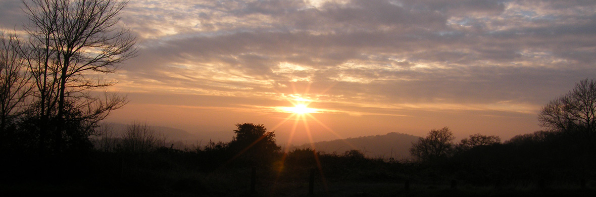
The following Page is copied into Posts because it seems very few visitors look beyond the Posts and therefore miss this important finding which is crucial to the credibility of the  pattern.

The CROOKSBURY LINE at 232.32 degrees from North would appear to be aligned to the mid-winter sunset.  At just over 7 Druid Miles (DM) the line passes through St Bartholomew’s Church at Wanborough.  At just over 8 DM, and on the extremity of visibility, lies the site of the Hogs Back Barrow on a high ridge which appears to be the aiming point for the midwinter sunset.  The line then passes close by Hillbury Hillfort at 10 DM, but it is other alignments which pass through the fort itself, and then carries on to Culverswell Barrow.   Although precisely on the line it is slightly beyond the 12 DM point at the crest of the hill. Carrying on down the hill the alignment terminates between two very close tumuli known as Crooksbury Barrows. Nothing has so far been found beyond this point.

Culverswell Barrow

Culverswell Barrow ditch with mound on right side viewed from the south before the removal of trees.

232_12 Culverswell Barrow


RED LETTER DAY

On 25 July 1979 I finally proved to my own satisfaction that at least one of the alignments was laid out intentionally by prehistoric peoples. I had always realised that my case would be greatly enhanced by the discovery of a previously unrecorded barrow in a precise location predetermined by myself prior to a site visit.

It had seemed logical that one would be more likely to find a prehistoric site on the highest point of an alignment and so profiles were produced using the contours shown on the Ordnance Survey six inch to the mile maps. These proved very useful for the demonstration of sightlines and showed several high points where no ancient site was recorded. One of the most prominent of these was at Culverswell Hill on Crooksbury Common at the south western end of the CROOKSBURY LINE. The alignment was followed on a compass bearing from the well-preserved bowl barrow about 300 m to the South West. After negotiating some dense rhododendron bushes I emerged onto the pine covered plateau to the North West of the bluff to be confronted by a large mound surrounded by a shallow ditch. It was so obviously a barrow that it was quite beyond me that it was unknown to the Surrey Archaeological Society. The top was deeply cut by a badly eroded cross- trench indicating that it had been dug into at some time in the distant past but had remained unrecorded. The following weekend a tacheometric traverse was carried out from Littleworth Cross to the mound through the nearby Crooksbury barrows and back to the road thus establishing a grid reference for my survey pegs by the barrow to 1m of accuracy. When plotted onto the 1 to 1250 Ordnance Survey sheet it would seem to be in alignment as predicted.

The barrow has since been visited by the County Archaeologist who requested the county’s foremost expert on the Bronze Age. Mr Stuart Needham, to give his opinion. Mr Needham ruled out the alternatives such as a windmill stead, or landscaping and concluded his report by expressing great surprise that such a fine prehistoric monument had remained unrecorded in an area well known for its earthworks. I suspect that one reason is that most people walking in this area of Scots pine covered sandy hills would use the established paths. The path which crosses below the bluff affords a view up to the barrow but as no ditch is visible from the south side owing to the erosion of the slope, the earthwork appears to be merely the top of the small hill. The ditch and mound are only obvious when viewed from the North, the least accessible direction.

Letter to Dr D G Bird, County Archaeological Officer, from Stuart Needham.

‘Dear David

ROUND MOUND ON CULVERSWELL HILL C. SU 89234561.

Thank you for notifying of this earthwork;   I have recently had the opportunity of visiting the site.   I found a sizeable round mound approximately 24.8m diameter and perhaps approaching 2m in height.

The top of the mound has been mutilated in the past by the digging of a cross-shaped trench, now much silted.   Around roughly half of the mound’s base may be detected traces of a ditch 2.8m across and at present barely 0.2m deep.   The mound is sited on the end of an eastward facing spur with steep slopes on three sides.   The ditch peters out here, perhaps there having been no necessity for it, or otherwise it has been removed or concealed by a greater degree of erosion down the slopes.   Inspection of the side of a foxhole suggested a possible composite mound structure, but as usual such evidence is ambiguous.   The ground to the west rises gently and evenly with no indications of undulations frequent in this sort of sandy terrain resulting from natural agencies, or extractive disturbance.   There are some rhododendron clumps immediately to the west of the mound, but no sign of any associated landscaping.

In my opinion the extant features – the size, circular plan, evidence for a ditch, and its siting – are strongly in favour of it being a genuine ditched bowl barrow, which would of course normally be referable to the earlier Bronze Age.   Other possibilities such as a natural mound, a feature of relatively recent landscaping, or the base of a post windmill, can I think be reasonably dismissed for the present.

It really is astonishing that that such a fine upstanding monument should have escaped notice for so long in view of the proximity of the triple (sic) bell barrow on Crooksbury Common!

Best wishes

Stuart Needham’

In the summer of 2015 the site was visited with the purpose of carrying out a GPS survey and the resultant coordinates were added to the AutoCAD database.  This showed that the original survey was accurate and that the barrow was indeed perfectly on the alignment.

St Nicholas Church, Compton

I now turn my attention to one of the most interesting sites – the church of St Nicholas in the village of Compton.

The church is mainly Norman in construction with a Saxon tower to the West end. This church is unique in having a two-storey sanctuary above the chancel built in the 12th century. The purpose of this arrangement is a puzzle.   The Saxon wall to the north side of the chancel has a small window believed to have belonged to a hermit’s cell.

212_7+ Compton Church212_7-compton-church-rev

217_7-compton-church-rev

Uniquely there are four alignments passing through this site.   Beginning with the FROWSBURY LINE; there are only three sites on this alignment.   Starting at the church the line heads north-west at 293 degrees and passes through Frowsbury Barrow at just over 1.5 Druid Miles.   In just under 1.5 DM it ends at the Ancient Monument sign marking the Hog’s Back Barrow.  This barrow is also on the CROOKSBURY LINE.   The churchyard at Compton is very roughly circular and it can be demonstrated that a circle of the same diameter as Frowsbury can be fitted within this area suggesting the possibility that the church is evolved from a similar site.

The COMPTON LINE passing through the church at 219 degrees mirrors the TYTING LINE, both being 30 degrees east and west of the SOUTH LINE.   It is strange that the site to the north-east on the line is a medieval moat and the site to the south-west is a Victorian church, and yet the alignment of these sites is extraordinarily precise.

The ARTINGTON LINE through the body of the church also has dubious sites which need further research.

The fourth line, the DEERLEAP LINE at 260 degrees, has six points although one is a moat and another is a Victorian church, but once again the precision is exceptional.  Refinement of this line brings it to the north side of the church but well within the churchyard.  The distance  from  Deerleap Barrow to the churchyard  is 16 Druid Miles.

Compton Church from South East

Compton Church from south-east

Compton Church from South West

Compton Church from south-west

In the above picture, three alignments meet inside the door from the porch.

Weston Wood Mound and Settlement

The NEWLANDS LINE, at 132° is 100 °  from the Crooksbury Line, and again starts from Whitmoor Barrow.  At 4 Druid Miles (DM) it passes through St John’s Church at Merrow and carries on to Newlands Corner Barrow at 6 DM.  These distances are very precise and have been used as the decided criterion of the Druid Mile.  In Weston Wood the line brushes the side of the reported position of a disputed barrow, now completely destroyed by sand extraction, and then passes through the site of a Mesolithic settlement.  At 9 DM passes close by Shere Heath Barrow but not close enough to be taken as an alignment.

268_1+ Weston Wood Mound

268_1+ Weston Wood Mound-page-0

The path at the top of the above plan is the main prehistoric trackway through Surrey, popularly known as the Pilgrims Way, which followed the North Downs from Kent through to Salisbury Plain.

THE MESOLITHIC SETTLEMENT

I have recently unearthed a sketch plan from the Surrey Archaeological Society archives of the excavation in Weston Wood of the Mesolithic settlement carried out c1961-3. The plan covers an area fifty metres square. It shows a trackway running from the south-east towards the north-west; with various post holes and points of interest; and with two areas of ploughed field to the east side. The excavation was carried out by an amateur team and appears rather inadequate by today’s standards and indeed I believe that the notes for this excavation have still not been published after half a century. Unfortunately this site has long been eaten away by sand extraction and is now a landfill site.

Weston Wood Excavation 1964

The Newlands Line is on a bearing of 132 degrees from Grid North. The trackway on the plan is at the bearing of about 152 degrees using the given North point. The excavation plan is a fairly poor sketch, not drawn very carefully by today’s standards, and is located with very approximate Ordnance Survey co-ordinates, and I suspect that the site of excavation was located very approximately in this area of scrubby land near the edge of the encroaching sand extraction with no local detail to tie in to the Ordnance Survey. The excavators set out a five metre grid as shown by the reference marks on the edges of the plan and it is possible that they located north using a compass. The plan is dated 1964 and at this time Magnetic North was some 13 degrees west of Grid North. We have about a 20 degree difference between the path on the plan and the Newlands Line, but if the North point was established using a magnetic compass then we only have a difference between the Newlands Line and the path of some 7 degrees. The Line is some 40 metres to the west of the given OS co-ordinates for the site but these are only to ten metres accuracy indicating a lack of precision.

This is certainly all very speculative and I would like to emphasize that I include this site, not because I have much faith in the validity of my findings, but because I have tried to include as much information as I can to help any possible future research.   There are obvious problems, such as the time period involved.   The Mesolithic period ended some five thousand years ago, so any relationship to the alignments would appear to be coincidental.   The most likely factor for the positioning of a settlement here would be the proximity of the natural spring at the Silent Pool.

White area is plastic covering on landfill site. The mound would have been just beyond this.

White area is plastic covering on landfill site. The mound would have been just beyond this.

THE MOUND

Weston Wood Mound was recorded as being about 135 feet in diameter and some five feet high.  The top was flat.  It had been thought that it may have been a landscape feature associated with the parkland of Weston House in Albury but no evidence as to its origins had ever been established.  It was destroyed by sand extraction in the late 1990s.

The medieval road from the village of Albury to the south ran over the ridge past the mound towards Newlands Corner in the North West.  The age of the mound had always been a matter of controversy.  In SAS Vol 60 of 1963 W Crawford Knox theorized that the medieval road went around the mound in a manner which suggested that the mound predated the road.  An excavation in 1965 revealed little, but notably, a coin of c1750 was found beneath the clay capping, suggesting the possibility that the ancient structure may have been modified as a landscape feature.

Albury New Church

The site of the mound in the landfill looking over Albury New Church

The most popular website used by enthusiasts of prehistoric monuments is ‘The Megalithic Portal’.  A search for Weston Wood brings up two photographs submitted by Eileen Roche purporting to be the mound shortly before it was destroyed.  In 1999 I began a twice-yearly monitoring of the volumes of sand extraction in the pit and have great familiarity with the site.  Looking at the photographs I feel that the mound shown would have been a soil stock and that the ancient mound would have been further north.  But now we shall never know.

Top of Albury Landfill in the area of the mound

Top of Albury Landfill in the area of the mound


Developments

After sifting through the numerous pages of calculations and speculations accumulated over years of intermittent research it became apparent that a decision must be made to settle on some criterion upon which all this data could be based.   There were two lines which stood out from the others as extraordinary – the Newlands line with its precise alignment and distances, and the Crooksbury line with its newly discovered barrow and precise alignment.   The bearing of the Newlands line was 132.82 degrees and the Crooksbury line 232.32 degrees.   It has already been seen that the rays are around ten degrees apart and by dividing the difference by ten for the intervening rays we have an interval between each ray of 9.95 degrees.   This interval was applied to all rays in the pattern and a list was compiled of the intersections of these revised rays and the distance points at one Druid Mile (DM) intervals from the base point of the rays at Whitmoor Barrow.   These points were then compared with the physical detail as shown on the Ordnance Survey as downloaded to the computer database.   This was straight forward for circular structures such as barrows where the centre point was fairly obvious but when passing through a building a best estimate of the centre was used.

By 2012 the technology of hand held GPS instruments was very advanced with an accuracy good enough to make them a suitable tool for field research, so the decision was made to surf the internet for an instrument with the most suitable specification.   I settled on the Garmin GPSMAP 62 and carried out some field tests to check the accuracy.   Results varied from nearly perfect to, in the worst case, eight metres of error when compared with known Ordnance Survey (OS) co-ordinates established by professional surveying instruments.   Because of these variations it was necessary to revisit critical sites to re-record the co-ordinates and take an average of several readings.

Once a few sites had been visited with the GPS and the results plotted onto the database it became clear that there was a discrepancy between the WASG grid used by the Garmin instrument and the OS  grid titled OSGB36. There is a lot of information on the OS website about how this grid originates and how to use conversion programs to compute very precise coordinates. Although the grid used by Garmin is called OS grid in the format selection, it did not appear to conform to the OS map grid. Therefore it was decided that to check the difference between the two grids.  Check readings would be taken on-site from known points. First chosen was the OS trig pillar at Jacobswell just south of Whitmoor Barrow. Trigonometrical pillars are usually concrete structures, standing around four to five feet high, and constructed on prominent hill tops affording views over long distances and are part of the network of triangulation stations upon which the OS of Britain is based.  Also points were taken on the corners of other sites such as the church and churchyard walls on St Martha’s Hill. When these were plotted into the database it was seen that there was indeed a discrepancy. Due to the inherent inaccuracies of Ordnance Survey detail it is not possible to attain spot-on fitting of data. After meaning out the various results and taking the trig pillar coordinates as being the main data point it was seen that all GPS data needed to be moved 8 metres south and one and a half metres West. It would have been possible to calculate a very precise difference between the two groups but the accuracy of the hand held GPS is no better than about 7 feet or two metres, therefore it would seem that refining the difference between the two groups would be excessive and a waste of time. I have since confirmed these conversion factors by taking readings at other pillars in West Surrey.

The first exercise with the new instrument was a visit to Whitmoor Barrow.   I walked around the ditch taking readings at about five metre intervals.   Each reading was taken after holding the GPS at eye level pointing in several directions until the readout settled down and became constant.   These readings were stored as waypoints in the instrument and transposed onto my AutoCAD base plan in the office.   The Ordnance Survey extract of the barrow were already on this plan and it was seen that the adjusted GPS co-ordinates and the map co-ordinates of the barrow were an excellent match.   This confirmed my intention of using the Whitmoor Barrow as the base point for the overall pattern of rays.   A similar exercise was then undertaken at Culverswell Barrow and at the twin Crooksbury Barrows a short distance away.   The co-ordinates of the Culverswell Barrow confirmed my original theodolite survey of some years ago and the co-ordinates of the Crooksbury Barrows again proved an excellent fit.

Buoyed up by these satisfying results I was keen to use these new-found techniques to discover other lost sites.   The first I looked at was the Mount Pleasant Barrow on Whitmoor Common.   This is marked on The OS as the site of an Ancient Monument no longer existing.   The co-ordinates on the OS were noted as was the co-ordinates of the point on Mount Pleasant line being at a bearing of 252.22 degrees and one Druid Mile from the base point (Whitmoor Barrow).   The common is a flat area of land surrounded by woodland to the north, a railway to the east with roads on the other two sides.   On reaching the supposed site of the Ancient Monument nothing could be made out amidst the rough tussocky grass but on navigating to the point on the pattern some seventeen metres to the north west a circular bank some seven metres in diameter could just be made out beneath the scrubby birch trees (see photos at header MOUNT PLEASANT LINE).


Whitmoor Barrow Extra Pictures

I have been lucky enough to hitch a ride in a neighbour’s De Havilland Chipmunk.  After a tour around the North Downs he asked if there was anywhere special that I would like to see so I took the opportunity to do a few circuits around Whitmoor  Barrow as I was intrigued by the possibility of detecting crop marks.  This monotone photo shows the barrow as a red circle above and to the right of centre.  The large lone oak in the centre of the picture is to the south of the barrow.  The large field is scrubby grass grazed by ponies and shows nothing of any interest that I could make out although there are plenty of variations in tone.

dscf0577bw_whitmoor

In the picture below the barrow can be seen about halfway to the base of the photo  from the lone oak.  The view is looking south over the suburbs  of Guildford.  The only marks visible are old hedge routes and paths.

DSCF0570 from north

Entry be added to St Martha’s Church under ST CATHERINE’S LINE

Chilworth is a linear village following the River Tillingbourne and was a centre for the manufacture of gunpowder from the 17th century until the First World War. The parish church has always been St Marthas, sited high above the village to the North, on what has been called Martyrs Hill. The church was rebuilt from ruins in 1848-1850. Of the original church the earliest visible remains date to the early 12th century. The church stands some 574 feet above sea level on a greensand Ridge.

There is an old folk tale that two chapels, St Martha’s and St Catherine’s, were built by two giant sisters to expiate some sin. But having only one hammer between them they tossed it from one to the other across the two-mile gap in the river valley until the chapels were built.  A strange similarity to the belief of some new-agers that these lines are paths of some power.    I have also seen a reference to an old legend that there was a tunnel between the church and Tyting Priory down the hill to the North West, possibly suggesting folk memories of an alignment passing through the two sites.

St Martha's Chapel in winter

St Martha’s Church in winter from the North West

The five circles at St Martha’s were examined by Grinsell in 1931. Since then one has been destroyed by the construction of a reservoir and another nearly obliterated by the path from the village. In 1954, E S Wood excavated Circle number four to the west of the church. He concluded from an examination of the geology that they could have been constructed anything up to 4000 years ago and that they were sacred enclosures of the Bronze Age. Since then it has been suggested that they are more likely to be the steads of tree-clumps of eighteenth or early nineteenth century date. Due to the acidity of the sand nothing was found but a few flakes of flint. Reportedly the diameter of the circles ranges from 72 feet to 77 feet although my GPS readings suggest a figure of 88 feet for the East circle.

St Marthas NW

The church from the South East looking across the site of the two eastern rings

260_1 St Martha’s Church and Rings

St Martha's Church and Rings

Plan updated in May 2016

The following text is adapted from Surrey Archaeological Collection volume 54, 10-16.

There were originally five circles at St Martha’s, first mentioned in 1850. In 1876 Dyer, in British Popular Customs, writes that it was the custom, the origin of which is lost in the obscurity of time, for people to make a pilgrimage to St Martha’s (or Martyrs) Hill on Good Friday, and to spend the time dancing and music making around the Norman church (T F Thistleton Dyer 1876). In 1895 (G Clinch and S W Kershaw in Bygone Surrey) wrote that it clearly had no connection with the solemn event celebrated by Christians in this day. Hillare Belloc (The Old Road 1904), knew of the hill’s reputation as a pagan centre and saw it is the holy meeting place of the tribes of the area. W Johnson (Folk Memory 1908) considered a possibility that the two small mounds to the north of the church wall were tumuli and also volunteers the information that when the early Christians erected a church where a heathen temple formerly stood, they performed a dance to their god as the heathens had done to theirs. He thought that the rings may be the remains of a maze. He speculates on the possibility dancing in church is a Christianization of pagan worship. The Good Friday carousels appear to have ceased around the end of the 19th century.  The Victorian County History, Volume 3 1911, states that the best of the circles was destroyed by the construction of the reservoir.  It is recorded that people still visited the hill on Good Friday in 1914 but the singing and dancing had died out. A fair was held on Ben Piece (open ground down the hill to the west) but had died out before the end of the century.   It is known that a processional dance started in Guildford over Pewley Down, and past Tyting. Possibly similar to Helston Furry dance. Apparently the dance was both processional (symbolic of the passage from life to death and back) and round (fertility), and took place outside of the churchyard.  It is thought that it died out due to the unseemly boisterousness as befitted a spring festival. Old prints indicate that the churchyard wall may have been circular before 1890. It may be coincidence that St Martha’s was built on Martyrs Hill or could early Christians have been put to death there. Could it refer to sacrifices? There is a tradition that the church was built to commemorate the spot where the martyrs died for why else would a church be built in such an inaccessible spot. Unlike many isolated churches this one was never the centre of a vanished hamlet.

St Catherine's from St Martha's Chapel

The view West towards St Catherine’s Chapel

In May 2016 I decided to pay a visit to the prehistoric rings at St Martha’s church.  I wanted to get out there to have a look before the spring growth completely covered them, and knowing that they were very difficult to see due to the shallowness of the ditches and erosion over the years.   I did have a rough survey on plastic film that I carried out possibly in the 1980s, and as I have no memory of it at this distance in time I could not guarantee any sort of accuracy.  I also have a sketch plan from the Surry Archaeological Collections published many years ago, and which seems to be the only time a location plan was ever attempted, this bearing very little resemblance to my survey drawing.  I needed to check the accuracy of my drawing so used the handheld GPS to record what I could find of the circles. After much searching and wandering around all I could find was the top half of the circle nearest to the church.   This was recorded and transposed onto my computer database to compare with the information already entered from my original survey.   Although  it wasn’t a particularly good fit it did at least prove that what I had on my original drawing was more accurate than the sketch plan from the SAS records.  My reason for the interest in these circles was the vague possibility that they may have been positioned in a less arbitrary manner than would seem to be the case on site. Could they reflect the shape of a constellation suggesting an astronomical purpose? Or could they somehow mirror some of the alignments that I have located? Looking at them on the database neither of these seem to be a possibility and at the moment I’m ruling out any interest in these circles, but possibly at a later date their location may be of some relevance.

St Martha's looking South East

St Martha’s looking South East